![]()
My friends, Leo and Eric, and I decided to do a late season trip to Tamarack Lake in Desolation Wilderness. Desolation Wilderness is heavily regulated and is under quotas for most trailheads in the summer. Since it was off-season, we were able to get a permit from the ranger station off Highway 50 on the way to the trailhead. Permits are $5 per person per night (Max of $10 per person if you are doing a longer trip). We headed in from the Echo Lake trailhead. You can miss the turnoff if you are not watching closely. From Sacramento head east on Highway 50 until you get to Johnson Pass Road. Take a left onto this road and then another left on Echo Lakes Road. The road in to Echo Lake goes by many cabins (if you end up by a bed in breakfast place you missed a left turn).
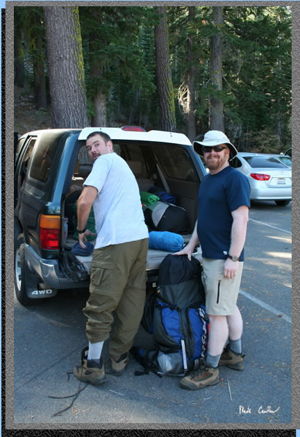 Here are Leo and Eric as we are getting ready to take off from the trailhead.
Leo is the one that looks like there is a bear approaching. See map
below of our route and elevation profile. There is a decent sized lot
that you can park at, above the lot at the dock/store (open during the
summer only). I have seen the lot pretty full in the summer so I would
get there early if you are headed there peak season. It was pretty empty
for us, as we were off season, and also headed out on Sunday.
Here are Leo and Eric as we are getting ready to take off from the trailhead.
Leo is the one that looks like there is a bear approaching. See map
below of our route and elevation profile. There is a decent sized lot
that you can park at, above the lot at the dock/store (open during the
summer only). I have seen the lot pretty full in the summer so I would
get there early if you are headed there peak season. It was pretty empty
for us, as we were off season, and also headed out on Sunday.
 Here
is the trailhead from another angle. The
trail continues north of the parking lot. Be sure to take a look at
Lake Tahoe on the way down to the trailhead.
Here
is the trailhead from another angle. The
trail continues north of the parking lot. Be sure to take a look at
Lake Tahoe on the way down to the trailhead.
 Here
is the lower parking area with Echo Lake in the background. The water
level was very low and the boat ramp was a ramp into gravel more than
water. There is a water taxi that runs on the lake during the summer.
I have never taken it, but if you are looking to cutout part of the
hiking, it is available. I don't know of any other trailheads that offer
such a service.
Here
is the lower parking area with Echo Lake in the background. The water
level was very low and the boat ramp was a ramp into gravel more than
water. There is a water taxi that runs on the lake during the summer.
I have never taken it, but if you are looking to cutout part of the
hiking, it is available. I don't know of any other trailheads that offer
such a service.
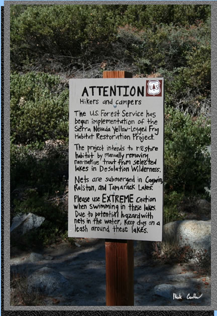 As
you can read from the sign posted at the trailhead, the forest service
decided to get rid of some no native trout from some of the lakes in
the area. We weren't planning on a swim, as it was not warm, but if
you are headed out in the summer be careful. We saw the floats holding
up the nets at Tamarack Lake so they are not kidding.
As
you can read from the sign posted at the trailhead, the forest service
decided to get rid of some no native trout from some of the lakes in
the area. We weren't planning on a swim, as it was not warm, but if
you are headed out in the summer be careful. We saw the floats holding
up the nets at Tamarack Lake so they are not kidding.
 The
trail is a mixture of exposed granite sections to partially covered.
If it is hot get an early start. There is shade around Tamarack Lake.
You can see one of the many cabins along the lake in this shot. I am
not sure if many of them are for rent but if they are it would be a
nice place to relax (or use as a basecamp).
The
trail is a mixture of exposed granite sections to partially covered.
If it is hot get an early start. There is shade around Tamarack Lake.
You can see one of the many cabins along the lake in this shot. I am
not sure if many of them are for rent but if they are it would be a
nice place to relax (or use as a basecamp).
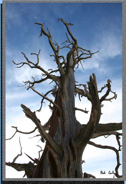
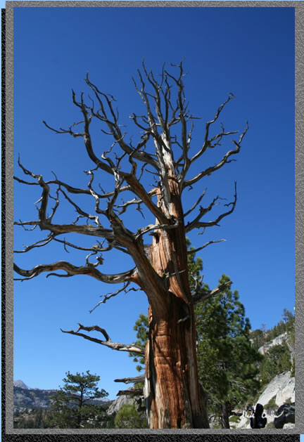 Here
is one of those trees that won't give up the fight.
Here
is one of those trees that won't give up the fight.
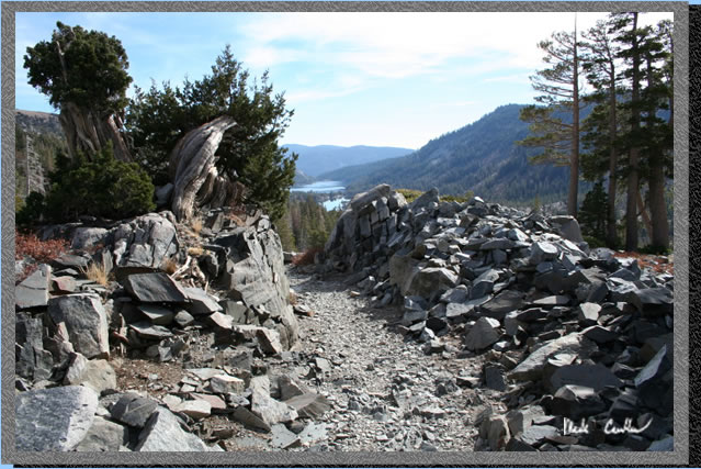
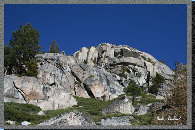 Here
is an example of the granite along the north side of the trail. Make
sure to look up occasionally so you don't miss it.
Here
is an example of the granite along the north side of the trail. Make
sure to look up occasionally so you don't miss it.
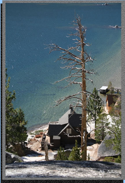 This
picture shows another cabin right on the lake. Most of these places
have docks so I think boating in is the choice by most that live here
(or maybe they take the water taxi).
This
picture shows another cabin right on the lake. Most of these places
have docks so I think boating in is the choice by most that live here
(or maybe they take the water taxi).
 This
shot is when I was looking back at Echo Lake (looking east). As you
can see, the majority of the hike is a gentle uphill. The elevation
profile proves that. It looks a little scary but if you look at the
scale on the left you can see that there is not really that much elevation
gained and the distance over which you gain it makes it pretty easy.
This
shot is when I was looking back at Echo Lake (looking east). As you
can see, the majority of the hike is a gentle uphill. The elevation
profile proves that. It looks a little scary but if you look at the
scale on the left you can see that there is not really that much elevation
gained and the distance over which you gain it makes it pretty easy.
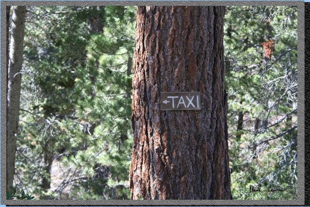 Have
you ever seen a sign for a taxi mounted on a tree along a trail. The
idea seems a little funny but I think the next time I am out here I
will try it out.
Have
you ever seen a sign for a taxi mounted on a tree along a trail. The
idea seems a little funny but I think the next time I am out here I
will try it out.
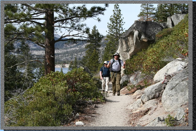
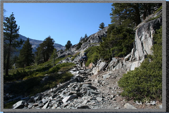 Another
uphill section as you leave the lake behind. This trail is well used
and you will see fellow hikers even in the off season.
Another
uphill section as you leave the lake behind. This trail is well used
and you will see fellow hikers even in the off season.
 Here
the first trail junction you will encounter. It is well marked by some
Yo-Yo. I hope they catch the guy that marked it and tattoo yo-yo on
his forehead. Whomever wrote it doesn't understand why the rest of us
come out to the wilderness. If you make a wrong turn here you are headed
to Triangle Lake.
Here
the first trail junction you will encounter. It is well marked by some
Yo-Yo. I hope they catch the guy that marked it and tattoo yo-yo on
his forehead. Whomever wrote it doesn't understand why the rest of us
come out to the wilderness. If you make a wrong turn here you are headed
to Triangle Lake.
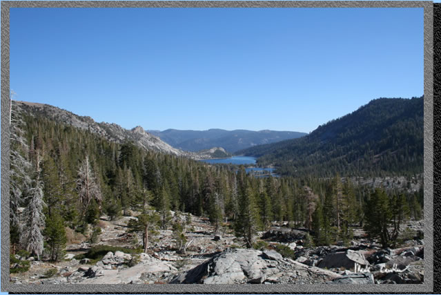 Getting
close to our destination with Echo Lakes pretty far away now. There
are actually two lakes that make up Echo Lake. Lower and Upper Echo
Lake are connected by water though (at least according to the map).
Getting
close to our destination with Echo Lakes pretty far away now. There
are actually two lakes that make up Echo Lake. Lower and Upper Echo
Lake are connected by water though (at least according to the map).
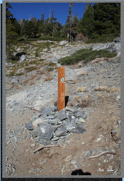
 Here
is the marker for the left turn to Tamarack lake. The trail from here
to Tamarack Lake has been cairned (ducked) by everyone
so it is a little confusing but if you head in the lakes general direction
and follow the occasional footprint or duck you should be able to make
it without too much trouble.
Here
is the marker for the left turn to Tamarack lake. The trail from here
to Tamarack Lake has been cairned (ducked) by everyone
so it is a little confusing but if you head in the lakes general direction
and follow the occasional footprint or duck you should be able to make
it without too much trouble.
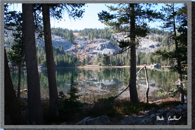 Here
is Tamarack Lake nice and still. We headed to the far side of the lake
to a nice campsite a little back from the lake and with some nice trees
for cover. There are some old sites that are almost on the water. Most
are marked with signs not to use. Please obey them, the fines are hefty
now.
Here
is Tamarack Lake nice and still. We headed to the far side of the lake
to a nice campsite a little back from the lake and with some nice trees
for cover. There are some old sites that are almost on the water. Most
are marked with signs not to use. Please obey them, the fines are hefty
now.
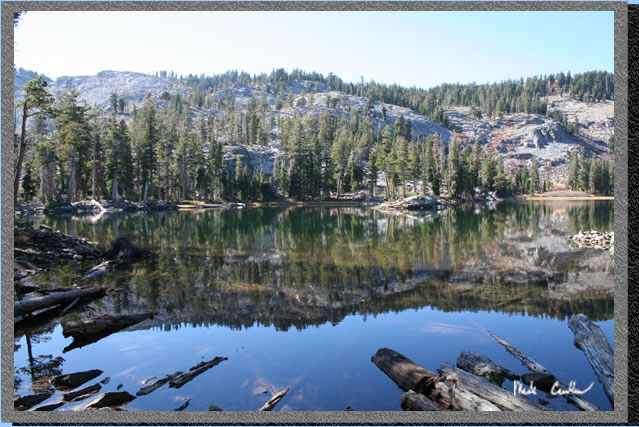
 Another
shot of the lake .
Another
shot of the lake .
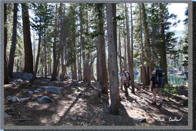 Here
is us meandering through the trees on the way to finding our campsite.
Here
is us meandering through the trees on the way to finding our campsite.
 Everyone
is "hiding" from me. Can you see the backpackers?
Everyone
is "hiding" from me. Can you see the backpackers?
 The
water levels are definitely lower this year. Hopefully we have a nice
wet season to refill all of these glorious lakes.
The
water levels are definitely lower this year. Hopefully we have a nice
wet season to refill all of these glorious lakes.
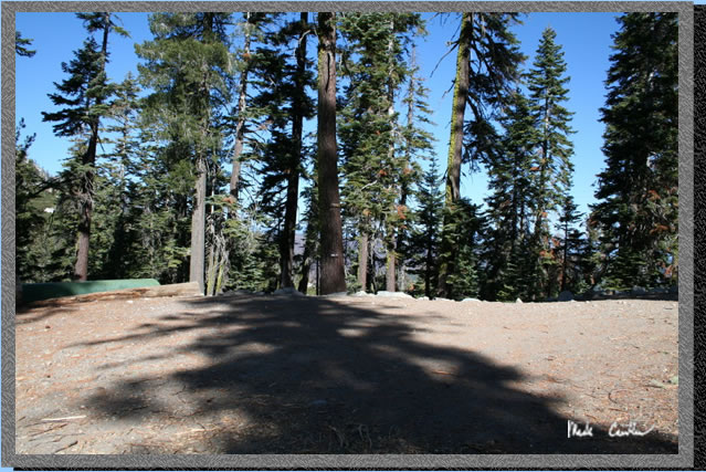
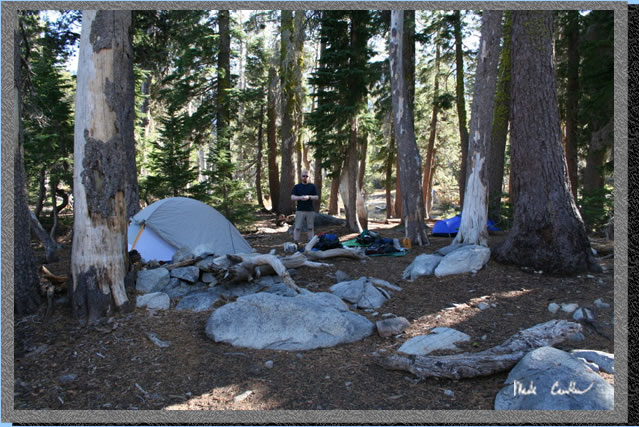 Here
is camp. The tent on the left is Leo's while the blue one man on the
right is mine. Eric decided to sleep under the stars on this trip. Stars
were plentiful as we had a clear sky with no moon interfering. Luckily
Eric was with us to explain some of the things we could check out with
the monocular he brought along. He is the avidbackpackers resident astronomer.
Here
is camp. The tent on the left is Leo's while the blue one man on the
right is mine. Eric decided to sleep under the stars on this trip. Stars
were plentiful as we had a clear sky with no moon interfering. Luckily
Eric was with us to explain some of the things we could check out with
the monocular he brought along. He is the avidbackpackers resident astronomer.
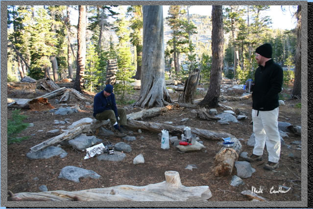 Here
is our kitchen in the morning. Not much for wildlife on this trip except
for birds.
Here
is our kitchen in the morning. Not much for wildlife on this trip except
for birds.
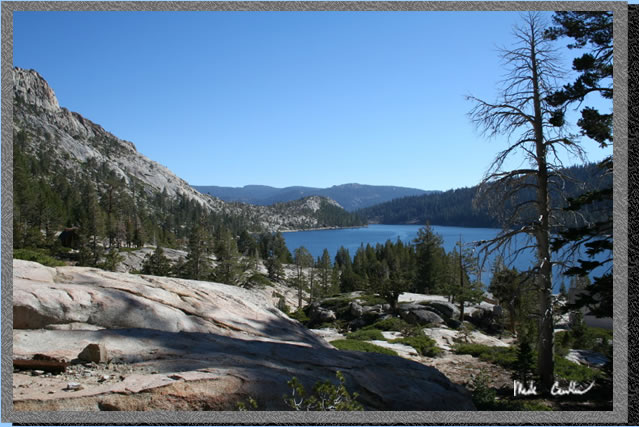
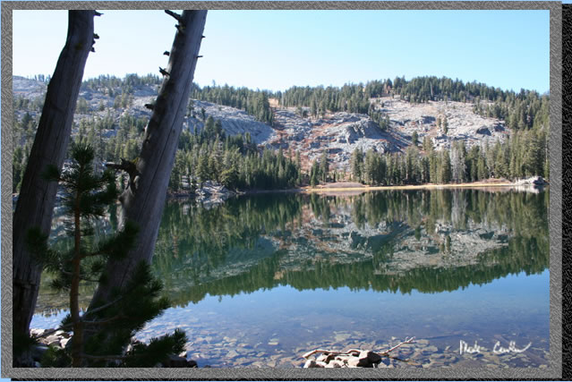
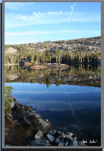 Another
shot of Tamarack lake. One thing I would recommend is to head over to
Ralston Lake and
see Ralston Peak.
Another
shot of Tamarack lake. One thing I would recommend is to head over to
Ralston Lake and
see Ralston Peak.
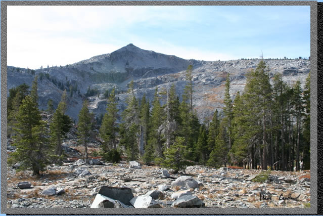 Here
is Ralston Peak. Ralston Lake lies at the base. I imagine that an occasional
rock makes it way into Ralston Lake from all of the loose ones above
it. That would be neat to see and hear (during the daytime).
Here
is Ralston Peak. Ralston Lake lies at the base. I imagine that an occasional
rock makes it way into Ralston Lake from all of the loose ones above
it. That would be neat to see and hear (during the daytime).
 We
were headed out now and back on the main trail. The path we took from
the lake to the main trail was slightly different than on the way in
as I headed a little too far to the right. For this reason the map and
profile are not exactly the same for both directions of travel.
We
were headed out now and back on the main trail. The path we took from
the lake to the main trail was slightly different than on the way in
as I headed a little too far to the right. For this reason the map and
profile are not exactly the same for both directions of travel.
 Getting
closer to the trailhead now .
Getting
closer to the trailhead now .
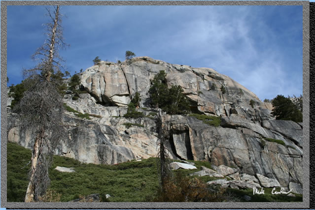 Another
shot of the granite along the trail with a nice misty cloud
above.
Another
shot of the granite along the trail with a nice misty cloud
above.
 A
gnarled tree with the sun behind it.
A
gnarled tree with the sun behind it.
 Here
we are near the end of the trail.
Here
we are near the end of the trail.
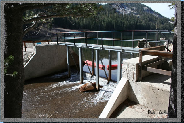 This
is the bridge over the outlet of the lake that you must cross to get
to the trailhead. As you can see the water level is pretty low but still
flowing.
This
is the bridge over the outlet of the lake that you must cross to get
to the trailhead. As you can see the water level is pretty low but still
flowing.
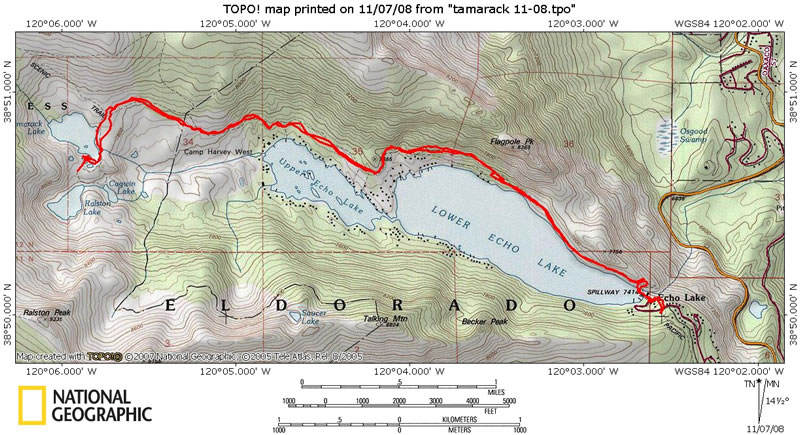
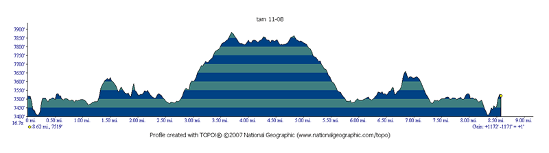
Here is the path we took. You can see that the trail stays close to the lake for the majority of this trip. There are some good sites located between Tamarack and Ralston Lake. The profile is below (roundtrip was around 8.5 miles (car to camp).