![]()
Point Reyes
National Seashore offers a number of camping options. Coast Camp is
a short 3.1 miles each way via the Coast Trail or a really short 1.8
miles via a fire road, see map and profile below.
 The
beauty of this camp is you are right on the water (well a short hike
down to it) and you can explore the beach once you have setup camp.
Wildcat Camp is also the same distance from the
ocean but the sites are really close together (of course there is a
waterfall to walk to once you get to Wildcat Camp). At Coast Camp sites
1 through 7 are the best with each offering some privacy from the other
sites. All 14 sites are very exposed as you can imagine being this close
to the beach, Sites 1 through 4 are probably the best if you still want
to see a corner of the ocean (no breaking waves just blue ocean). Although
you can't see the ocean from most of the sites here you can hear it
in the evening/early morning. Things to note are poison oak is plentiful
and the raccoons here are no joke. Lock up anything that smells or looks
like food. Each site has a metal locker, picnic bench and barbeque.
We decided to skip the freeze dried on this trip and use the barbeque.
I mean how often can you barbeque when backpacking! There is a really
nice pit toilet near sites 9 and 10 with water near the beach access
trail. Sites do book up for the weekends so reserve your site early.
We went on a Friday and sites 1 through 7 had only 3 occupied that night.
Permits can be obtained by calling 415-663-8054. Permits must be picked
up from the Bear Valley Visitor Center on your way in. Not sure why
this is their policy as they mail you a confirmation of your reservation.
If you are arriving outside of the visitor center's hours they will
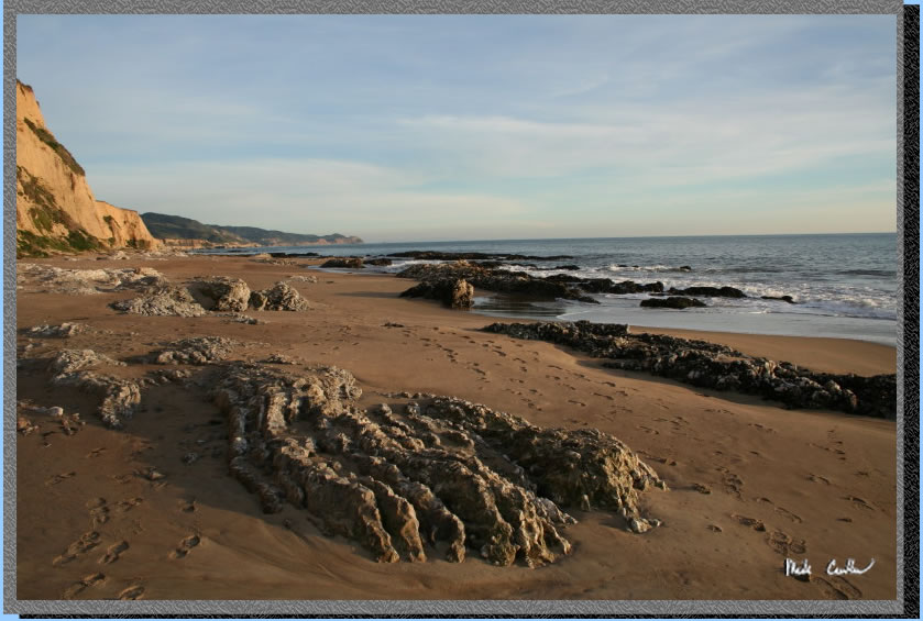
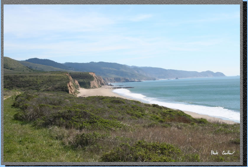
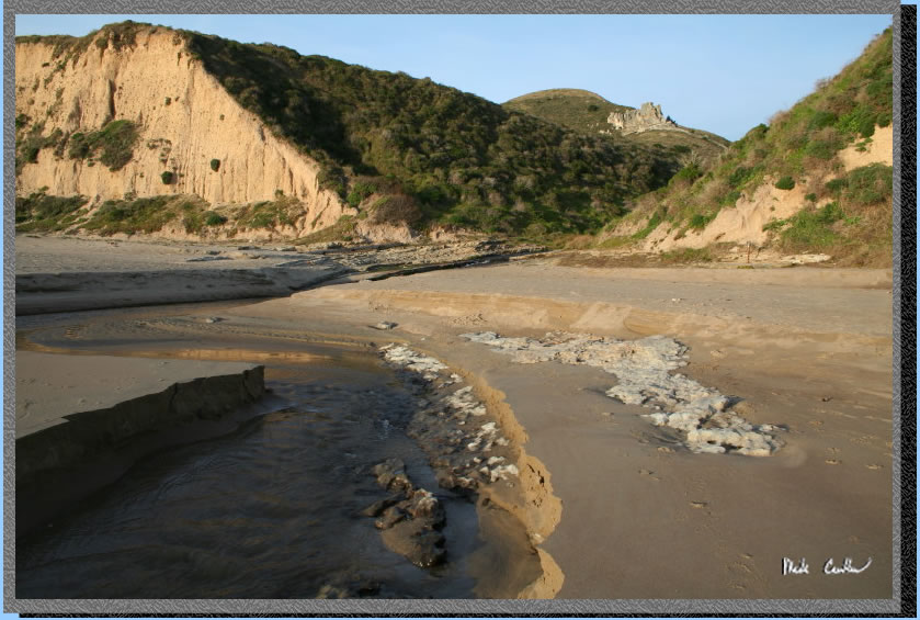
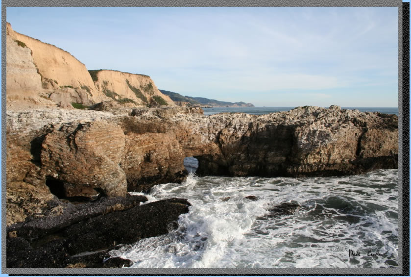
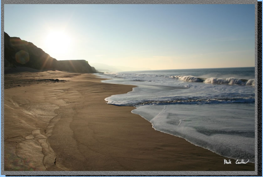
post permit outside for you. Shot is of Sculptured Beach, well worth
the short hike to the south.
The
beauty of this camp is you are right on the water (well a short hike
down to it) and you can explore the beach once you have setup camp.
Wildcat Camp is also the same distance from the
ocean but the sites are really close together (of course there is a
waterfall to walk to once you get to Wildcat Camp). At Coast Camp sites
1 through 7 are the best with each offering some privacy from the other
sites. All 14 sites are very exposed as you can imagine being this close
to the beach, Sites 1 through 4 are probably the best if you still want
to see a corner of the ocean (no breaking waves just blue ocean). Although
you can't see the ocean from most of the sites here you can hear it
in the evening/early morning. Things to note are poison oak is plentiful
and the raccoons here are no joke. Lock up anything that smells or looks
like food. Each site has a metal locker, picnic bench and barbeque.
We decided to skip the freeze dried on this trip and use the barbeque.
I mean how often can you barbeque when backpacking! There is a really
nice pit toilet near sites 9 and 10 with water near the beach access
trail. Sites do book up for the weekends so reserve your site early.
We went on a Friday and sites 1 through 7 had only 3 occupied that night.
Permits can be obtained by calling 415-663-8054. Permits must be picked
up from the Bear Valley Visitor Center on your way in. Not sure why
this is their policy as they mail you a confirmation of your reservation.
If you are arriving outside of the visitor center's hours they will
post permit outside for you. Shot is of Sculptured Beach, well worth
the short hike to the south.
So like I said we planned
on eating well so on the way in we hit point Reyes Station. A quaint
little town that has a nice deli/grocery store and bakery across the
street. There are other restaurants around and even a farmers market
on the weekends. We were lucky enough to find tamales being sold out
of a guys trunk. He was a little aggressive on his sales pitch as we
were barely out of the car before he started the ales pitch. Honestly
never bought food out of someone's trunk before but we were hungry and
pleasantly surprised at how awesome the tamales were. And at 1.50 each
with plates/utensils/napkins provided it felt like we were stealing
them. After we filled up on tamales we hit the bakery across the street.
I had some chocolate cake (hey it was almost 10:30 by then) with the
other guys getting some croissant sandwich gut bombs. They almost looked
as good as the chocolate cake. We decided we better hit the Visitor
Center next and hit the trail. We chatted a bit with the volunteer (who
tried to talk me out of buying a map and instead using a photocopied
piece of paper) and then got our permit from a strictly no nonsense
ranger. We decided to use the COast Trail which starts at the Coast
trailhead just shy of the hostel. Parking is allowed along the road
if you can park on the shoulder. Being a Friday morning we had no difficulty
finding a spot at the trailhead. If you are not as lucky there is a
gravel lot further along the road (which adds a few tenths to the trip).
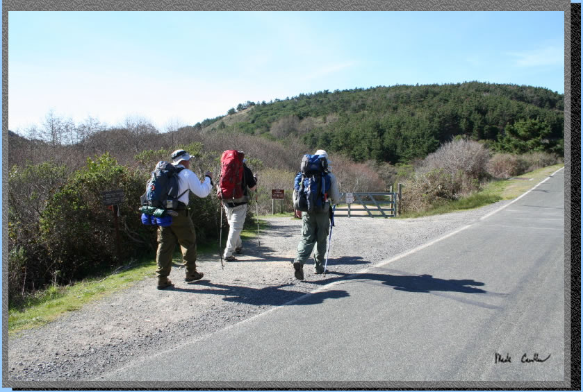
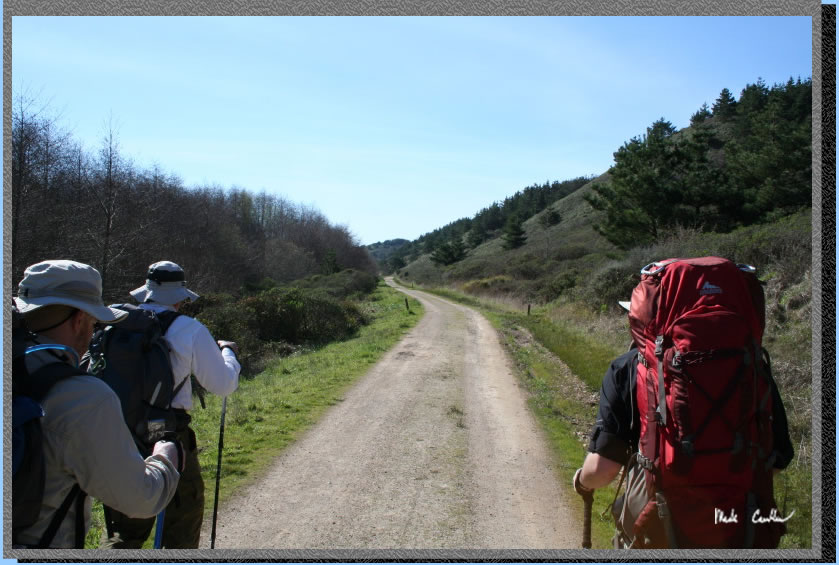
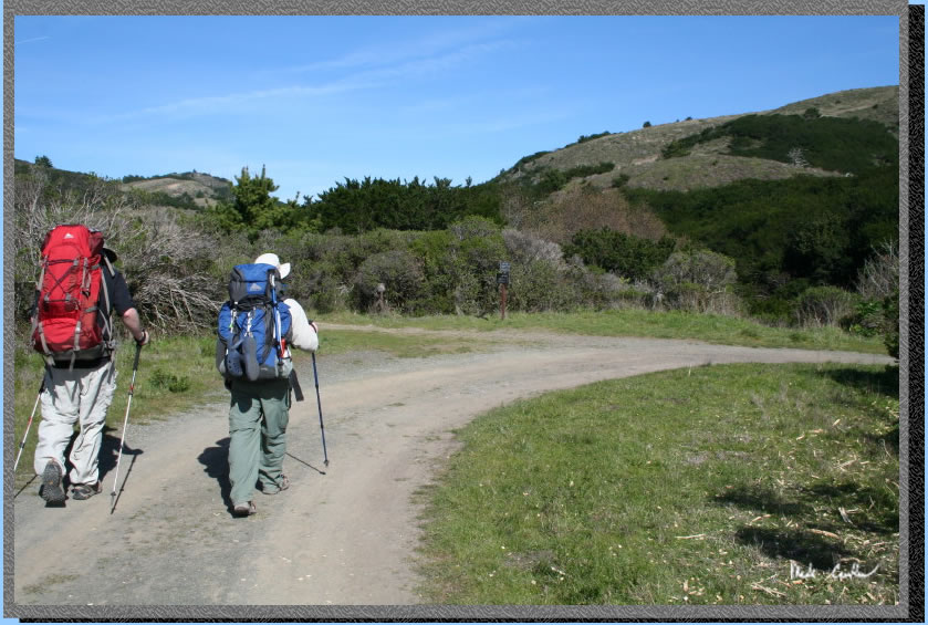
We all had decent pack weights as we were carrying raw meat on ice,
charcoal, marinated vegetables and makings for trailside margaritas
(on the rocks). Here we are hitting the trail.
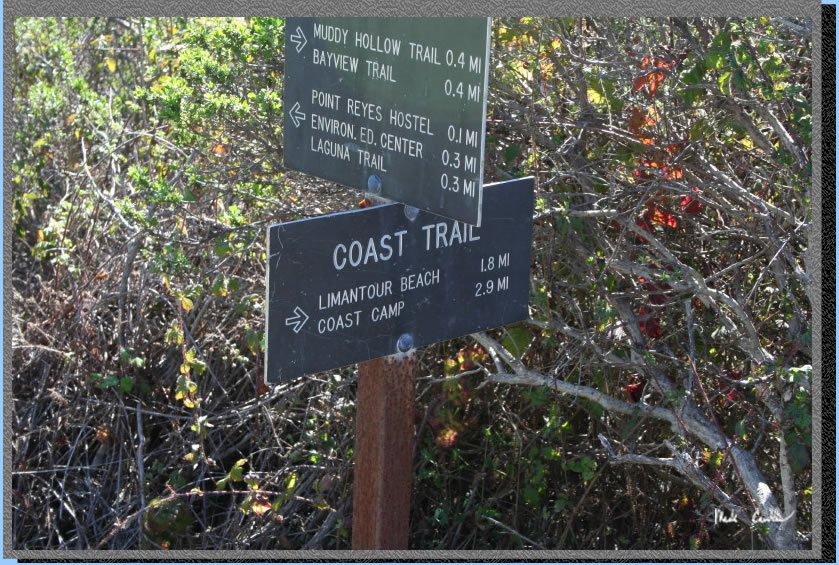
Here is the first trail sign
you will see. The sign says 2.9 but my gps clocked it at 3.1 from car
to camp #7.
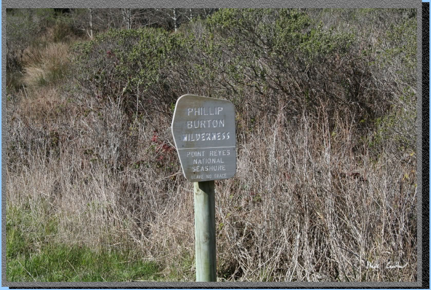
Another trailside sign. This
one intrigued me a bit because it said wilderness on the sign. On my
map (that I did buy from the volunteer after he fumbled running my credit
card, probably the reason he didn't want me to buy something) it shows
no wilderness... After a quick Google search I saw that this was originally
Point Reyes Wilderness but renamed after Phillip Burton (a California
Congressman) in recognition of Burton's dedication to wilderness preservation.
The Wilderness is managed by the National Park Service.
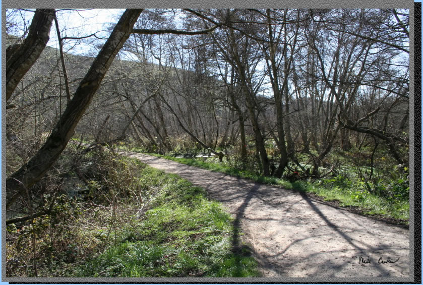
Here is the trail. So yes it is more road like and you can tell the
rangers use it to get to Coast Camp for cleaning it up. We had gorgeous
clear weather forecast with only a slight breeze. Not bad for February.
The fog here can be nasty so make sure you have rain/dew gear.
The trail is 95 percent uncovered so I can imagine in the summer when
it is actually hot at the beach it could be a warm hike. The Coast Trail
runs parallel to an unnamed creek (at least unnamed on my map) until
it goes under the trail at 3/4 of a mile in. The creek turns into a
marsh past this point. If there are mosquitoes in the area they would
be here.
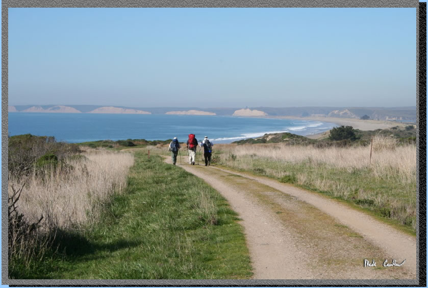
The trail runs straight for the beach now so be sure to get ready for
some awesome views. Limantour Beach is the the north as seen in this
shot (looking backwards on the trail).
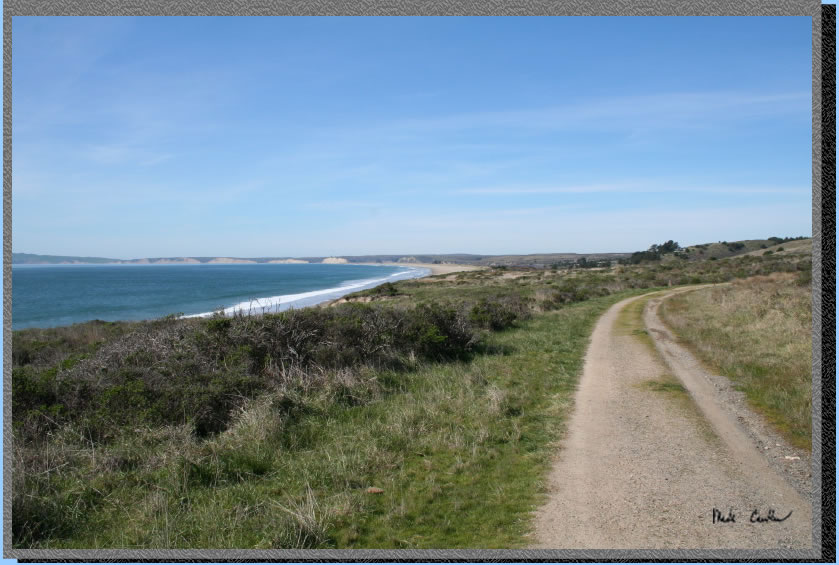
Looking forward you see Santa Maria Beach and Sculptured Beach in the
distance. If the tides cooperate for you, Sculptured Beach offers great
tide pooling. I do recommend checking a tide table so you know when
making a narrow crossing could get you stuck between waves and a sheer
cliff. You don't want to be on the evening news as the guys that had
to get rescued.
Here is the junction of Laguna Trail and Coast Trail (Laguna Trail would
be the shorter mileage option but a little more elevation gain/descent).
Make a slight left here is you are in 1 through 7 and then your next
right. All sites are well marked. Watch for bunnies as they are running
all around.
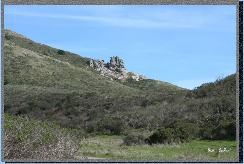
If you continue on the Coast
Trail towards the bathrooms (and sites 8 though 14) you will see this
interesting rock formation. I expected to see it named on my map....
hmmm why did I buy this $10 map again... No seriously the map is marked
well and waterproof, I think this rocky outcrop might not have a name.
I think I will name it ABC rock (it looks like 3 rocks joined together).
Here are the provided facilities. Very clean pit pit toilet and trash/recycle
cans so you don't have to pack your trash out. There is another set
of trash/recycle cans closer to sites 1 through 7 as well.. 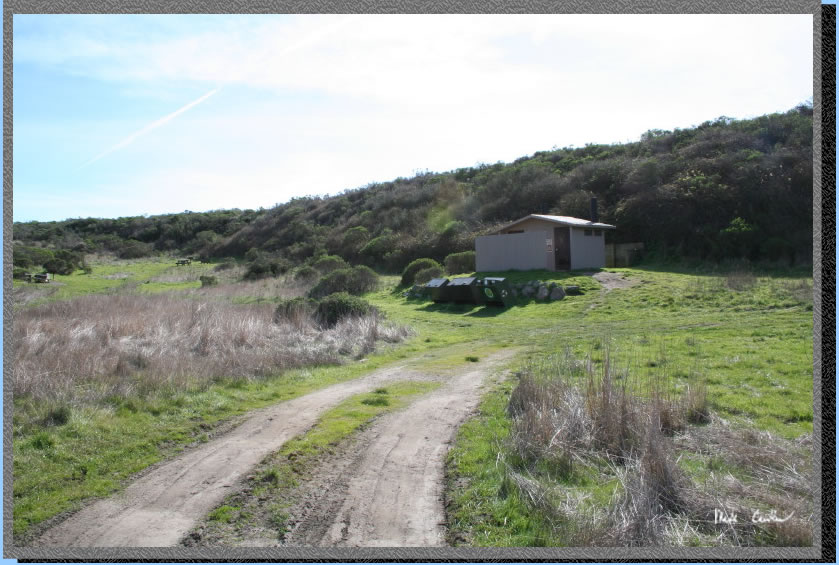
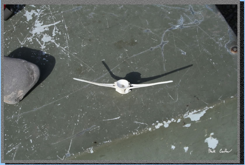
We found quite a few things around camp that had obviously been on the
beach at some point. This one intrigued us as it appeared to be bone
but the spinal column opening and the ribs seem almost misaligned. The
rib like structures curb upwards in the picture (look at the shadow)
I have my pre-med friend working on an identification for me. We are
thinking some sea creature as land animals wouldn't have a structure
like this..
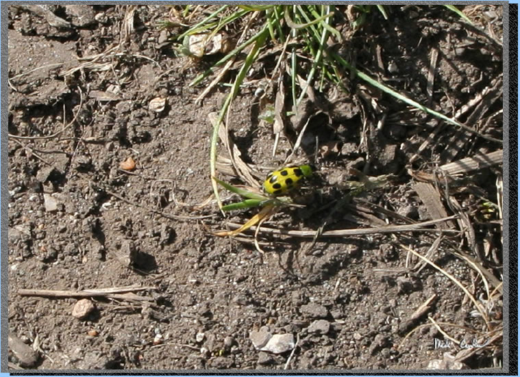
After we stored the food and setup camp we decided to head down to the
beach. I grabbed a shot of this fast moving beatle on the trail.
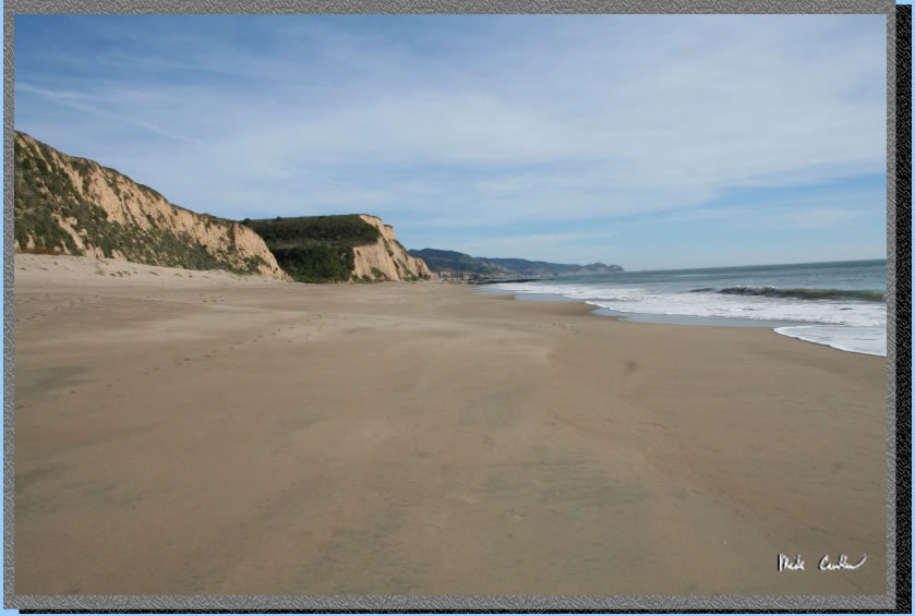
So not all of the beach was this pristine, but good sections were. We
saw a few other groups out on our day hike, but honestly felt like we
had all this beach to ourselves..
Here is Santa Maria Creek where is rushes into the ocean. It looks almost
like a weird reflection for the distance but it is a creek. Crossing
it was easy as it is only a foot or so deep in the deepest parts. 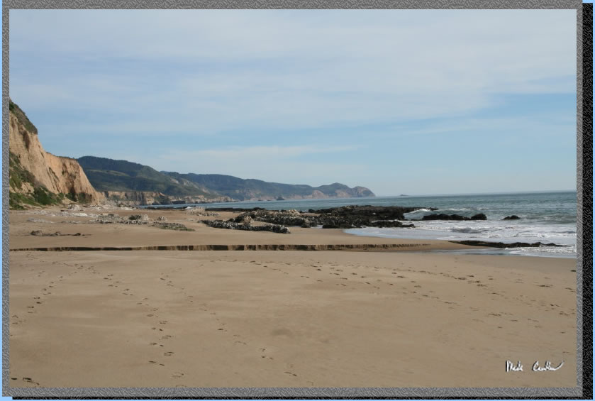
Here you can see the creek
crossing again. It was a little easier to cross further from the ocean.
Or you can pick a shallow spot and walk across it.
Here is the ABC crew on this
trip. We decided to take a group shot setting up our trekking poles
as a tripod. I had to scramble back to be in the shot in time. The water
in front is actually the waves encircling this rock. There was a definite
timing thing to get to the rock without getting wet.

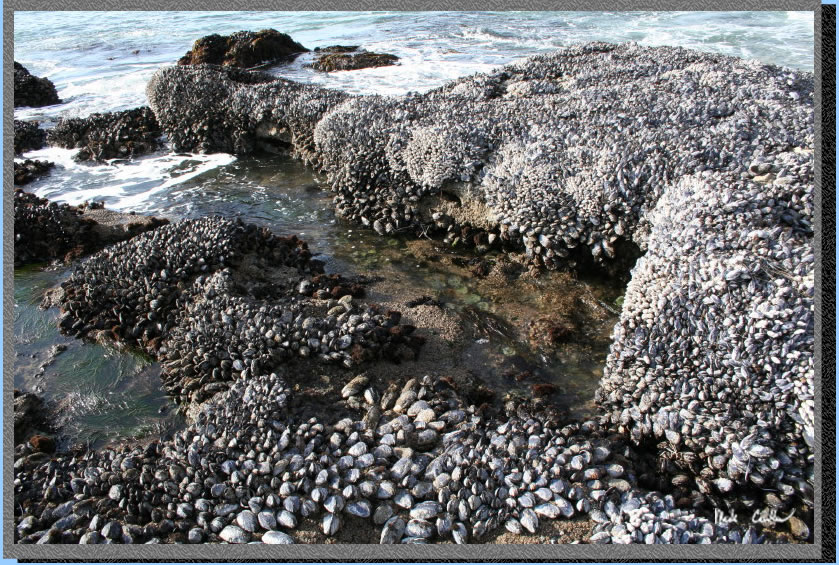
Here are some of the creatures in the inter tidal zone, notice the green
anemones in the middle. Use caution whenever in the break zone. The
saying "Never turn your back on the ocean" is one I believe
should be followed.
Here we are looking back
towards Coast Camp .
It was just great picture
taking weather. It was really hard to whittle my selection down to a
reasonable amount to post.
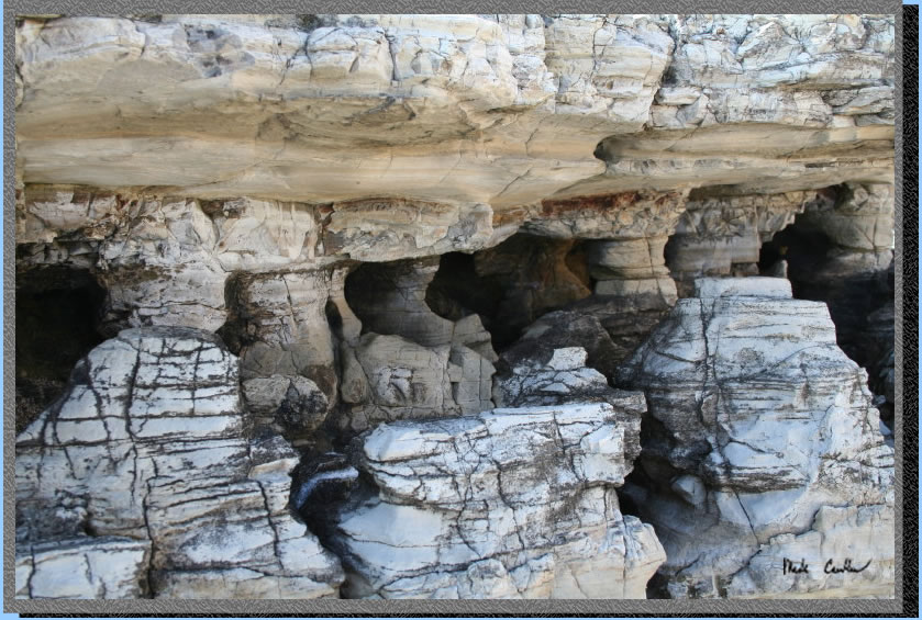
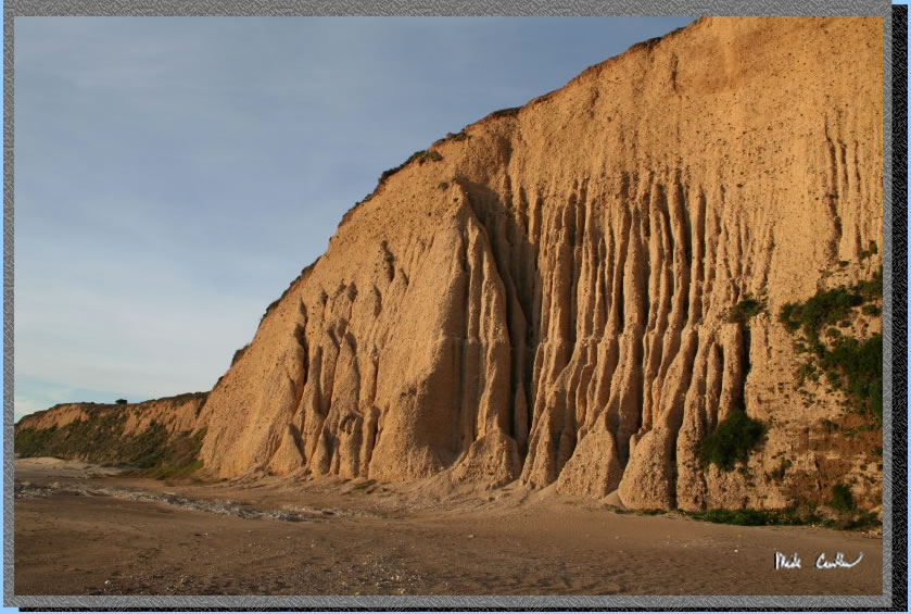
Although this looks like some sort of cliff side cave dwellers home
it is actually just the side of a big rock at Sculptured Beach. The
textures draw you in, and the absence of a foreground for perspective
leaves you wondering how big these caves are.
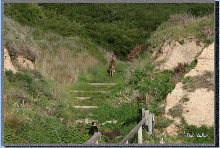
We saw some hove marks along the beach and finally caught up to this
guy. This mule deer was using the trail as his getaway path.
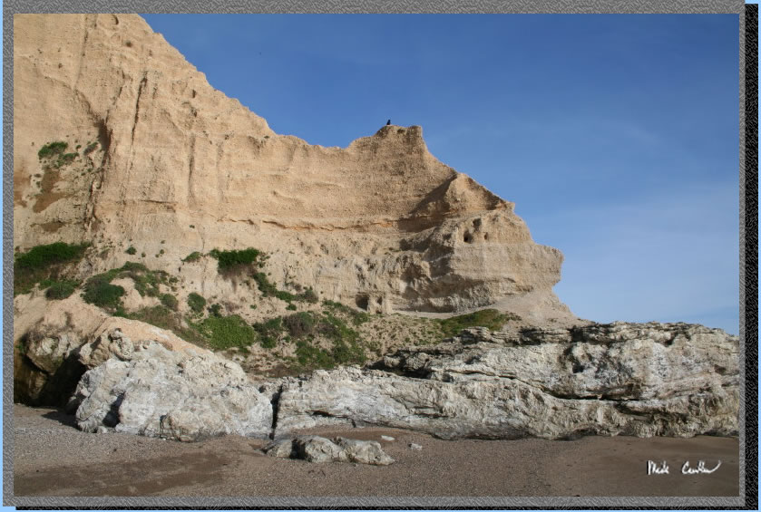
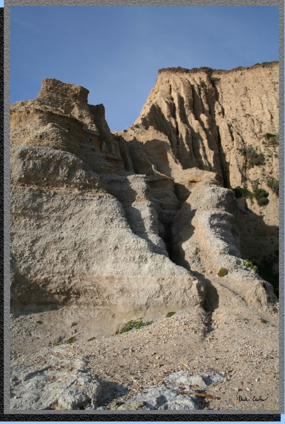
What is holding all of this
sand up. When the crow landed on the top of it I almost expected him
to have to take flight when it all came crashing down.
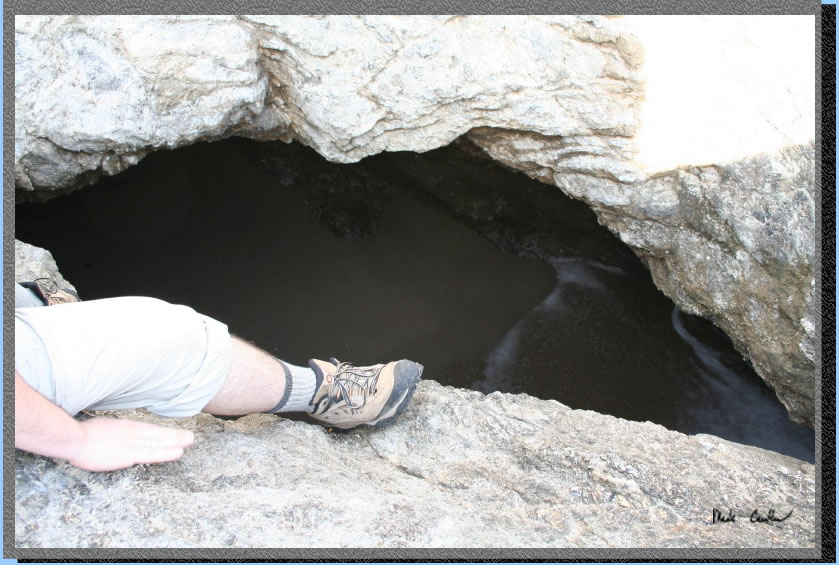
Near the rocks (where at anything but low tide is the end of the route)
we came to a hole with a a private beach inside. Of course going into
the hole would be easy, but coming out not so much, as it is a good
6 feet down with waves coming in and out of it.
Here the rocks form an arch that you just want to swim through. Well
maybe not. It was cool to watch the waves break around it.
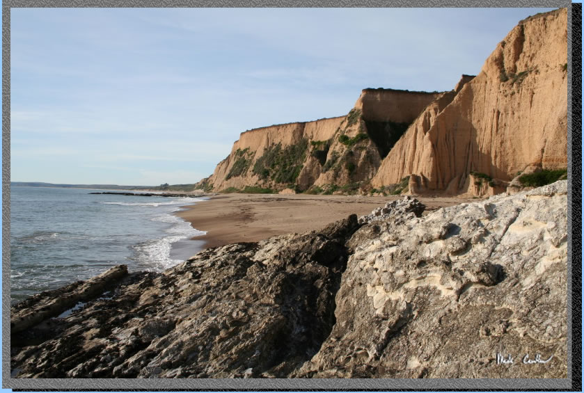
Another great cliff shot.
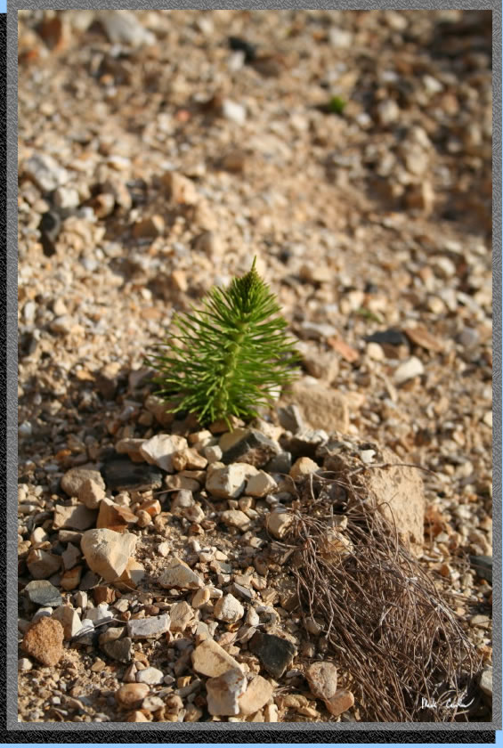
So what the heck are these
little plants?To me they looked like miniature Christmas trees just
popping out of the side of the cliffs. They come out with the "needles"
down and then pop them out once out of the sand.
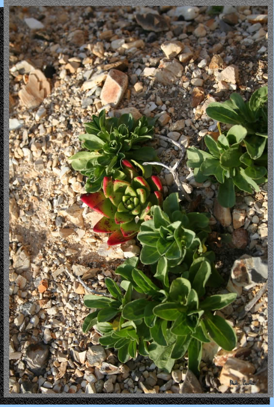
Some cool looking green/reddish
succulent.
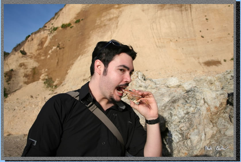
No Dave you need to cook
it first. Don't worry no crabs were hurt during this shot. This guy
was already eaten by someone else (notice the hole on the top of shell).
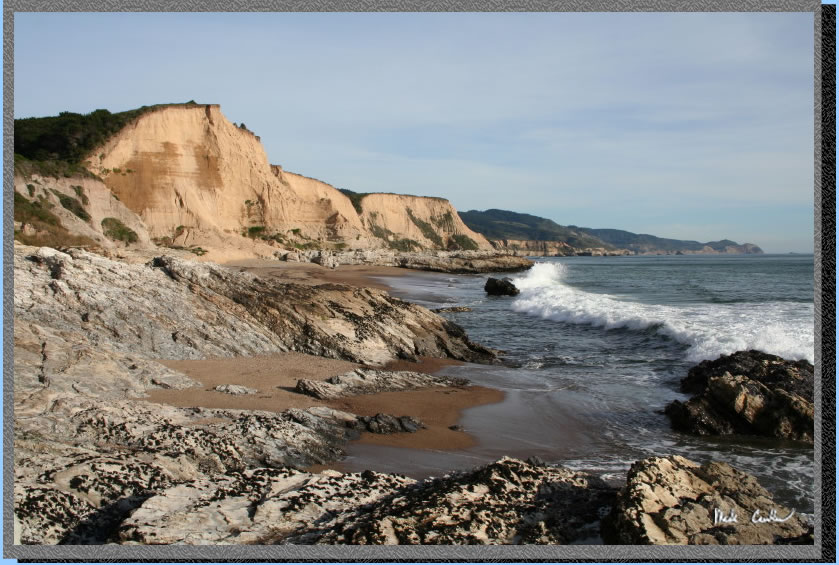
We decided to head back so
we could cook with some daylight. Another cliff shot with the sun low
in the horizon now.
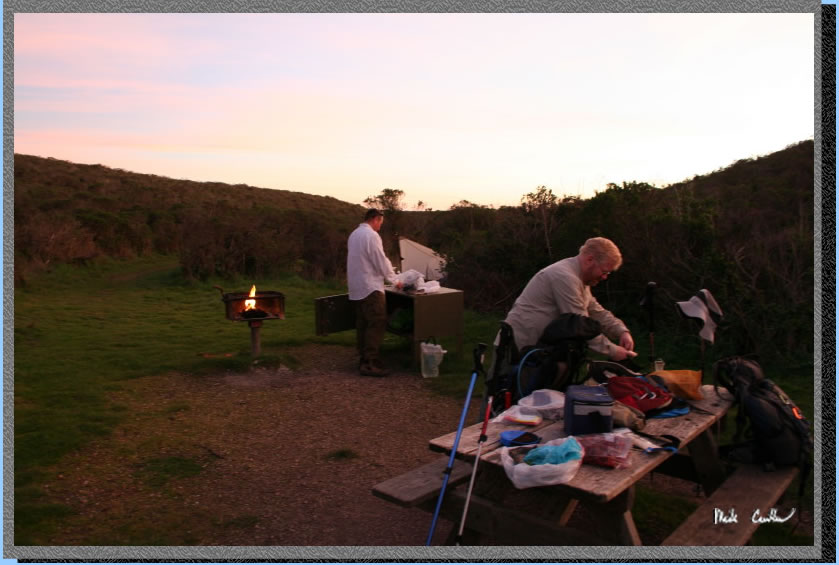
Here we are preparing dinner.
We brought 3 pounds of carne asada from Trader Joe's that we cooked
on skewers over 6 pounds of charcoal. We also had some marinated bell
peppers tomatoes and onion. If there was a raccoon within a hundred
miles I bet he could smell us cooking. We cooked on skewers and ate
everything either from a skewer or made a wrap using a tortilla, so
no dishes. The ice for keeping the meat cool was used to have some trailside
margaritas, on the rocks. We didn't want the ice to go to waste. Leo
is at the provided metal locker and Eric is bartending at the picnic
table. Trail is grass path on left, We had 2 tents and 1 tarp setup
at camp with plenty of space.
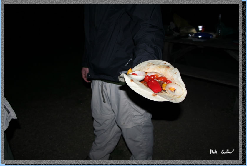
Here is a wrap ready to go.
We all ate until we could eat no more. Luckily we all were hungry from
our beach day hike, so everything was gone in short order.
The next morning I grabbed
some shots with the sun rising. The waves were a little larger today
and the beaches were unbelievably pristine.
We reluctantly packed up
and headed back to the trailhead. We decided to try the deli in Point
Reyes Station on the way back (unless the tamale guy was there again,
but he said he wasn't coming back until Monday). Great trip that has
easy hike in. Add it to your list for a good warm up trip, off season
non-snow trip, or a first timer trip.
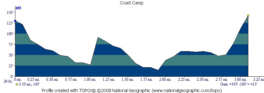
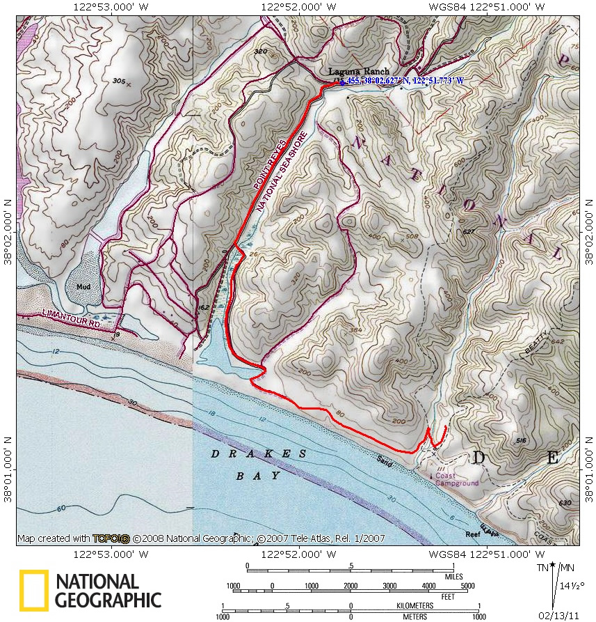
Red line shows the portion
of the Coast Trail that we hiked and then section of trail to get to
site #7. Elevation profile shows how easy this hike is on the lungs/knees.
. 
(back to top)