![]()
 Tyler
and I decided to do a two-night trip to an old favorite of mine, Round
Lake. This particular Round Lake (a popular lake name) is in the Meiss
County Roadless Area to the south of highway 89 (south of Lake Tahoe).
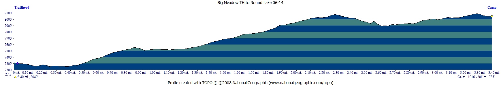
We used the Big Meadow Trailhead right off Highway 89. Camping permits
are not required, but you are required to get a fire permit and follow
leave no trace (and the current fire restrictions). This section of
trail is part of the Tahoe
Rim Trail (TRT). Mileage is
a little more than 3 miles with about 1,000 feet of climbing and 250
feet of descending leaving you 750 feet higher than the trailhead. See
map/profile below. I parked at the furthest parking
spot, so the mileage is slightly higher. I would rate this trip as easy,
as long as hiking at 7,000 to 8,000 feet does not affect you much. Trail
junctions are well marked and route finding is easy. This trailhead
provides plenty of options for day hikes, or extend this hike, or camp
at a different lake. For a through hike see this trip
to Echo Summit using the TRT and Pacific Crest Trail (PCT). You
can also visit Dardanelles
Lake or Scotts
Lake using this trailhead. We stayed at Round Lake both nights of
our trip and ventured to Dardanelles Lake and back on our second day.
Much of the trail to Round Lake is covered which is nice when it is
warm. The trail can be dusty in spots and is also very popular on weekends.
We went during the week and had the lake to ourselves the first night
(I think). We had 2 other groups around the lake on the second night
(a Thursday night). There are plenty of sites around Round Lake so it
can still feel like you are out there by yourself. We stayed on the
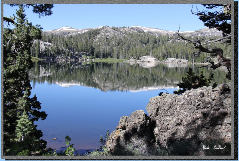
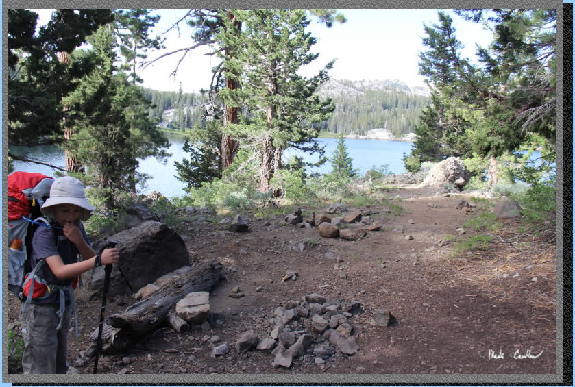
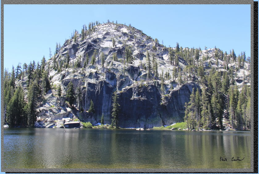
north side (outlet side), above the lake. Our camp was a little more
open and had some great lake views like this one captured one morning.
We did not fish, but were told there was good fishing at Round Lake,
and I saw many jumping in the early morning and evening.
Tyler
and I decided to do a two-night trip to an old favorite of mine, Round
Lake. This particular Round Lake (a popular lake name) is in the Meiss
County Roadless Area to the south of highway 89 (south of Lake Tahoe).
We used the Big Meadow Trailhead right off Highway 89. Camping permits
are not required, but you are required to get a fire permit and follow
leave no trace (and the current fire restrictions). This section of
trail is part of the Tahoe
Rim Trail (TRT). Mileage is
a little more than 3 miles with about 1,000 feet of climbing and 250
feet of descending leaving you 750 feet higher than the trailhead. See
map/profile below. I parked at the furthest parking
spot, so the mileage is slightly higher. I would rate this trip as easy,
as long as hiking at 7,000 to 8,000 feet does not affect you much. Trail
junctions are well marked and route finding is easy. This trailhead
provides plenty of options for day hikes, or extend this hike, or camp
at a different lake. For a through hike see this trip
to Echo Summit using the TRT and Pacific Crest Trail (PCT). You
can also visit Dardanelles
Lake or Scotts
Lake using this trailhead. We stayed at Round Lake both nights of
our trip and ventured to Dardanelles Lake and back on our second day.
Much of the trail to Round Lake is covered which is nice when it is
warm. The trail can be dusty in spots and is also very popular on weekends.
We went during the week and had the lake to ourselves the first night
(I think). We had 2 other groups around the lake on the second night
(a Thursday night). There are plenty of sites around Round Lake so it
can still feel like you are out there by yourself. We stayed on the
north side (outlet side), above the lake. Our camp was a little more
open and had some great lake views like this one captured one morning.
We did not fish, but were told there was good fishing at Round Lake,
and I saw many jumping in the early morning and evening.
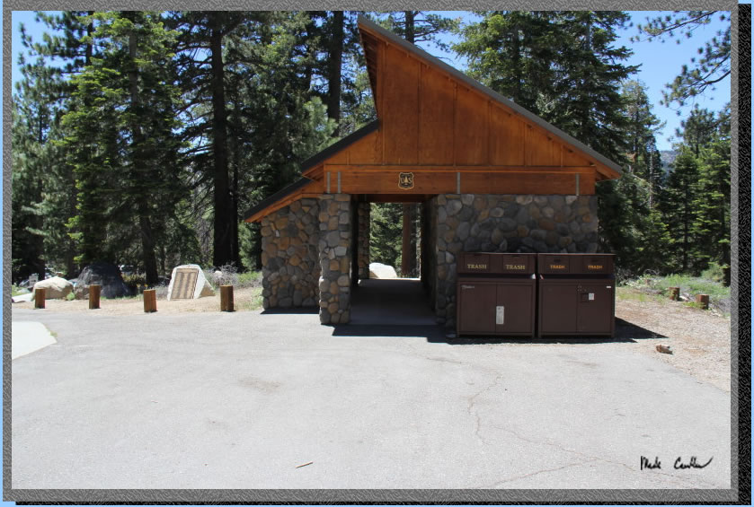
Here
is a picture of the Big Meadow Trailhead. As I mentioned the trailhead
is located off Highway 89 which you can access either from Highway 50
or Highway 88. I think 50 is a little faster but not as scenic as 88
over Carson Pass. The trailhead does not have water so plan accordingly.
There are nice pit toilets (yes, there are nice pit toilets and some
not so nice pit toilets) and trash cans . The trailhead is on the north
side of the roadway. Here is a shot of the trash and bathroom facilities.
Leaving the
trailhead, headed south (towards the highway) will lead you pass this
informational sign/map. Make a point of looking at it and also carrying
a map of the area. There are Black Bears and Rattlesnakes so know how
to handle an encounter with each.

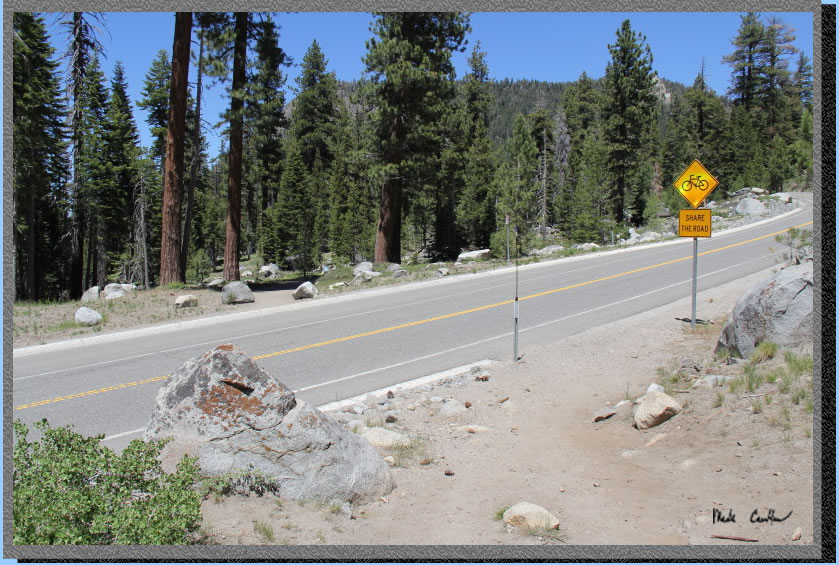
The trail crosses Highway
89 here at the yellow "Share the Road" sign. I find the safest
way to cross here is to use my ears as much as my eyes. The road has
a curve and it is difficult to see vehicles approaching, but easy to
hear them before you can see them. Wait until you can't see or hear
any vehicles and quickly cross the street. Crossing with a heavy pack
means you are a little slower and less agile so keep that in mind.
You will hear Big Meadow
Creek once you get hiking on the other side of the road. The trail stays
to the east of the creek and goes up at a moderate pace. Mountain bikers
and horses frequent this area so look out for both. This first section
will quickly have you breathing hard, so take your time.
They reworked this first
section of trail a few years back (Ok maybe more than a few now). It
is a much better grade than it used to be but keeps you further from
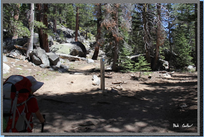
the creek. Before you know it you will be at your first trail junction,
Scotts
Lake.Stay to the right at this junction. The trail evens out at
this point. Here is a shot of the trail junction.
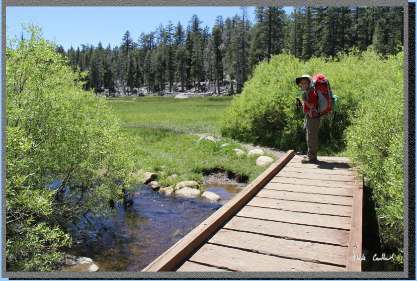
A short hike and you are
at the Big Meadow Creek crossing which has a nice bridge. The water
was flowing like it was more like July than June, but I was just happy
that things were still blooming and green out here. Here is Tyler on
the bridge. I have seen this bridge under water in early season before.
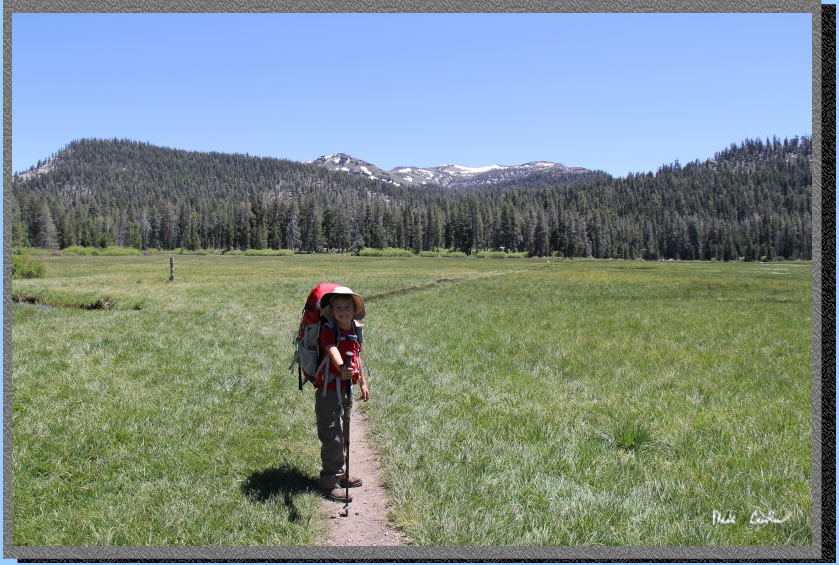
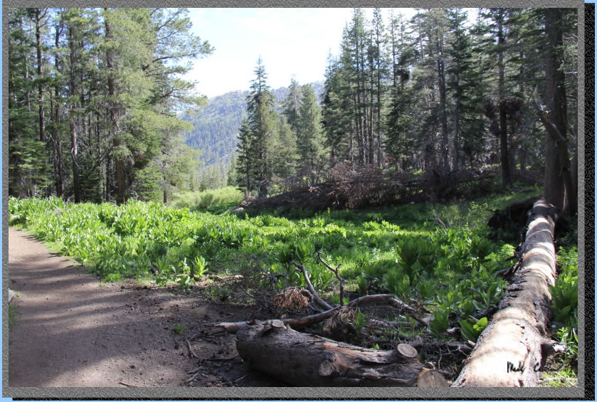
Here is Big Meadow in all
its glory. You can see snow on peaks in the distance. It was nice to
see some snow still around. All the talk of drought made me wonder if
there would be anything green/wet out here.
After crossing Big Meadow
you head uphill again under mainly conifer cover. There was an abundance
of mule ear through this section..
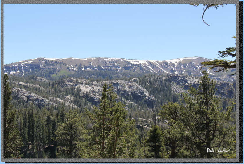
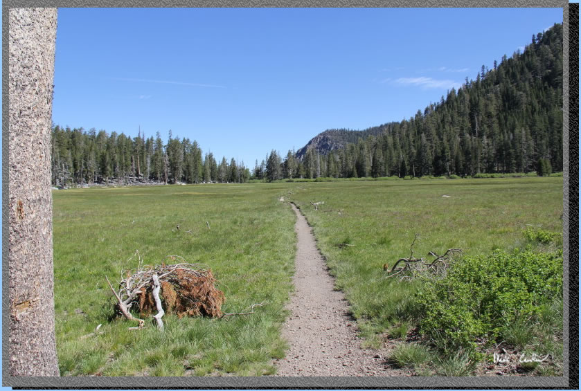
You reach a ridge and then
head down the other side. The ridge gives some great views of the surrounding
peaks. Weather was great for us with it reaching almost 70 and nice
afternoon breezes to help control the mosquitoes. This shot was captured
heading down the ridge. You reach the trail junction for
Dardanelles Lake once you reach the bottom. Stay left to Round Lake.
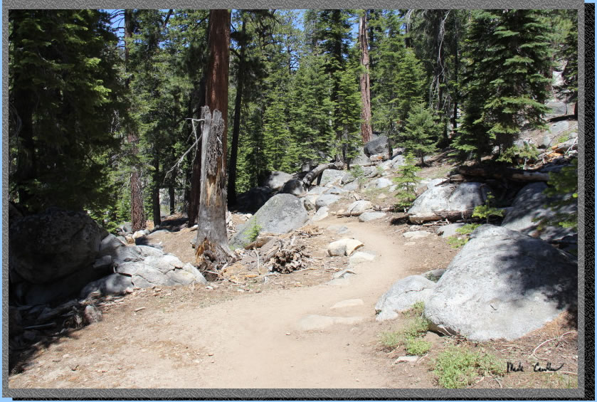
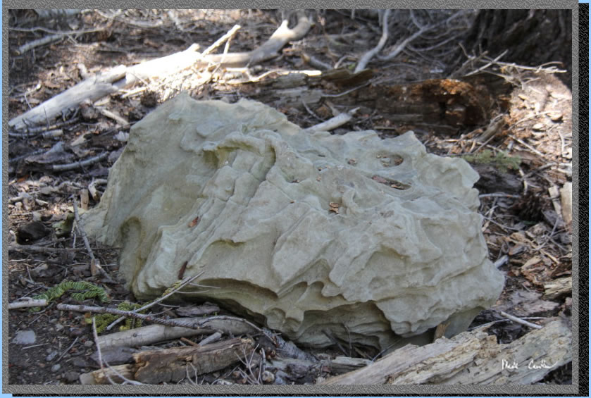
There are some really neat
rocks to check out along the trail. Granite is always neat but this
area has some metamorphic rock that looks like the roughest exposed
aggregate boulders you have ever seen. Some of these boulders are the
size of cars and some are even bigger. This rock is neither, I am actually
not sure what kind it is but it looked cool so I had to grab a shot.
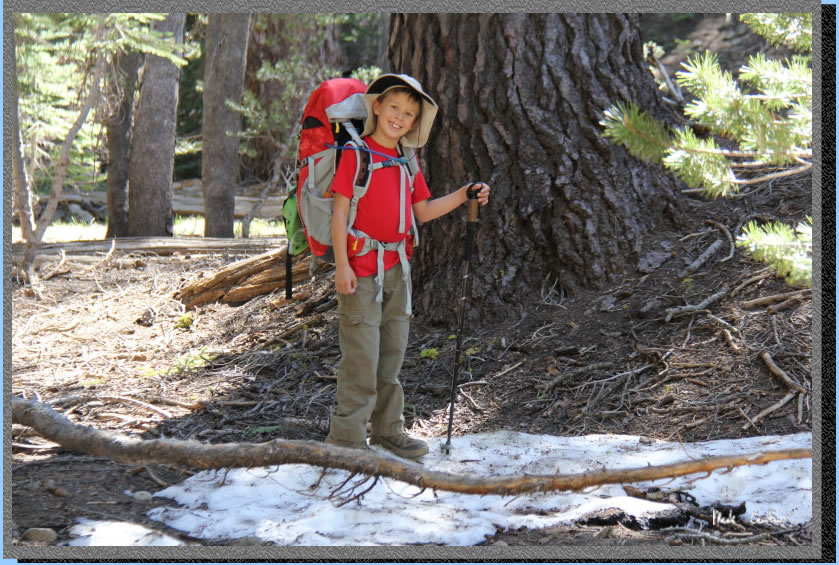
I told Tyler to keep his
eyes peeled for snow and I think he almost gave up until we were almost
to Round Lake. Here he is standing on his patch of snow. There wasn't
much but it was enough to make an 8 year old happy..
So we picked a site on the
north side of the lake above the lake. Fire restrictions are in full
effect so we could not gather wood or have a campfire. We did have an
awesome view of the lake and surrounding peaks. It was a little exposed
to the wind but I was willing to put up with that to lessen the amount
of potential bugs. We talked with one family headed out that said there
first night was pretty windy and their second night was pretty buggy.
I was hoping for something in the middle. Lucky for us we had a nice
breeze until after dinner and then we made it into the tent when the
bugs got a little to thick. Deet was definitely needed to keep the mosquitoes
away, as you would expect for a June trip. We managed to not get bite
on this trip.
We had a nice night with
mild temperatures. It got cold enough to get into our sleeping bags
which was nice. Once Tyler talked me out of mine in the morning we ate
a nice Mountain House breakfast and discussed our plans for our second
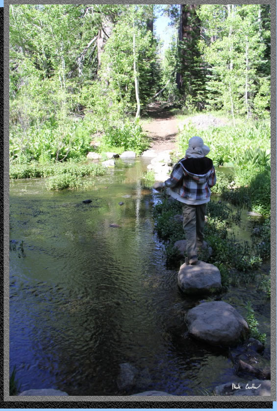
day. We decided to pack a lunch and head to Dardanelles Lake. I should
have run my GPS but was lazy so I didn't. I think the mileage was about
3 roundtrip. We had to back track to the trail junction with Dardanelles
Lake and then do three stream crossings. I think Tyler liked the boulder
hopping across the streams the best. All crossings were easy with strategically
placed boulders.
After a nice easy hike we
made it to Dardanelles Lake. We saw two other backpackers around the
lake but no one camping. This lake is shallower than Round Lake but
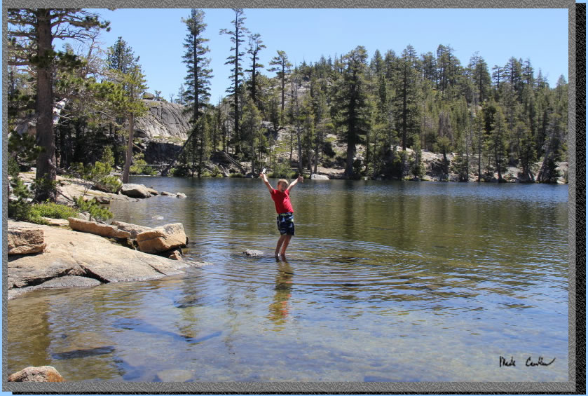
still very swimmable. We decided that with the mild temperature and
the breeze we would just get our feet wet. There was snow on the far
side so the water was damn cold. Here is Tyler happy we made it to the
lake.
. 
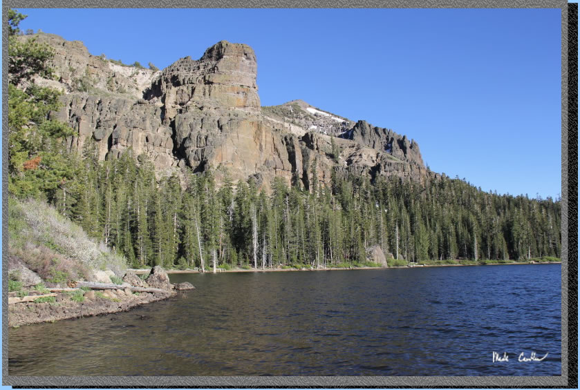
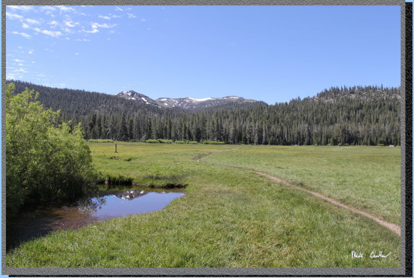
Here is another shot looking
toward Round Lake. There were dragonflies, ducks and geese around this
lake. Plenty to see.
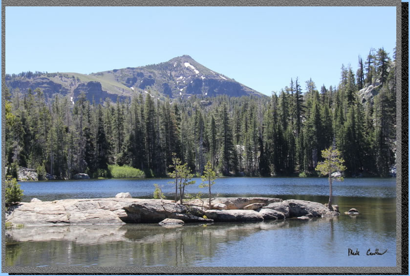
It is a little hard to tell
but that is snow along the shore on the far side of the lake. This hunk
of granite was awesome. It looks fake with the placement of the trees
and the polished edges. We hung out and explored this lake for much
of the day and then reluctantly headed back past Tyler's melting snow
patch to our camp at ROund Lake. We ran into a large group of day hikers
just getting to Round Lake. They did a little cliff jumping off the
west side of the lake before heading out.
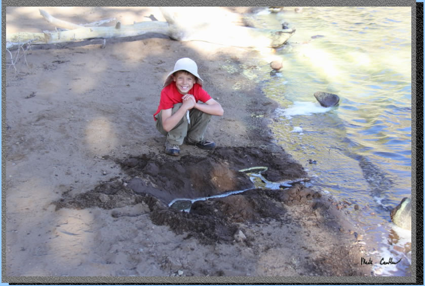
Tyler decided to play on
the beach while I organized camp a little. Here is his creation to catch
the pollen that was blowing over to our side of the lake.
The snow patches above the
east side of the lake were creating some nice cascading creek noise
for us. We walked up to the largest one and checked it out. It wasn't
really that much water, but it sure does have a neat sound that carries
across the lake. We stayed up a little later on our last night in the
hopes of seeing some bats. We did not make it late enough though. It
being almost the summer solstice the day just outlasted us.
We had a slightly windier
night on our last night. We packed up after breakfast the next day and
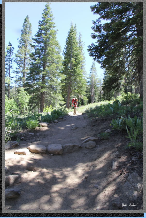
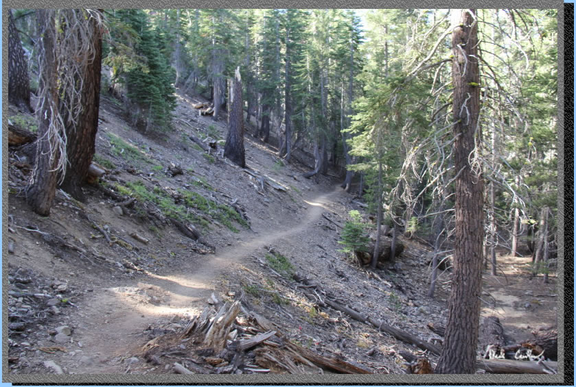
headed out. Here is a shot of the trail close to Round Lake looking
back. Most of the trail in is up, so we had a nice easy hike on the
way out down to the trailhead. This section of trail was also rerouted
a number of years ago. I like the current grading better so you don't
have as much lost elevation.
This shot was taken after
the junction to Dardanelles Lake near the start of the Big Meadow Creek
(at least one finger of it).
We made good time on the
way out and ran into only a couple groups headed in on the Friday. Here
is BIg Meadow looking north.
. 
I grabbed this shot as we
we got to the bridge over Big Meadow Creek. The curving trail, snow
capped peaks and reflection made it my favorite picture of the trip.
This was another great trip and Tyler had a great time. I love this
trail and Round Lake. If you are introducing someone to the Sierras
this a a great way to do it. I always recommend staying away from the
"crowds" by avoiding weekends, and this area can be really
busy on the weekends in the summer. The parking lot overflows onto the
road. Unfortunately, the great places are usually busy on the weekends.
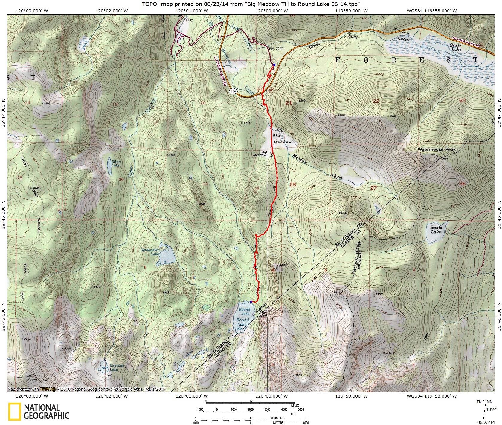
Map and profile from BIg Meadow
Trailhead to Round Lake is shown below.
Click either for a larger version.
.
(back to top)