![]()
Day 1, Day 2
 Permit
- A permit is required for all overnight stays in Emigrant Wilderness.
Permits can be obtained in person at the Summit Ranger Station at 1
Pinecrest Road in Pinecrest off Highway 108. There are currently no
trailhead quotas or fees for the permit.
Permit
- A permit is required for all overnight stays in Emigrant Wilderness.
Permits can be obtained in person at the Summit Ranger Station at 1
Pinecrest Road in Pinecrest off Highway 108. There are currently no
trailhead quotas or fees for the permit.
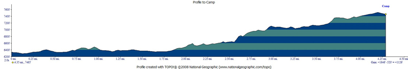
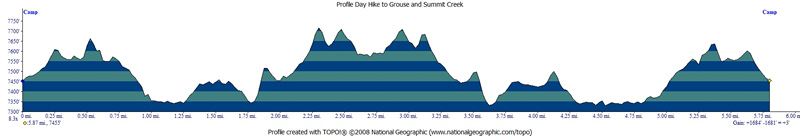
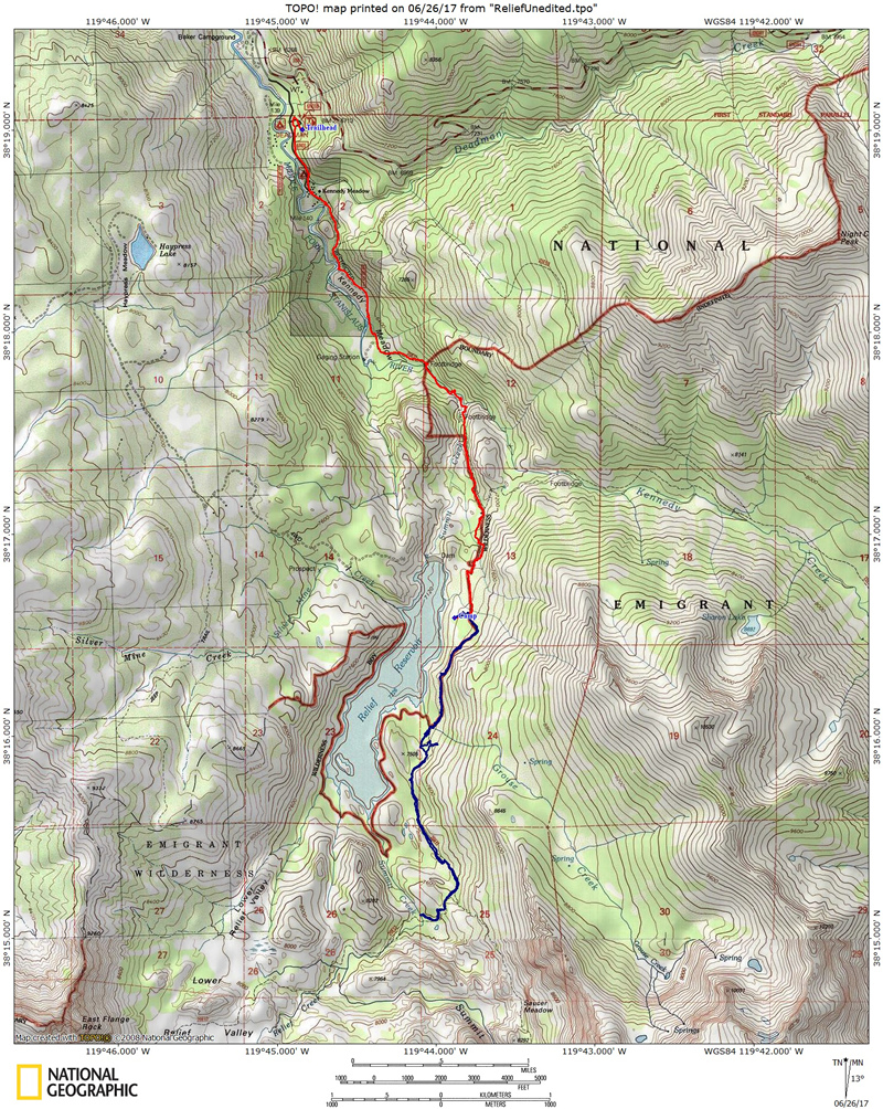
Mileage/Terrain - Day 1 was Kennedy Meadows Trailhead to Relief Reservoir, approximately 4.25 miles (your mileage will vary based on site selection). There is a net elevation gain of approximately 1,100'. Terrain varies from nice tree cover to exposed dusty sections. The trail has some steep sections with steps. Day 2 was a 5.75 mile day hike to Grouse Creek and Summit Creek. See map/profiles below.
Camps/Water - There is a bathroom, trash cans, water at Kennedy Meadows Trailhead. The first part of the hike takes you past the Kennedy Meadows Pack Station (has store and restaurant).
Hazards - Black Bears, creek crossings, snow, mice/squirrels, and mosquitoes. Nearest Ranger # 209-965-3434 (always check with ranger ahead of time for current water/trail conditions - this season it is simply a must because of the long wet winter and massive spring runoff).
DAY 2
Tyler and I
woke up and had a good breakfast and then packed up our ten essentials
(and lunch) to head out for a day hike further south along the trail.
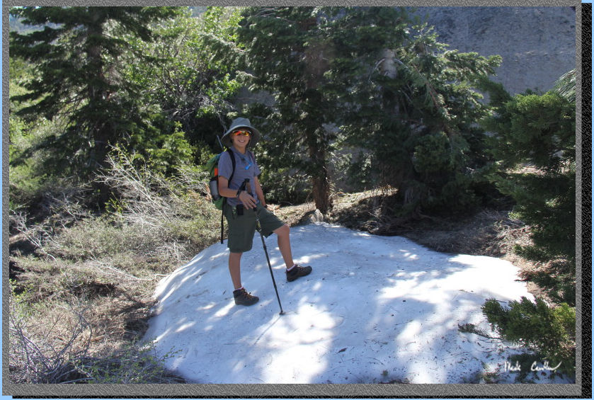
Here is the map and profile of the trip in and the
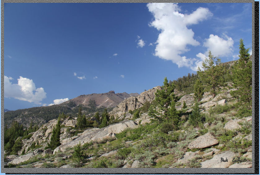
day hike the next day. It was already warming up fast with it forecast
to be close to 90 degrees again today. The trail continues to head up
with some great views (at the expense of no real cover). We were able
to find a couple patches of snow right along the trail. Here is Tyler
with his snow smile on.
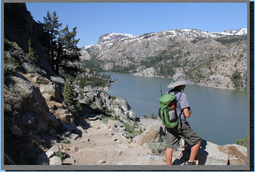
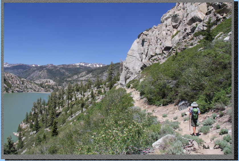
You eventually reach the
high point on the trail and then head down now. The trail remains open
with great views. You are headed down now to a good river crossing (good
meaning you will have to get your feet wet).
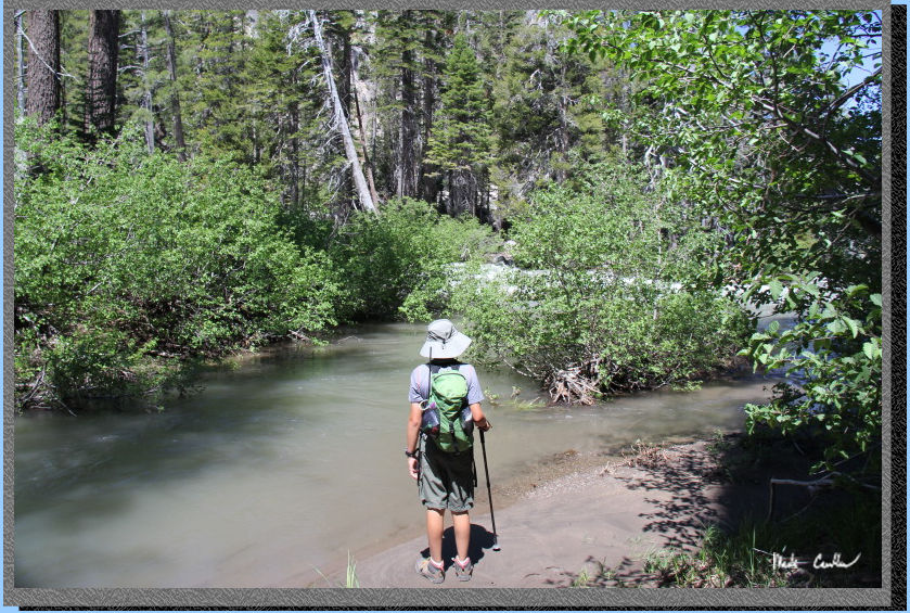
I forgot to take a picture
showing the extent of this creek crossing. I honestly was more concerned
with safely crossing the creek and forgot. The creek is wide through
here but still fast moving. Luckily the highest spots were still below
your knee. We took our time and put on sandals and slowly crossed Grouse
Creek. The water was seriously freezing. It only hurt for a little while
though as it quickly numbed your feet. I would say there were 4 sections
like the one you see below that had to be crossed in succession.
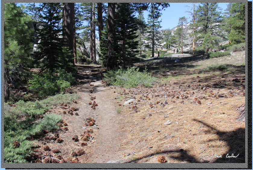
After we safely made it across we dried off our feet, put on our boots
and continued down the trail. The trail is more covered now and there
are several small creeks to cross (actual creeks now, not creeks that
look like rivers). Here is a shot of the trail through this section.
There were tons of pine cones. I would say we had a plethora.
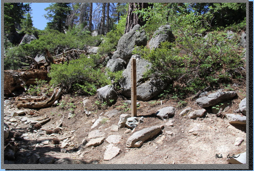
This shot shows the next
junction with Upper Relief Valley. We stayed right and went toward Lower
Relief Valley. We were curious what the next creek crossing might be
like (Relief Creek after it combines with Summit Creek) so we continued
on.
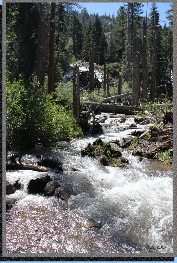
It was a little hard to take
a picture that showed you the amount of water in this creek. The section
in front of Tyler is moving, but it is backed up some as the white water
through the trees is the main part of the creek and not letting much
of this water in. We heard this creek ripping through here much sooner
than we could see it. We didn't try to wander further upstream to see
if there is any way to continue on the trail that is on the other side
of the white water
If you look close at the white water section on the right through the
gap in the bushes you can tell it is headed downhill toward the reservoir.
Should you be unfortunate enough to fall in through here I am sure you
would end up in the reservoir. So we decided to head back to have lunch
on a nice log before crossing Grouse Creek again and heading back to
camp.

We only saw one other group
on the trail that day and they were headed out to the point past Grouse
Creek. This section has some nice tree cover and likely has some nice
camping spots. None of that area would have as nice a view as our site
did, but the water access looked good. Here is Tyler on the way back
to our site, pretty close now.
We still had time to head
down the to the water. I thought about going in, briefly, but the clouds
were picking up again so I decided against it.
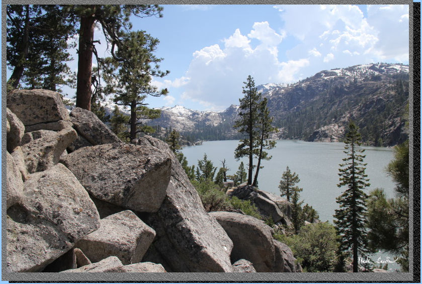
I did have some time to grab some cool shots on the way back up to camp.
I like this one with the piled rocks in the foreground.
Here is camp. I brought my older REI Halfdome as it breathes better
than my Scout UL2. With the forecast of "HOT" I thought it
was well worth the extra weight. I had to leave the rainfly on because
of the threatening afternoon clouds.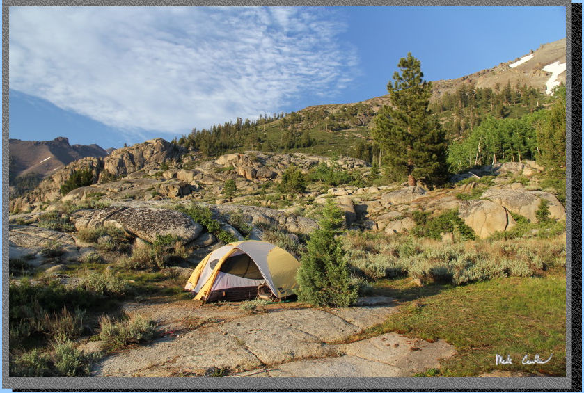
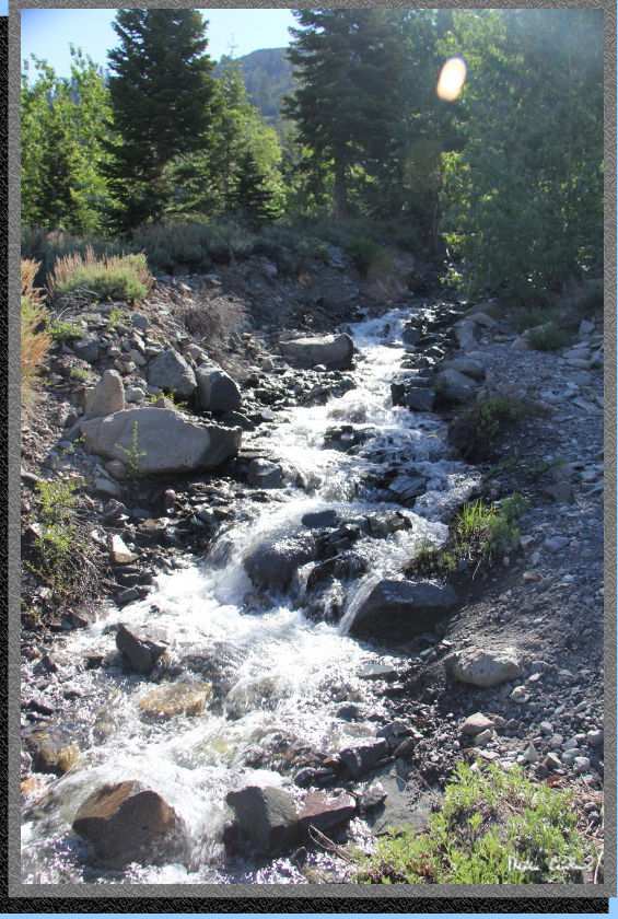
Here is the creek we usually
filtered our water from. No trick photography here, it was really flowing
that fast. I actually took this on the way out.
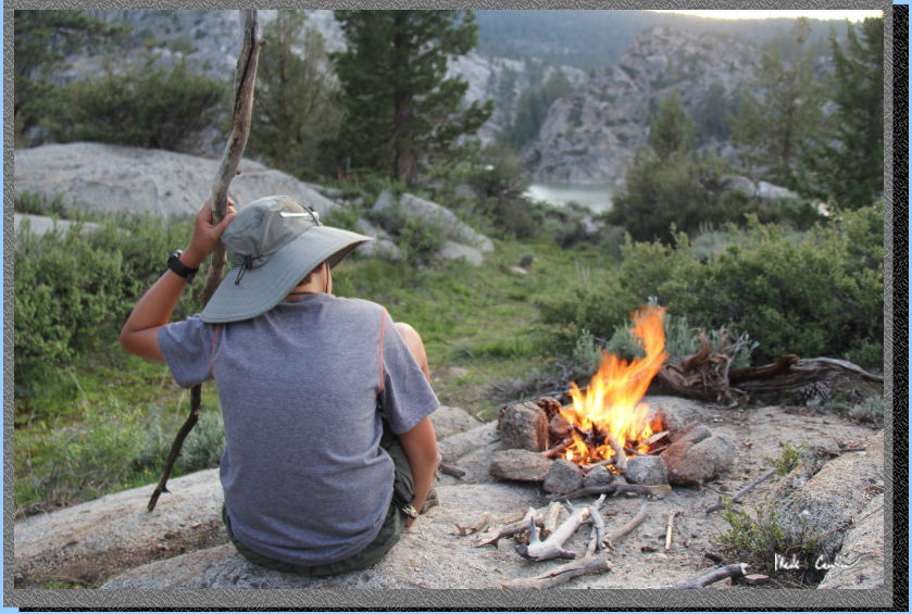
Here is the Fire Marshall at camp tending to his fire. Good job with
the fire Tyler. It also gave me chance to use my collapsible bucket.
We had it filled and ready. Luckily it cooled down quite a bit that
night (once the sun went down) so we could have a little fire. This
was an awesome trip with lots of water. I recommend that you make a
point of getting out to the Sierras this summer to experience it. Tyler
and I stayed up for a while looking at the stars (no moon to spoil the
perfectly clear sky. I was able to see a few satellites and a couple
shooting stars as well. I will leave you with a few shots that didn't
fit into the trip description.
Glowing tree...
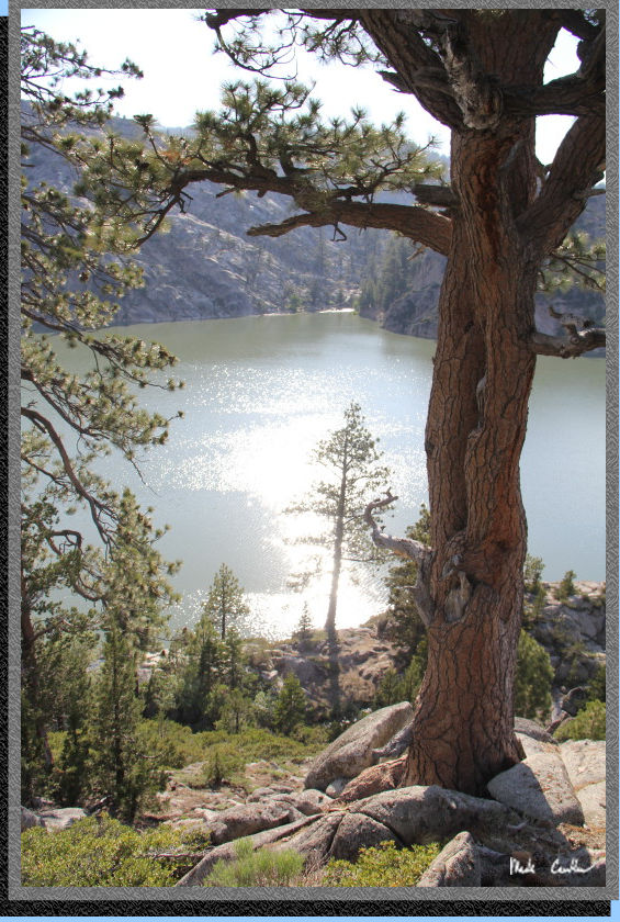
The view to the west from
camp.
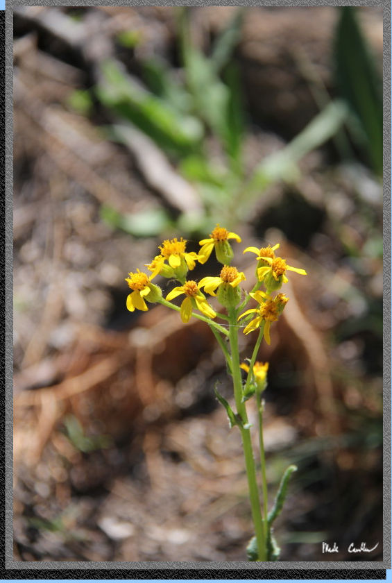
The wildflowers are not out
here in force yet, but I am sure they will be soon enough.
Go back to Page 1 by clicking
here. Scroll down for map and elevation profile.
Red line shows the
section we hiked with packs.
Blue line is day hike on day 2 to Grouse Creek and Summit Creek (and
return trip).
Elevation profiles below map.
Click on map or profile for larger version.
.
(back to top)