![]()
 Permit
- Desolation Wilderness only allows a certain number of people
per zone per
night. Many zones have more than one lake in them. Half
of each zones quota can be obtained through the online reservation system
at www.recreation.gov,
the other half are obtained the same day from the ranger station (two
miles east of the Highway 50/89 junction in South Lake Tahoe on Highway
50) or the Taylor Creek Visitor Center (three miles north of the Highway
50/89 intersection). I would get to the ranger station early if
you are doing the same day option. Fees: $5
for the 1st night; $10 for 2-14 nights per adult with a $6 service fee
per permit. (2 nights for 2 people would be $26)
Permit
- Desolation Wilderness only allows a certain number of people
per zone per
night. Many zones have more than one lake in them. Half
of each zones quota can be obtained through the online reservation system
at www.recreation.gov,
the other half are obtained the same day from the ranger station (two
miles east of the Highway 50/89 junction in South Lake Tahoe on Highway
50) or the Taylor Creek Visitor Center (three miles north of the Highway
50/89 intersection). I would get to the ranger station early if
you are doing the same day option. Fees: $5
for the 1st night; $10 for 2-14 nights per adult with a $6 service fee
per permit. (2 nights for 2 people would be $26)
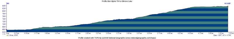
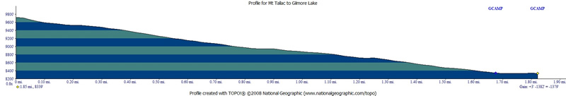
Mileage - 5 miles to Gilmore Lake (1,800' elevation gain) and another 1.75 to the top of Mt Tallac (1,400' more elevation gain). map
Camps/Water - There are trash cans and bathrooms at the Glen Alpine trailhead but no water. You could pump from the creek that leaves Lily Lake. Gilmore Lake had plenty of water, as did the creeks (but it poured on us day 1).
Hazards - Bears, Lightning, and pesky Golden Mantled Ground Squirrels (they will try to get your food).
NO FIRES ARE ALLOWED IN DESOLATION WILDERNESS (only camp stoves)
-Day 1-
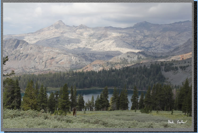
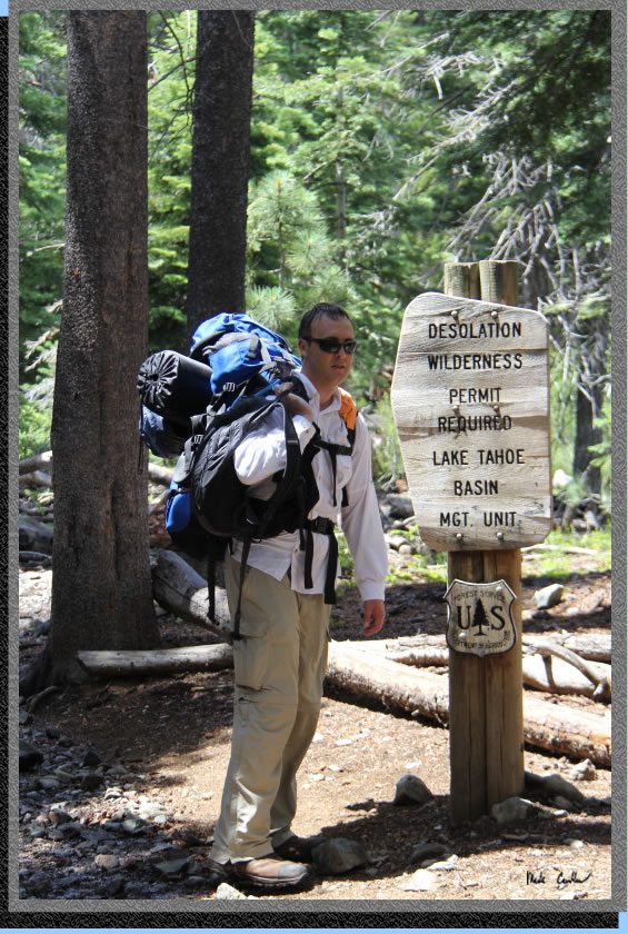
Lee and I decided to do a two night trip to Gilmore Lake with a day hike to Mt Tallac on day 2 (map/profile below). This is a popular section of Desolation Wilderness and even midweek you will not have the trails to yourself. We decided to head in from the Glen Alpine trailhead. To get to this trailhead you need to head past South Lake Tahoe on Highway 89. Head north past Camp Richardson and then look for Fallen Leaf Lake Rd on the left hand side. The road in goes along the lake and is very narrow (one lane). Stay on this road until it dead ends into the trailhead parking lot. You go by quite a few private cabins and have some nice views of the lake on the way in. You pass right by the Fallen Leaf Lodge and also the Fallen Leaf Lake Fire Department. Here is a shot of the trailhead. Parking can be full at this trailhead on the weekends, I have had to park along the road on the way in to the official parking lot in the past. We had a bit of weather headed our way, so the pictures on day 1 are not my typical assortment. I actually had to stash my camera in my pack and put on rain gear... more on that in a bit. I was able to take some good pictures on the way out of this section of trail on day 3 though. The weather was pretty muggy/humid at the trailhead and we had a little rain even. This trail is well traveled and all junctions are well marked.

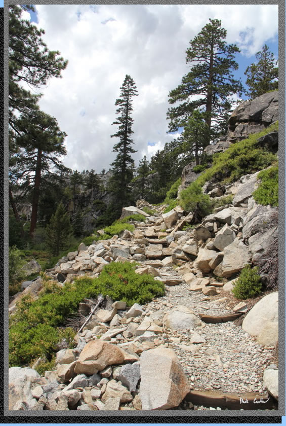
The trail is gently up along the rocky road on the way in. It started to rain some and we had distant thunder. Not enough rain to be more than annoying yet. We hiked through the Glen Alpine Spring (historic resort here). There are actually some lucky people with cabins on this first section of the trail before you reach the wilderness boundary. I had the camera out and then stashed it, and then the sun came back out again. I was able to capture this picture of the weather gods sending us a message...

Here is the Desolation Wilderness Boundary with Lee looking quite dry. I had thought we were wetter at this point already, apparently my memory is a little soggy (or maybe he dried out better than I).
Here is the trail ascending more sharply now, in the official wilderness. It was shortly after this section pictured when the sky simply opened up on us. We had some hairy moments of thunder and lightning cells and some heavy hail/rain. We put on our waterproof stuff and I stashed the camera in my pack. The trail turned into a river in many spots with areas flooded and stream crossings looking more like Spring, than late July of a drought year. I did check with a ranger on the weather on the way in, chance of thunderstorms. Well we had a good few hours of that "chance"...
Here is a shot that Lee grabbed with his cell on the way in. It really dumped on us. Lucky for us we were both prepared for this scenario. Lee had a poncho that protected him and his pack. I had a good set of rain gear and a garbage bag over my pack (cheapest pack cover available, always carry at least one). We both had good waterproof boots, but there were sections of the trail that simply turned into a stream in spots (we actually had to go around a couple sections of flooded trail). We took our time ascending, waiting out the worst of the hail/lightning when we could, safely. There was actually a time when we considered turning back because of the severity of the weather/lightning. Lucky for us the lighting eased a bit and we were able to continue. There were some people that were coming down the trail that simply were not prepared for the weather we were experiencing. The shot below may look like snow but it is all hail (yes it hailed that much that even after it poured, the hail remained). The rain was that crazy cold big drop stuff, I still feel sorry for those people hiking out in shorts/running shoes and tank tops. I was able to hike in my full rain gear without getting hot, that is how much cooler the weather got.

So, after a wild weather hike in we looked for a site that was not too water-logged (and looked like it would drain well should the weather turn again). We hiked to the east side of Gilmore Lake (over the dam) and found a good site tucked back from the lake a bit. The white stuff to the left of Lee is hail that remained into the evening.
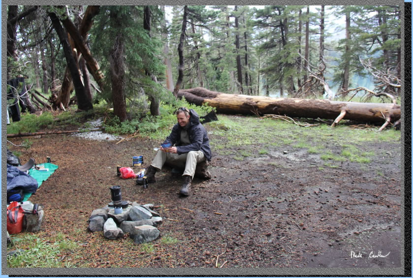
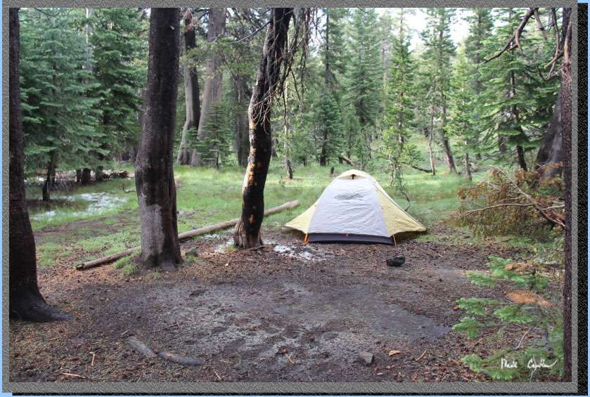
Here is the REI Half dome tent I have (not the newest model). I had packed this in case we had to deal with any weather at camp. It is nice to have the double vestibules should you need to spend any significant time in the tent. I had also cooked hanging out the vestibule before (not in the vestibule, that would be bad). You can see a few lingering sections of hail in this shot as well. Lucky for us the rain had pretty much stopped when we arrived at camp. There were still some dark clouds, and some more distant thunder and lightning that afternoon, but nothing like the hike in. We were able to dry out some of our gear that evening before climbing into our warm dry sleeping bags that night.
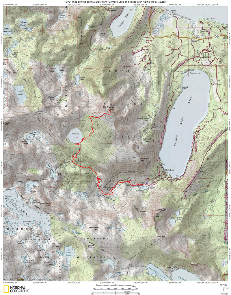
Bright red line shows the
trail from the parking lot at Glen Alpine trailhead to Gilmore Lake
and then to Mt Tallac. Elevation profiles below show the trail to Gilmore
Lake and then another one showing the hike from Mt Tallac back to camp
at Gilmore Lake. Click on either for a larger image.
.
(back to top)