![]()
Day 1, Day
2/ Day 3, Day 4/Day 5
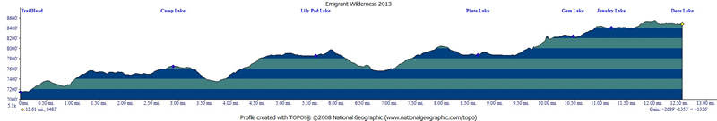
map/profile
Leo,
Dan and I decided to do a 4 night trip into Emigrant Wilderness. Our
plan was to take the mileage easy and explore the numerous lakes from
the Crabtree Trailhead. See previous trips to Bear
Lake, Pine
Valley/Grouse Lake, and Piute
Meadow/Camp Lake from this trailhead .  On
this trip we explored Camp Lake, Lilypad Lake, Piute Lake, Gem Lake,
Jewelry Lake and Deer Lake. See map/profile below.
I broke this trip into a few pages due to the number of images but will
include the map/profile on the bottom of each page. Emigrant Wilderness
is accessed via Highway 108. To get to the trailhead from the bay area
take highway 120 east until the junction of 120 and 108. Stay straight
to go onto 108. You can obtain your required wilderness permit (which
is free) at the Mi Wok Ranger Station (209) 586-3234 or the Pinecrest
Ranger Station (209) 965-3434. You have to backtrack a little if you
get it at Pinecrest, but not much. If you end up at Pinecrest ask the
ranger about taking the road to Dodge Ridge and then cutting over (so
you don't have to backtrack to Crabtree Road on 108). The trailhead
we left from is called Crabtree Trailhead off Crabtree Road. Parts of
Crabtree Road are unpaved but it was dry and in good condition. It is
a right turn (headed east) before Pinecrest Lake/Dodge Ridge turnoff.
Once you are on Crabtree Road follow the signs to the Aspen Meadow Pack
Station, but continue past/through the pack station to the trailhead.
Junctions are well marked all the way to the trailhead. There are a
few narrow spots but not a bad road. You
are allowed to camp right at the trailhead so it is an option if you
want to get an early start. This trailhead is popular. We saw vehicles
parked along the road on the way to the parking lot. My guess is that
the trails are crazy busy summer weekends. Make
sure you pick up a map with the permit. I always like to make sure that
my group has at least 2 maps, just in case one turns out to be for a
different wilderness...
On
this trip we explored Camp Lake, Lilypad Lake, Piute Lake, Gem Lake,
Jewelry Lake and Deer Lake. See map/profile below.
I broke this trip into a few pages due to the number of images but will
include the map/profile on the bottom of each page. Emigrant Wilderness
is accessed via Highway 108. To get to the trailhead from the bay area
take highway 120 east until the junction of 120 and 108. Stay straight
to go onto 108. You can obtain your required wilderness permit (which
is free) at the Mi Wok Ranger Station (209) 586-3234 or the Pinecrest
Ranger Station (209) 965-3434. You have to backtrack a little if you
get it at Pinecrest, but not much. If you end up at Pinecrest ask the
ranger about taking the road to Dodge Ridge and then cutting over (so
you don't have to backtrack to Crabtree Road on 108). The trailhead
we left from is called Crabtree Trailhead off Crabtree Road. Parts of
Crabtree Road are unpaved but it was dry and in good condition. It is
a right turn (headed east) before Pinecrest Lake/Dodge Ridge turnoff.
Once you are on Crabtree Road follow the signs to the Aspen Meadow Pack
Station, but continue past/through the pack station to the trailhead.
Junctions are well marked all the way to the trailhead. There are a
few narrow spots but not a bad road. You
are allowed to camp right at the trailhead so it is an option if you
want to get an early start. This trailhead is popular. We saw vehicles
parked along the road on the way to the parking lot. My guess is that
the trails are crazy busy summer weekends. Make
sure you pick up a map with the permit. I always like to make sure that
my group has at least 2 maps, just in case one turns out to be for a
different wilderness...
We ended up not starting
to hike until around 12:30, and it was rather warm, and we had heavy
packs. But, we were finally out on the trail so we were having fun while
we were sweating our way to Lilypad Lake. The distance was around 5
miles with much being in the uphill direction (see profile below). My
gps had a little "blip" near the Pine Valley overlook so actual
mileage is slightly less. You might be saying Lilypad Lake is not on
my map! Well it isn't named on the map, but rest assured it does exist
and it is located along the trail before you drop down to Piute Meadow.
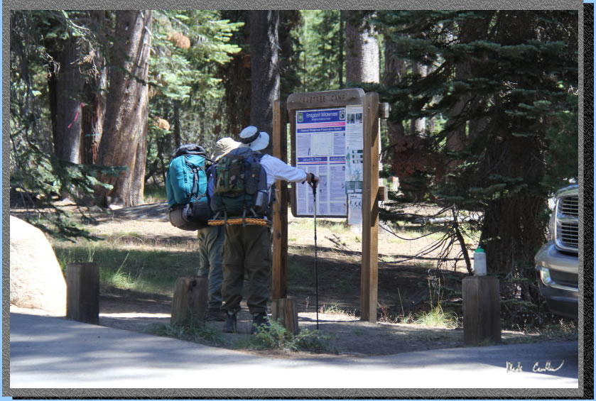
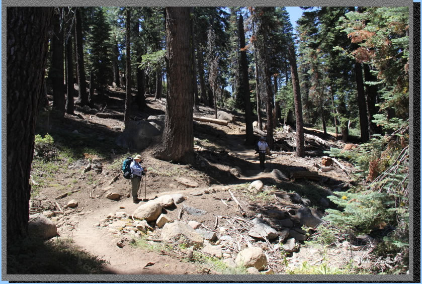
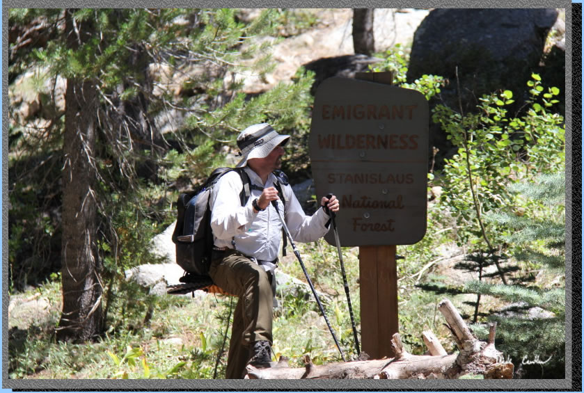
Here is a shot of Leo and Dan reading the trailhead signage. The trail
starts out from the east side of the trailhead and immediately crosses
a bridge over Bell Creek.
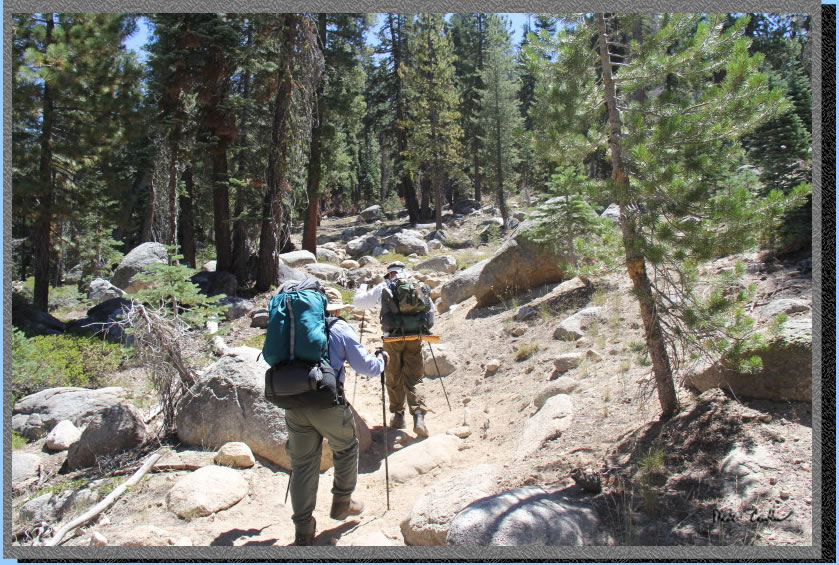
The first junction is not
too far down the trail. Stay straight at this junction (left goes off
to Chewing Gum Lake). You start climbing now and the trail is a bit
dusty in spots. We all tended to stay our distance from each other in
the dusty spots, so as to avoid the bulk of the dust kicked up. Here
are Leo and Dan making their way up the trail (we hadn't spaced out
yet).
You continue up until the
junction for the trail down into Pine Valley. We saw more people that
I thought we would on the trail this Monday afternoon. It seems even
midweek you will be seeing people out here. Everyone was pleasant to
speak along the trail. We saw an equal amount of groups headed in and
out.
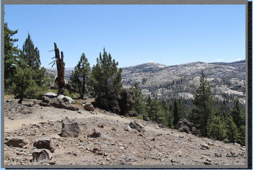
At the junction to Pine Valley
make sure to take it at least until you can catch this view. We heard
some cattle grazing out in Pine Valley. We never saw them (not for a
lack of trying) but could hear the cow bells in the distance a few times
on this trip.
We backtracked to the correct
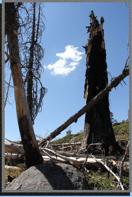
trail and headed on. Here is one of my "dead tree" pictures.
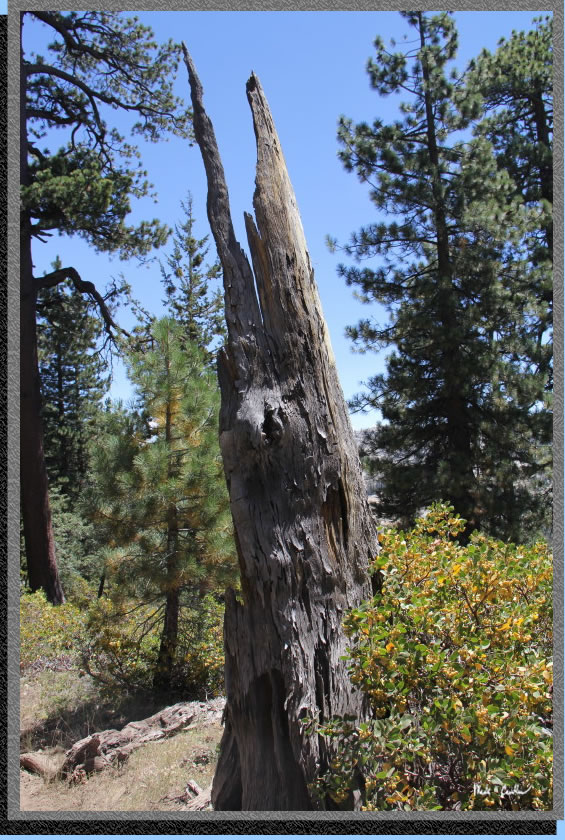
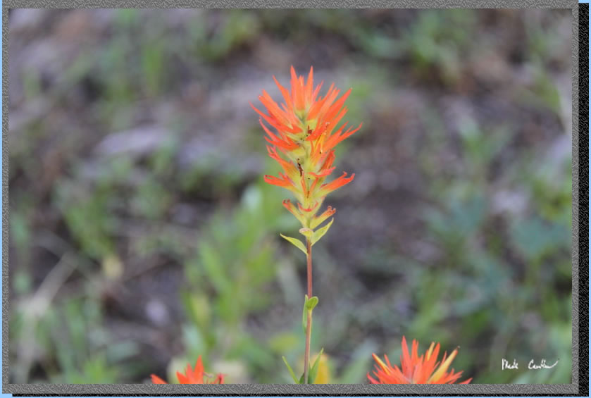
The conditions were DRY out
here. Wildflowers were scarce and so were water sources. We talked with
people who said that the only really good water sources were the lakes.
I can tell you that was pretty much the case from what I saw. Here is
one of the lucky wildflowers to still be hanging around.
You climb up to the Wilderness
Boundary (you did get a permit right?!). You are really close to Camp
Lake at this point. The trail follows the ridge on the left to Camp
Lake. There is a one night maximum stay at both Camp and Bear Lake.
We stopped at Camp Lake to
catch our breath and eat a snack. There is no camping between the trail
and the lake. You have to go up above the lake on the right (south)
side of the trail to camp. There are a few good campsites that are really
open and a couple that have some trees. Make sure that you check out
the views from these sites.

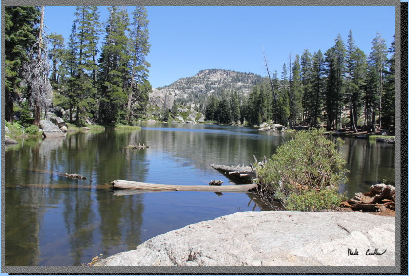
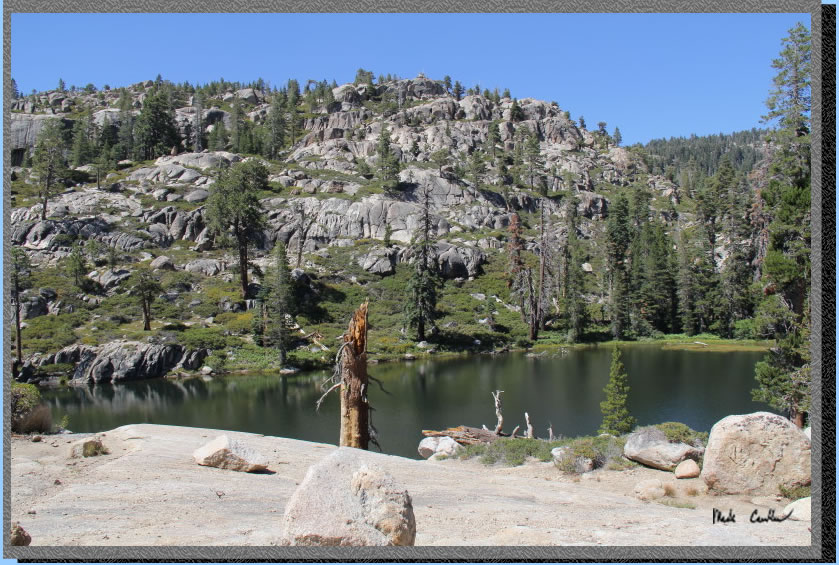
Camp Lake is nice and only
looked a foot below it's normal water level. This is a popular destination
with day hikers.
Here is a shot of Pine Valley
and the granite ridge overlook from above Camp Lake. There are a few
that just drop off so be careful when exploring up here..
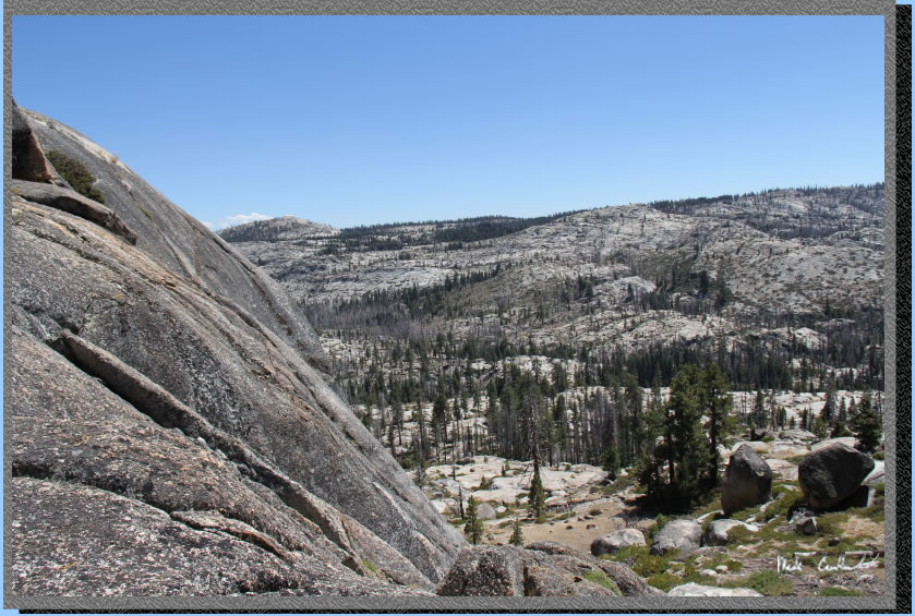
This shot is looking more
southwest, towards the cow bells.
We started to call them the "ghost cows" on this trip because
they sounded really close but we never saw one materialize...
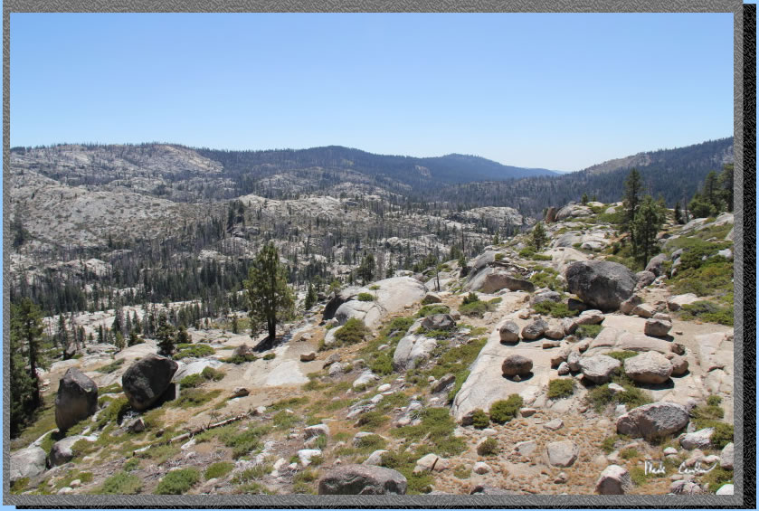
A couple of the sites above
the lake have some views of the lake. You can see the ridge behind the
lake that I mentioned you follow on the way in.
The next section of trail
you hike down to Lily Creek (which was dry where you cross it). You
could see and hear it on the way down but the terrain to get to the
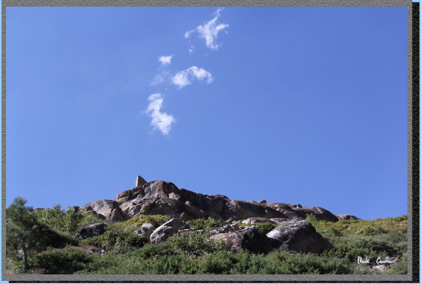
small pools that are visible looks difficult. Make sure you tank up
at Camp Lake. We didn't see much for clouds on this trip so when I saw
one I snapped a picture.
Here is Lily Creek that comes
out of Bear Lake. You can see that keeping our
feet dry was not a problem on this "river crossing".

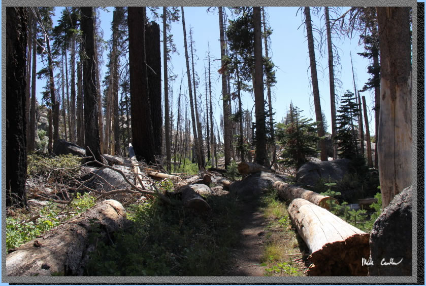
A little ways after the creek
crossing you start your ascent to Lilypad Lake. There was evidence of
a previous fire through this valley and also some new trees that were
taking advantage of the big trees being taken out.
I imagine that these little
trees are really trying to grow as fast as they can, to "win".
I think the tallest tree is the winner since it will steal the sunlight
from the others.
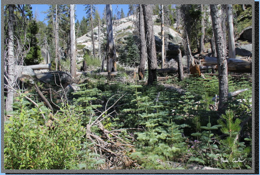
I was out this way 5
years earlier and there was a fire caused by lightning in the next
valley but maybe it spread to this one too?
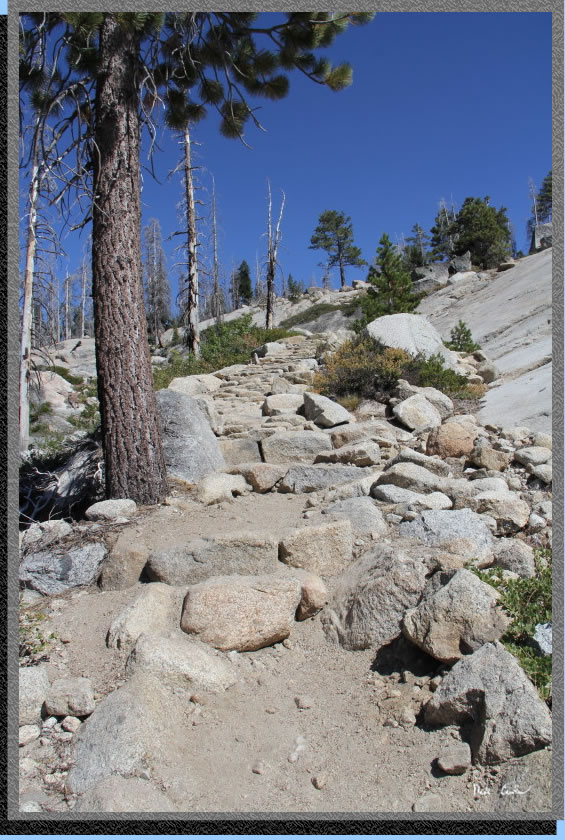
There are all kinds of stairs
on the trail. Some are tiny (Leo said they remind him of a cobblestone
road) while others are crazy tall and make you stretch and use muscles
to climb.
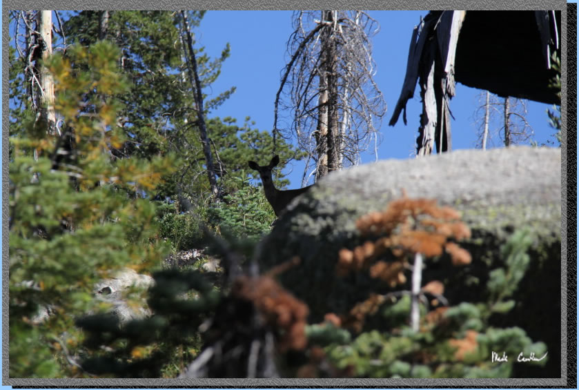
We hadn't seen much wildlife
yet when we caught a glimpse of this guy checking us out. We saw quite
a few deer on this trip in the meadow areas.
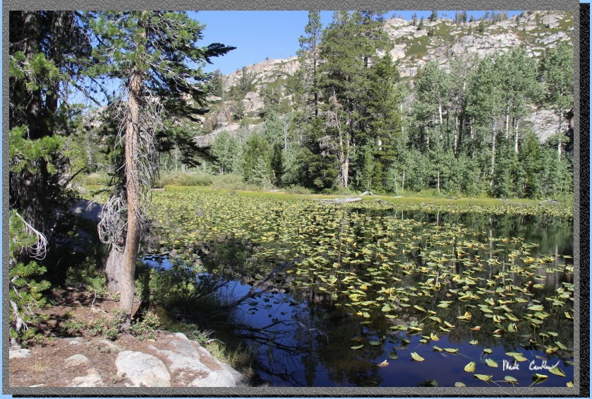
I have to say that I was
concerned when we saw this meadow. It looks like it was once a lake..
We were assured by enough people on the trail that Lilypad Lake did
exist. 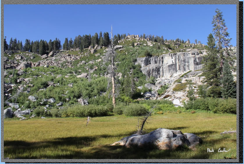
We camped in a well established
site as you first come off the trail to the lake. It was adequate but
sat a little lower than the lake and with the mild nights we were all
a little too warm. Bugs were minimal, except for the giant ants that
seemed ready to invade anything. Leo and Dan used hammocks to sleep
in and I used my "newish" Scout UL2. It was very spacious
to have to myself. It is lighter and packs smaller than my one man tent,
so I had to bring it.
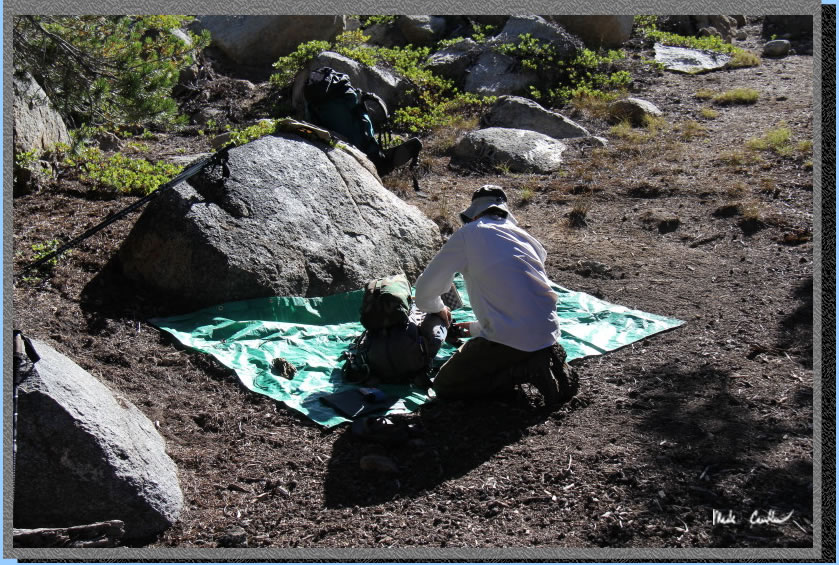
I actually forgot to take
any pictures of our site that night (sorry guys) so the shot above was
Leo packing up in the morning and this shot is of the lake. We couldn't
figure out where it got its name... We did see a very white colored
frog that night hopping through camp. When it was on the granite it
was very hard to make out. We saw one other group at this lake that
night. Bear bagging was a little tricky to find a decent tree. I had
to go a little ways from camp (not a bad thing really). Continue to
next page.
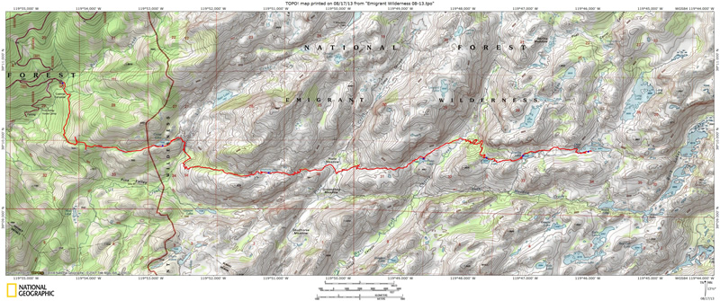
Map and profile
show
trip in from Crabtree Trailhead to Deer Lake. Click either for a larger
version.
.
(back to top)