![]()
The BIG map and profile page
(take me back to backpacking trip description)
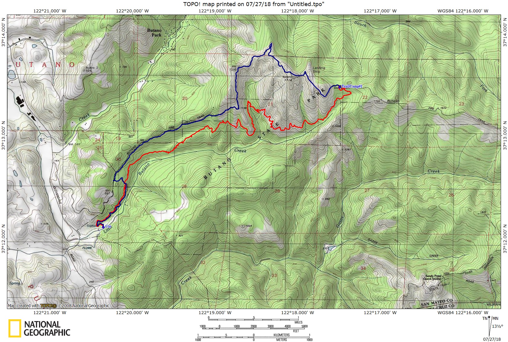
The red line shows
hike in to camp, and blue for the way back out. Scroll down for elevation
profile. We hiked in on the Jackson Flat Trail and out on the Butano
Fire Road (counter clockwise loop).
. 
Here
is the profile for day one. I ended up walking a couple of the sites
with Tyler before settling on site #1, so there may be a little extra
mileage because of that. We used the Jackson Flats Trail, Canyon Trail
and Indian Trail to Camp.
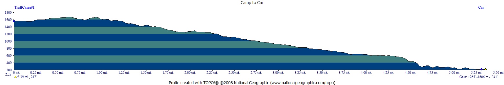
This
is the profile of day two. We used the Butano Fire Road on the way out
to go by the abandoned landing field. We cutover to the Jackson Flats
Trail using the Mill Ox Trail.