![]()
 Permit
- Permits can be obtained by using this
form or by calling 831-338-8861 for same day permits. You must check
availability calendar first here.
Informational guide is here.
Cost is $15 per site up to six people and an $8 non-refundable reservation
fee. Permit and parking pass are emailed to you once you have paid.
Permit
- Permits can be obtained by using this
form or by calling 831-338-8861 for same day permits. You must check
availability calendar first here.
Informational guide is here.
Cost is $15 per site up to six people and an $8 non-refundable reservation
fee. Permit and parking pass are emailed to you once you have paid.
Mileage - The guide/map has mileage listed at 5.7 miles using Jackson Flats and Canyon Trails (my GPS has it at ~7 miles). Using the Fire Road Trail on the way back we recorded 5.4 miles. See map/profiles below.
Camps/Water - This is a dry camp so you must either bring your water or confirm there is water in creeks to treat (there wasn't enough water in creek on our trip). I would recommend just bringing your own. There are 8 sites each with a large food locker. Pit toilet and trash cans closest to trail to sites 1 and 2. NO CAMPFIRES!
Hazards - Poison Oak, mosquitoes (were not too bad), steep terrain, weather (it can seriously rain here) and things on fire (more on that later)
Tyler and I had
planned on a Sierra trip but between the forecast wet weather and the
smoke from the current fires we decided to go somewhere cooler and with
better air quality. After exploring our options we decided on a trip
to the redwoods. Butano Trail Camp has 8 "environmental sites"
with a pit toilet and NO water. We packed in our water, but if the streams
are running you can filter on the way in. You pass some creeks about
a mile from camp. They were NOT flowing when we passed them on this
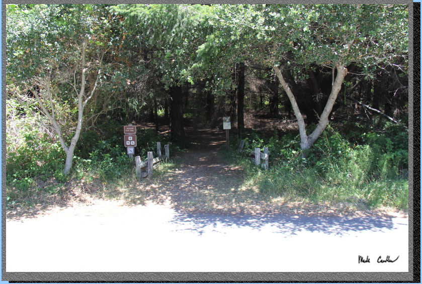
trip, so I would check with ranger ahead of time. To get to the trailhead
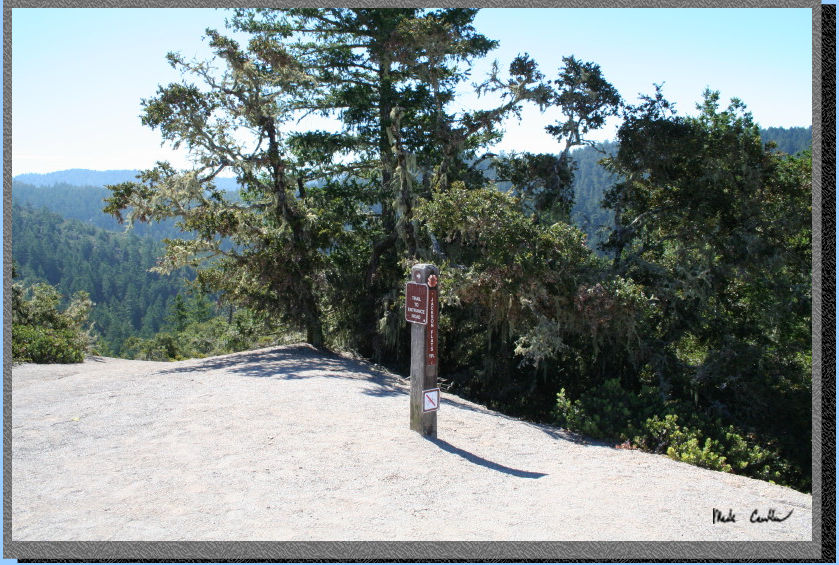
leave highway 1 and head west on Pescadero Road, past Pescadero and
then head south on Cloverdale Road to Butano State Park. We parked at
the gate/Visitor Center (see the stop sign in the picture). There is
not a lot of parking here, not sure where the overflow is if this is
full. We walked to the picnic area and used those bathrooms before hitting
the trail (follow road further in, 100 yards or so).

Tyler and I checked
out the Visitor Center before hitting the trail. I recommend checking
it out if it is open the day you go. There are some nice animal displays
and a 3d map of the park. Make sure you check out the dark room in the
left corner (it is a nocturnal display, also very scary). After I regained
my composure from the frightening nocturnal display we hit the trail.
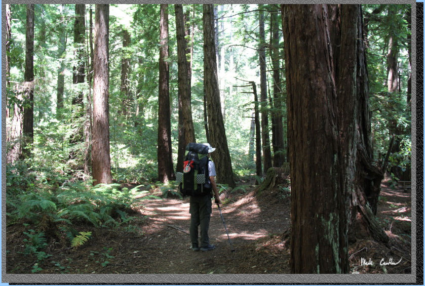
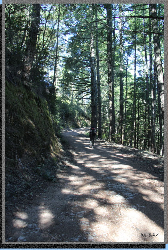
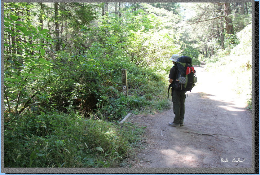
If you like shade then the Jackson Flats Trail is for you. It is probably
around 90 percent covered. We used the Jackson Flats Trail To Canyon
Trail to the Trail Camp. Here is the start of the trail to the right
of the Visitor Center.
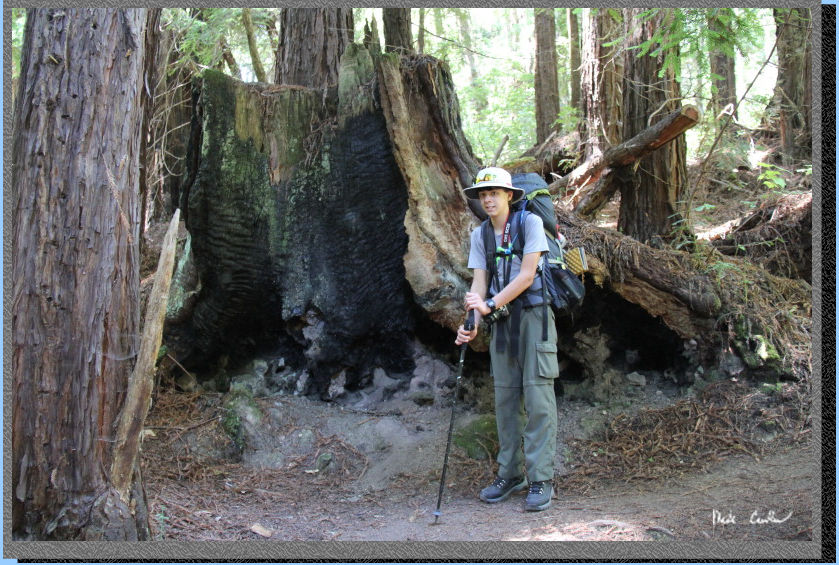
There is plenty
of evidence of old fires through this forest. This area was logged so
the redwoods you see are second and third growth trees. Here is Tyler
next to an old stump.
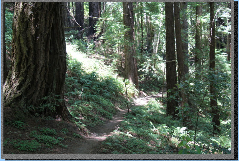
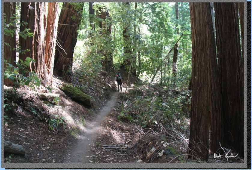
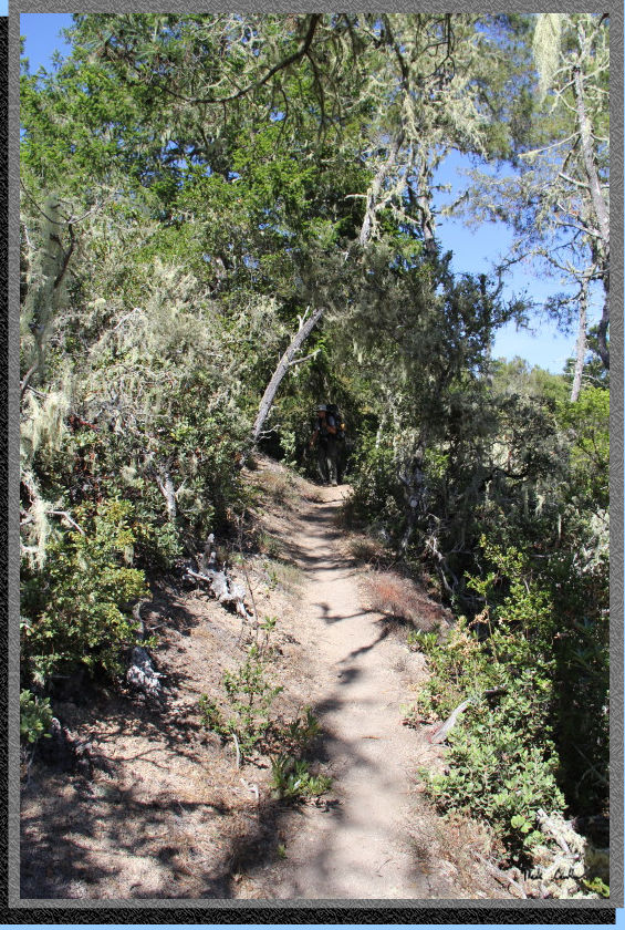
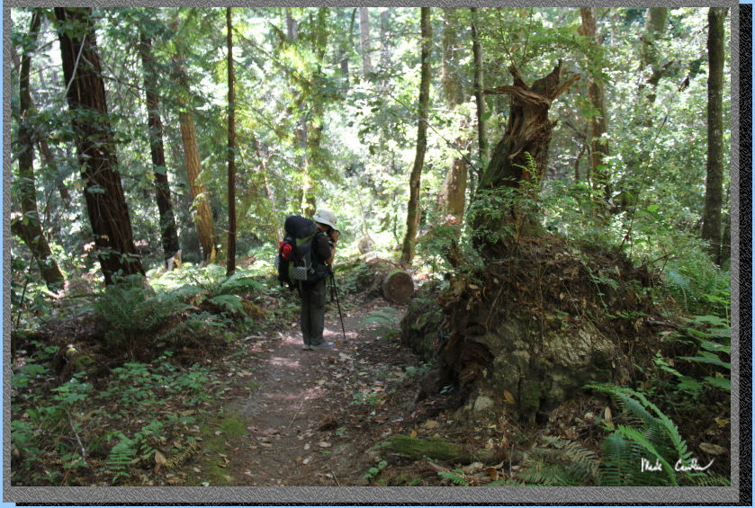
Much of the trail is like what is pictured below. The types of trees
vary depending on the section of trail, but shade remains a constant.
You will quickly
find yourself at the first junction, which is a four way junction. You
will want to take the second left to stay on the Jackson Flats Trail.
If you stay straight you go down the hill to the road into the campground
(don't do that). The loop we did had us coming back down to this junction
on the way out using the Mill Ox Trail from the Butano Fire Road.
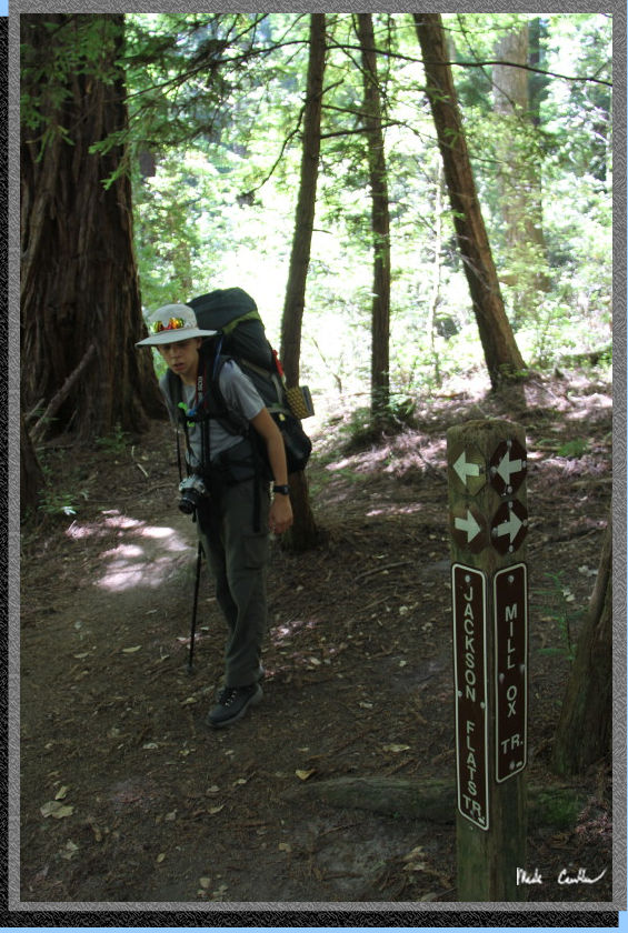
Here is the same junction but showing Tyler taking the second left to
continue onto the Jackson Flats Trail. Just read the signs and you will
figure it out. The map shows a four way junction but shows you continuing
straight for some reason. Just trust the signs and my description.
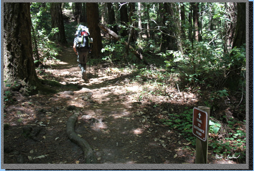
The trail does narrow in spots but we honestly didn't see many people
out on the trail. I only recall one family passing us at one point (day
hikers). There is Poison Oak, so know how to identify it. Unless you
plan to venture off trail it shouldn't be an issue.
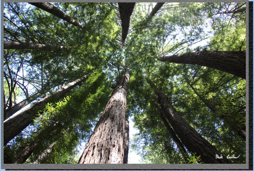
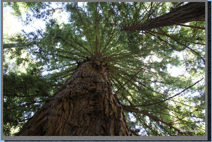
Make sure to look
up occasionally in this forest. You will quickly see that these giants
are filtering almost all of the light out.
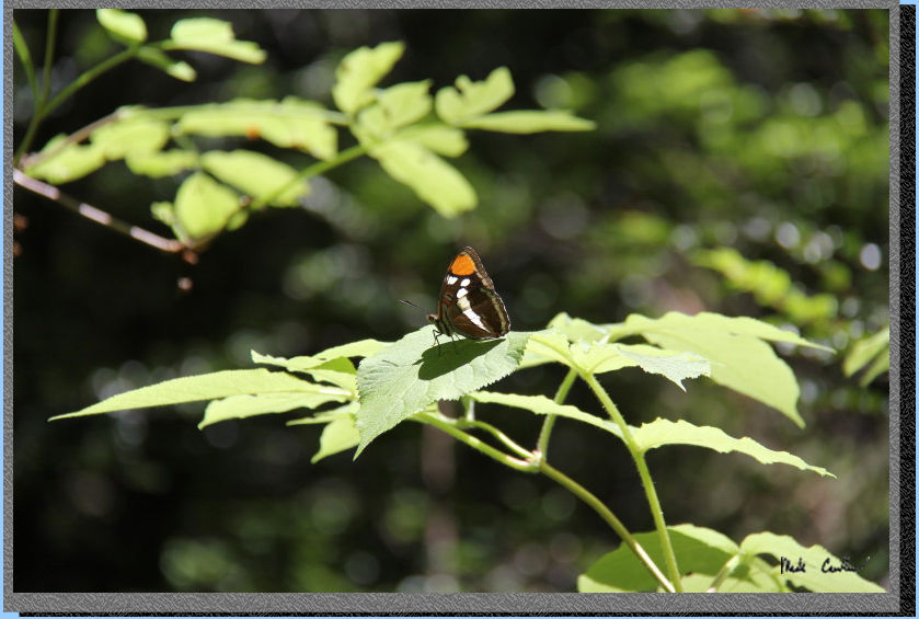
There were many
butterflies and this one cooperated for a good picture. They were looking
for sunny spots to stay warm.
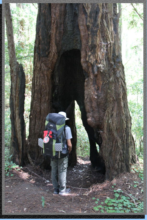
Here is Tyler checking
out another burned out tree along the trail This one you could walk
through. Very resilient trees.
The trail crosses
an area that can be marshy in the winter/spring. There are some boardwalks
wrapped with wire to keep you elevated from the muck. This time of year
it isn't damp at all, but still fun to walk on.

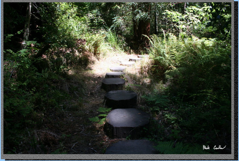
Here is a section
where the trail has you on stumps. I liked the effect of using stumps
to elevate the trail out of the softer ground.
Eventually you will
come to another trail junction that you will stay right at to go onto
the Canyon Trail. If you go left you head to the Butano Fire Road. Here
is another example of the trail conditions (I think prior to the junction).
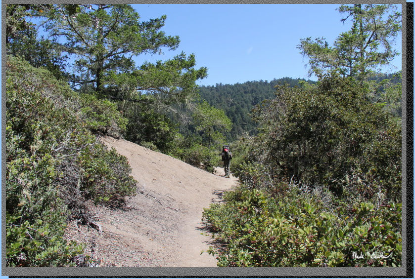
After the junction
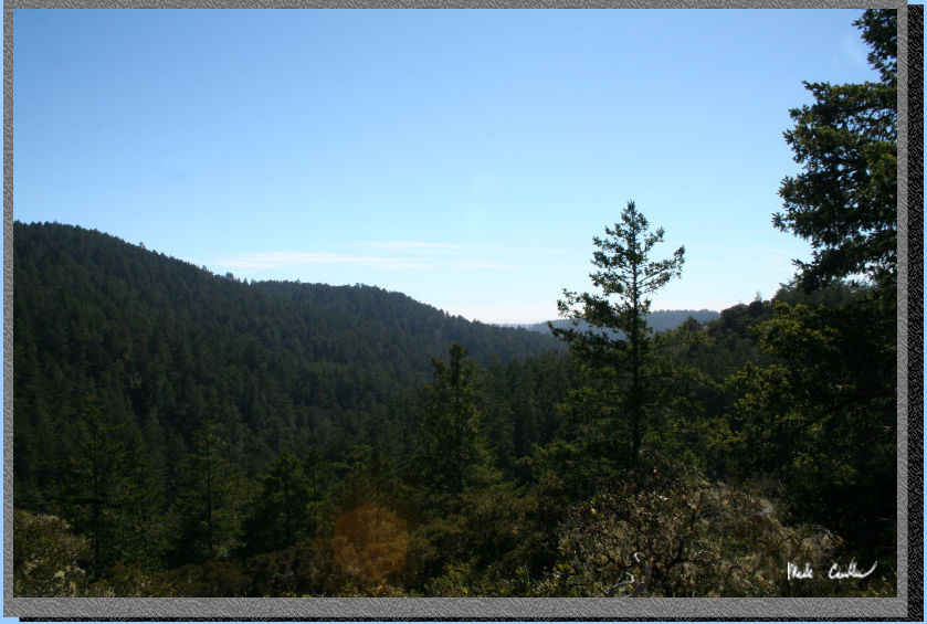
you will ascend to cross a "dessert" section. It was much
warmer and also provided some views of the canyon. There are a couple
of these open sections along the way. The trail gets windier now as
you weave your way into and out of the different drainages in the area.
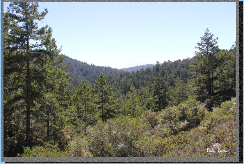
Here is the view.
You can't see the ocean but you can tell there is some coast influence
on the weather with the fog bank hanging out there.
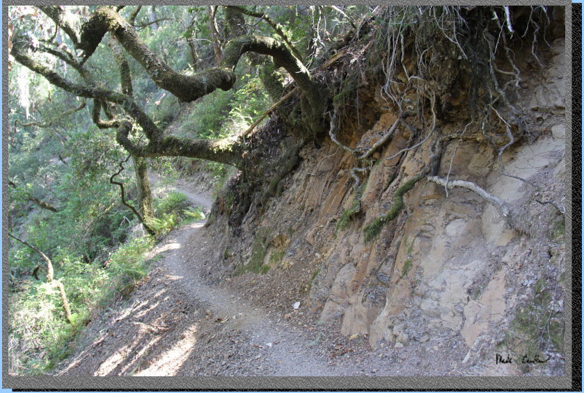
Here is the windier and more up and down conditions as you cross the
various creeks in the area. The trail remains mostly shaded but some
sections through here will be warmer than previous sections.
Crossing another open section into some moss covered trees.
Another open sections with some views that help you appreciate the number
of trees out here.
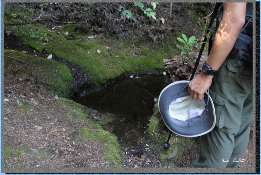
Here is the largest
puddle I saw on our trek. While the pool of water had a little trickle
of water coming into it, I could not see a measurable amount leaving
it. What this trip told me is to make sure to carry water this time
of year.
Make a left at this
junction toward the Trail Camp. It is labeled Indian Trail on map. I
just remember the other sign post said Olmo Fire Road and that was not
where I wanted to head. You can see Tyler ready to see camp soon.
We explored the sites on the way up. All sites are paired up, with a
trail to each pair. There are eight sites (with #8 being first as you
come in). We liked site #4 and camped at site #1. Our site was selected,
initially, as we wanted a breeze to keep the number of mosquitoes down.
With all the shade and apparently enough moisture they were around for
much of the hike in (they didn't bother us too much, until you stop).
We had sprayed once on the way in to not worry about them sneak-attacking
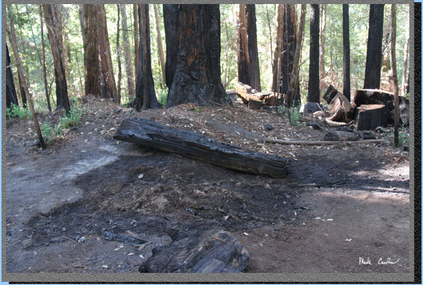
us on a break. We had smelled a faint odor of smoke on the way in (but
thought maybe it was a campfire from the nearby car campsites). It turns
out that when we reached site #1 we were greeted with the image below.
I snapped one picture of the roughly 8 foot by 3 foot "log"
on fire before we addressed how to put it out. This is a no campfire
area and there was evidence of a larger fire at this site at some point.
The image didn't capture the licking flames out the bottom of the log,
trust me when I say it was not a site we wanted to see, especially at
a dry camp. We used our trowels to dig up damp dirt to put out the log
and some of the hotspots around the log. It was slow going with plastic
hand shovels. 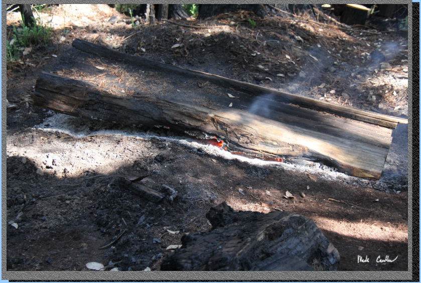
After we managed to get the fire under control (so no more active flames) we decided to try to get word to a ranger. Unfortunately the cell coverage is poor out here. I had fluctuating coverage but never enough to make a phone call. I did have enough to send texts and receive them with a long delay (up to 30 minutes of me turning my phone in and out of airplane mode to gain signal again). Since I didn't have a ranger's cell number I text my wife what was going on and asked that she call the ranger. I am in the habit of leaving the local ranger's number at home with map of the likely route we are traveling. She was able to pass word to the ranger and let me know that one would come check it out. We had dinner and kept an eye on the log, which mainly sizzled with just a little occasional smoke.
Two friendly rangers arrived with water to put out "the log". They had bought 5 gallons of water as they envisioned a much smaller log ( If I have to report a fire in the future I will give dimensions). The three of us were able to roll over the now mainly smoldering log. It turns out that 5 gallons of water on a log this size mainly angered the fire gods. The log now seemed to be making more noise and still smoldering away.
The rangers decided
that it was best to call Cal Fire to come with a rig and put out the
log and any remaining hot spots with some serious water. We waited about
half an hour for the Cal Fire crew and they used the right size tools
and a whole lot of water to make sure this thing was out. In chatting
with the Captain and the rangers it seemed that there was a fire a couple
nights prior from an illegal campfire that a different crew had to respond
to. It is likely this fire was a result of a hotspot left from that
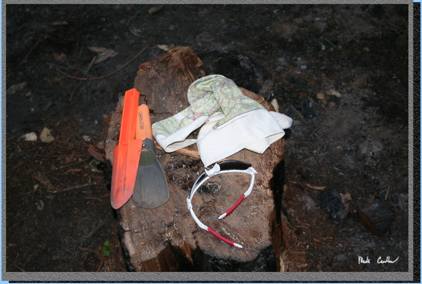
larger fire. Here is our "firefighting" equipment (bandana
over the mouth/glasses for Tyler as he as on the smoky side of the log).
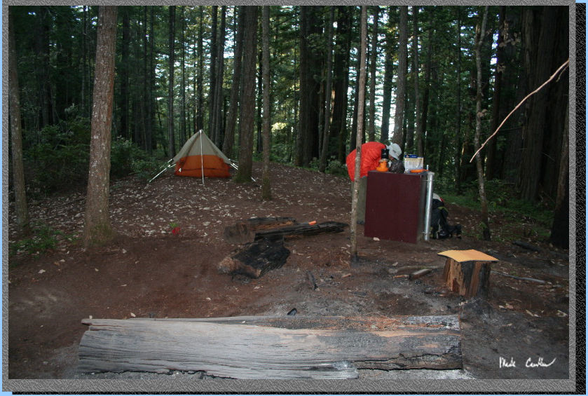
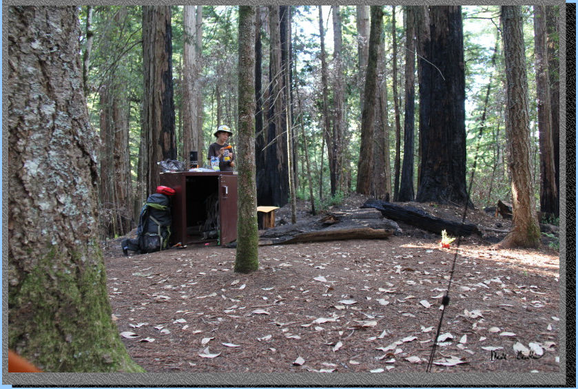
Here is camp when
we were having dinner I am the orange thing in the food locker. There
was likely good seating at this site before the bigger fire.
Here is camp the
next morning. You can see the log now all the way out and really blackened.
Close up of "the
log" before we headed out (and evidence of the fire fighting digging/flooding).
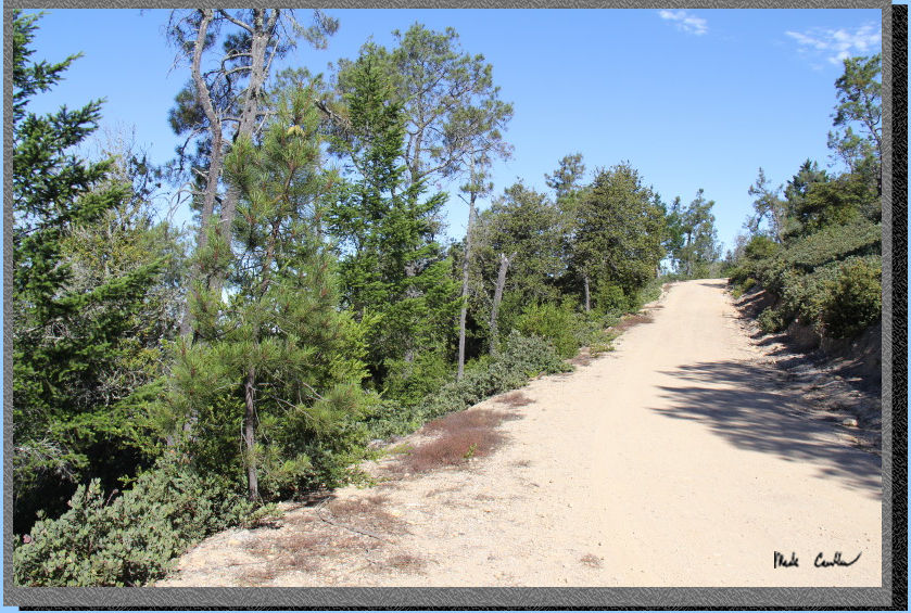
We used the Butano
Fire Road on the way out. It is shorter and also slightly less elevation
change. It is up and mainly exposed to the abandoned landing field.
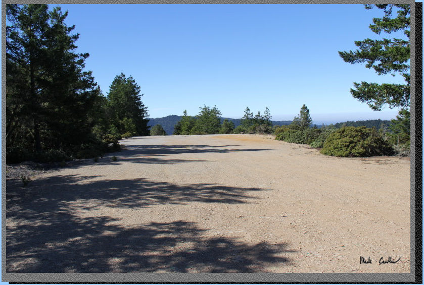
The trail bisects
the landing field. This is the view to the south. It was already warming
up that day, so we kept moving.
The next section
goes downhill with more cover. There is a mixture of sunny/shady sections
now to an unnamed junction which you stay right at. This image is one
of the shady sections.
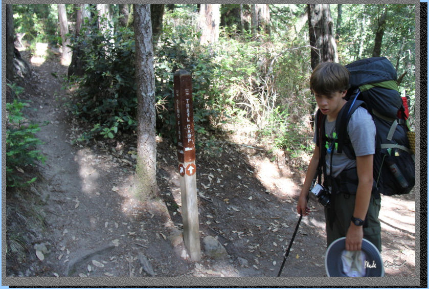
Continue downhill
to the next junction with the Jackson Flats Trail. We stayed right on
the fire road. Trail continues descent and with some good shade now.
Here is image of Jackson Flats trail marker.
Here is the trail
marker (and Tyler) for the Mill Ox Trail. This trail is a steep downhill
single track to the four-way junction with Jackson Flats Trail.
Another shot of
the Mill Ox Trail. We took a right at the four-way junction and were
back at the car before we knew it. This was a great trip (with a little
extra excitement). If you are not opposed to carrying water add this
one to your list. I am going to try to make a point of exploring the
actual campground one time I am out here. It seems to get good reviews.
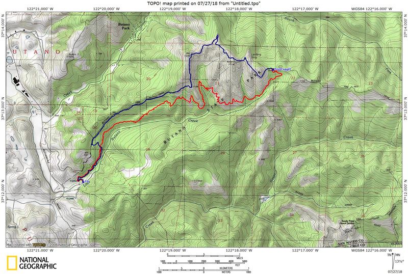
Scroll down for the map/profile.
The red line shows hike in to camp, and blue for the
way back out. Scroll down for elevation profile. Click on map or profile
to be taken to the larger version. We
hiked in on the Jackson Flat Trail and out on the Butano Fire Road (counter
clockwise loop).
(back
to top)
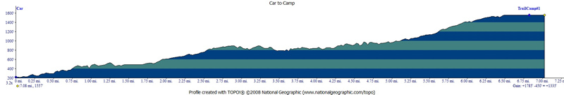
Here
is the profile for day one. I ended up walking a couple of the sites
with Tyler before settling on site #1, so there may be a little extra
mileage because of that. We used the Jackson Flats Trail, Canyon Trail
and Indian Trail to Camp.
(back
to top)
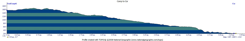
This
is the profile of day two. We used the Butano Fire Road on the way out
to go by the abandoned landing field. We cut over to the Jackson Flats
Trail using the Mill Ox Trail.