


![]()
Today
was our last day on the trail. We packed up and hit the trail by 8:30
that morning to give ourselves plenty of time to meet the shuttle. We
didn't really have a good "plan b" should the private shuttle
not work out, so we decided to not miss it. The trail from this side
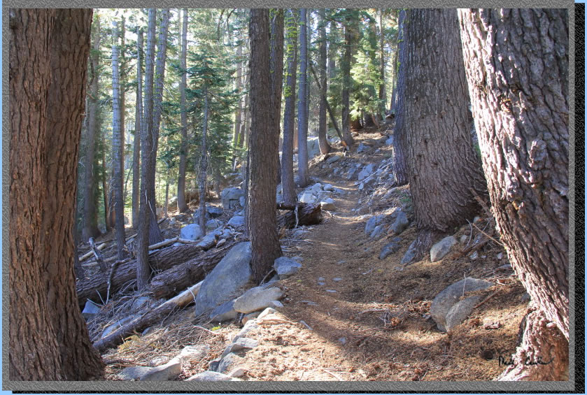
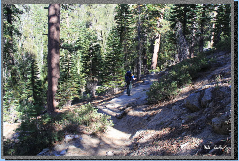
of Stony Ridge Lake to Meeks Bay Trailhead is about 6 miles. The trail
is all downhill. This photo was shot backwards into the morning sun
to show our descent down. See map below for route .
You pass Shadow Lake first.
To me it looks like Shadow Lake it trying to turn into a meadow. Shortly
after Shadow Lake you cross its outlet. Here is Eric surveying the best
crossing spot. The water levels are typically low this time of season
making for less bugs (not even a single mosquito on our trip) and much
easier water crossings.
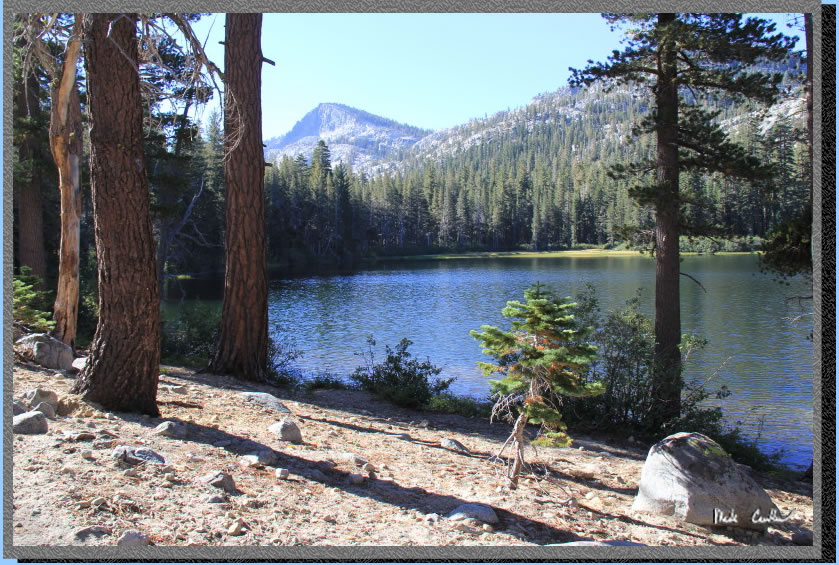
Crag Lake is next. Here is
a shot of this nice lake. We saw a group of 5 or 6 around this lake
packing up. If you are trying to lessen the mileage on this trip you
could camp around this lake. It is pretty darn close to Stony Ridge
though, but you could stay here one night then then use Rubicon the
next night.
Besides a faint trail to
HIdden Lake this is the only other junction today. This will take you
towards General Creek and back to the PCT. We stayed right/straight
to get to Meeks Bay.
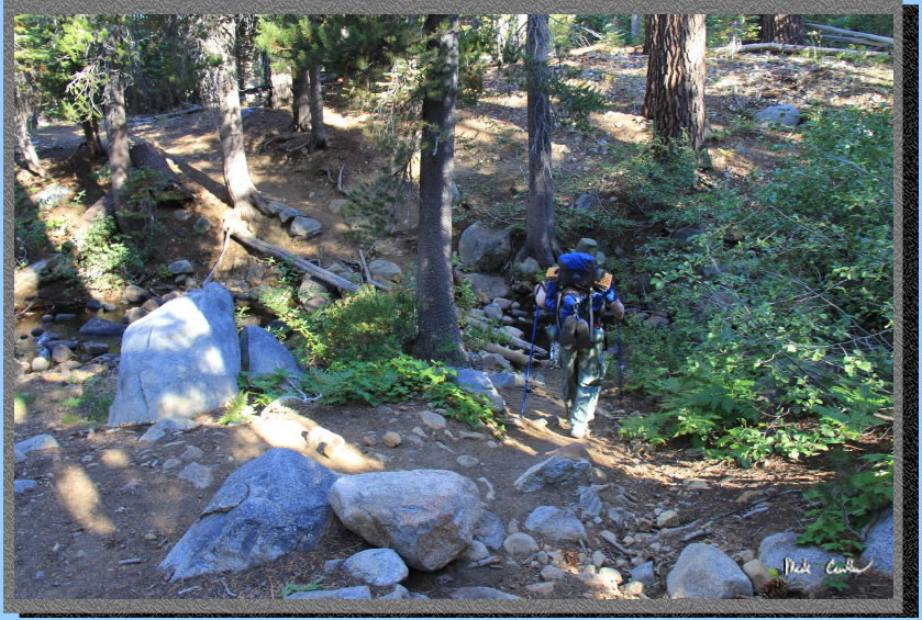
The bulk of this section
is covered and the descent is not too steep. Here is Eric motoring along.
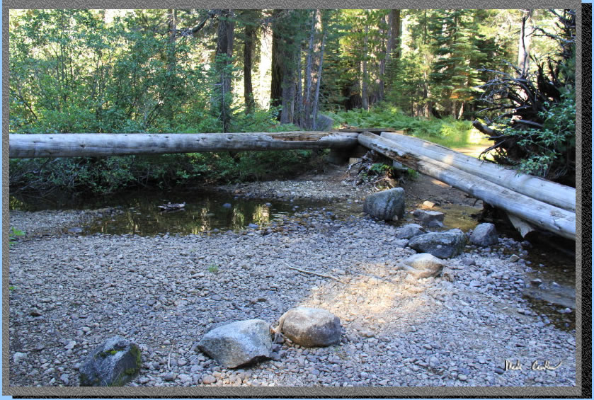
We were making good time
and were really ahead of schedule. Here is the Meeks Creek crossing.
The bridge was split in two but the water was low enough it didn't matter.
I imagine this crossing could be difficult in the Spring until this
bridge is repaired. It appears a large stump either washed into this
bridge or fell onto it. **Trail
report from Jedediah that this bridge has still not been repaired (check
with ranger on current conditions before counting on it being there)
**6/30/18**
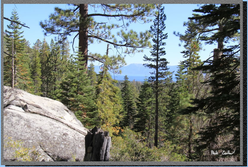
Eventually you start to see the big blue lake, Lake Tahoe. We both started
to discuss lunch plans at this point which motivated us to keep our
pace down the mountain.
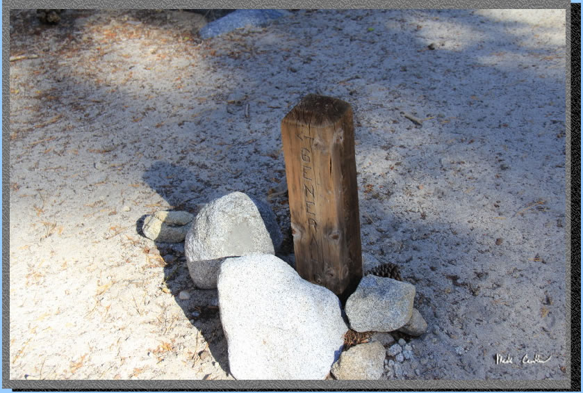
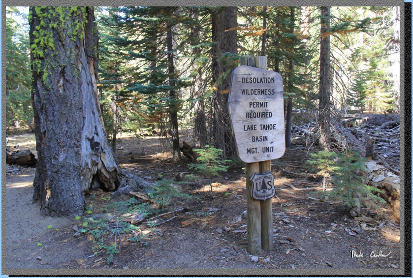
We ran into a ranger (before
this sign) and we chatted some. He told us there was some evidence of
bear further down the trail, and that Lake Genevieve had a small fire
on Monday. He asked us how it looked. You may have noticed that I didn't
post a picture of Lake Genevieve... well we were focused on heading
down the trail and I forgot to take a picture, sorry. It sounds like
the fire was on the far side of the lake as we saw no evidence on the
trail side. The ranger did check our permit and reminded us the rules
in Desolation. He was very nice about it and was glad to hear that our
trip went well.
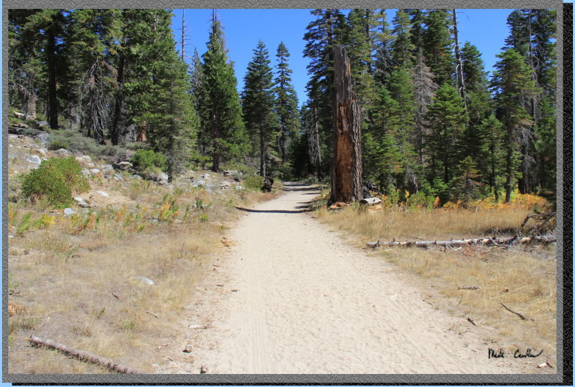
The descent stopped and
we got to the dirt road section. The very flat dirt road section. I
was able to get a call to Shuttle It, and Tahoe Joe said he could meet
us at noon. We hustled down the trail to meet him. We stopped and chatted
with some English hikers for a while, as they were looking for some
backpacking route suggestions. Eric gave them a rundown on the neighboring
lakes/routes. We made it to the trailhead about noon, and within a couple
minutes Tahoe Joe rolled up and had us back to our car in no time. He
was very nice and chatted with us about how he started his business,
and about the support he has provided to backpackers. It sounds like
he will do whatever you need him to do: ride to town for showers, drop
off supplies, shuttle you to/from trailheads, etc. He told us he even
delivered a pizza and champagne celebration to a group of PCT hikers.
If you are in need of a shuttle, or more, call him (530-318-9294). Tell
him I sent you and maybe I can get a free ride sometime. Image shows
the road to trailhead. If you want a better route description of this
section of trail see this trip from 2006. If
you are looking to get 20 miles of Desolation Wilderness under your
belt this route is hard to top. You visit all the highlights and could
do it in less time if you are willing to do more miles, or forgo the
layover day. If you have more time you could extend this trip to Echo
Lakes as well. Definitely add this section of trail to your possible
trip list. It is popular for good reasons.
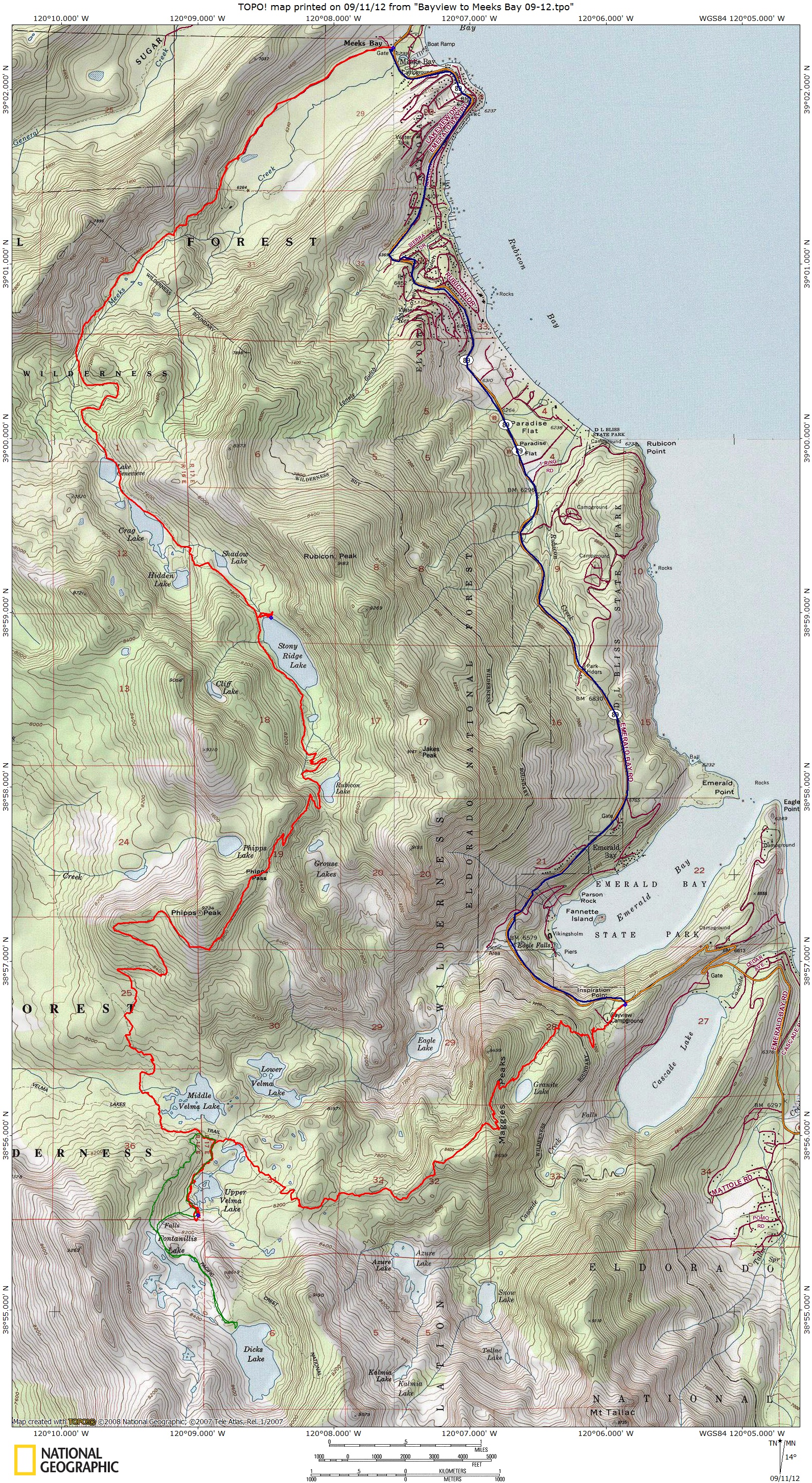
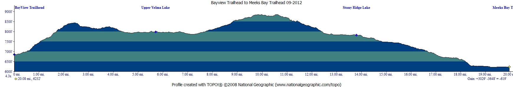
Scroll down for map and elevation profile.
Red line shows the
section we hiked with packs.
Green line is day hike on day 2.
Blue line is shuttle back to car.
Elevation profile below map.
Click on map or profile for larger version.
.
(back to top)
(take me back to trip description Day 1, Day 2, Day 3, Day 4 )