![]()
Tyler
and I decided to do another trip to Angel Island. He wanted to mix things
up a bit and get to the island a different way. We decided to try the
mass transit route. Since there was a temporary stay on the BART strike,
we took BART to Pier 1 (Ferry Terminal) and caught the Blue and Gold
Ferry to Angel Island (via Pier 41). The return trip would almost be
the same 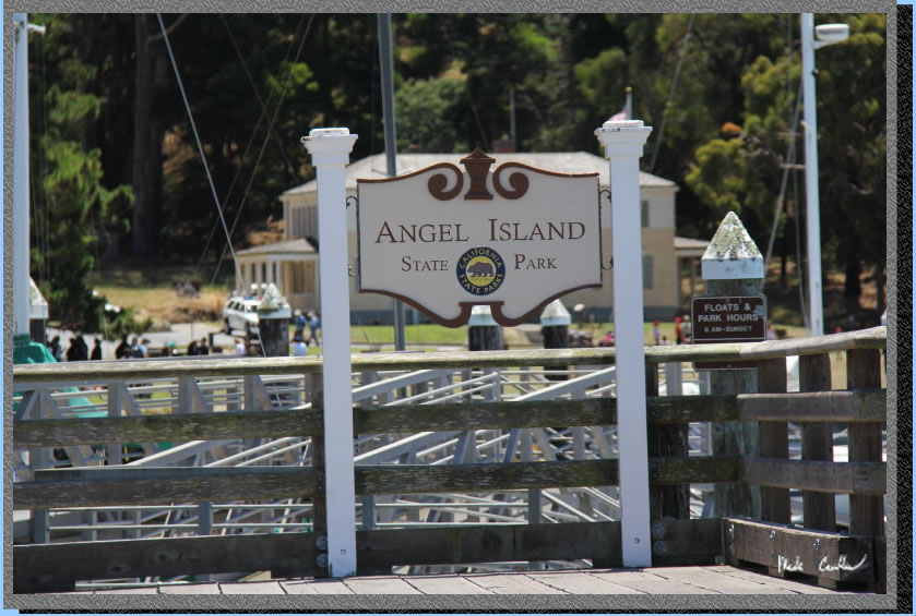 except
during the week the return ferry does not come back to the Ferry Terminal,
only Pier 41. It is about a 1.5 mile walk so we planned on catching
the Muni F line cable car to get us back to the Ferry Terminal/BART.
I booked our site, East Bay #1, about three weeks out on reserveamerica
and was able to get a site midweek only. Angel island is crazy popular
in the summer for camping. Once school starts up again sites become
more available. I have been here 4 times now (see trip to Sunrise
site #8 in 2010, East Bay #1 2012 and
East Bay #2 2013 ). Sunrise camp does
have uninterrupted views but East Bay site #1 is huge, away from neighbors,
has shade and some shelter from wind. I think all three East Bay sites
rock compared to Sunrise on the whole. Your other options to get to
the island include the Tiburon
Ferry and the Blue and
Gold Ferries. I hear that the ridge sites are the best for City
views, but also can be cold in the wind. The biggest thing you need
to work out is how you plan on getting to the island. Well it is mainly
how are you getting to the ferry you want, as parking overnight is the
biggest challenge. Of the routes I have used Tiburon and BART are the
easiest. BART allows for advance long term parking (greater than 24
hour) for $5 a day. Tiburon is $5 for 24 hours. Once you have worked
out getting to the ferry just see what sites are available on the day
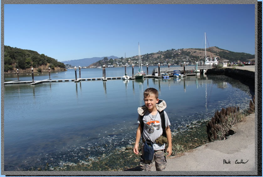
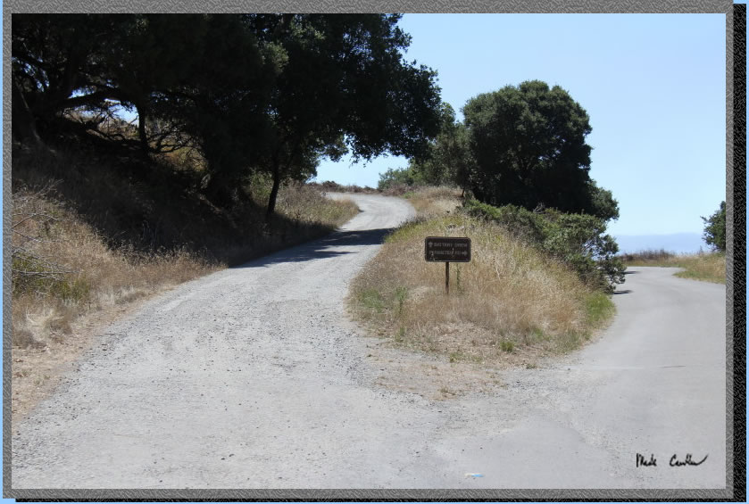
you can make it out here. The photo is the state park sign from the
ferry dock with the Visitor Center in the distance.
except
during the week the return ferry does not come back to the Ferry Terminal,
only Pier 41. It is about a 1.5 mile walk so we planned on catching
the Muni F line cable car to get us back to the Ferry Terminal/BART.
I booked our site, East Bay #1, about three weeks out on reserveamerica
and was able to get a site midweek only. Angel island is crazy popular
in the summer for camping. Once school starts up again sites become
more available. I have been here 4 times now (see trip to Sunrise
site #8 in 2010, East Bay #1 2012 and
East Bay #2 2013 ). Sunrise camp does
have uninterrupted views but East Bay site #1 is huge, away from neighbors,
has shade and some shelter from wind. I think all three East Bay sites
rock compared to Sunrise on the whole. Your other options to get to
the island include the Tiburon
Ferry and the Blue and
Gold Ferries. I hear that the ridge sites are the best for City
views, but also can be cold in the wind. The biggest thing you need
to work out is how you plan on getting to the island. Well it is mainly
how are you getting to the ferry you want, as parking overnight is the
biggest challenge. Of the routes I have used Tiburon and BART are the
easiest. BART allows for advance long term parking (greater than 24
hour) for $5 a day. Tiburon is $5 for 24 hours. Once you have worked
out getting to the ferry just see what sites are available on the day
you can make it out here. The photo is the state park sign from the
ferry dock with the Visitor Center in the distance.
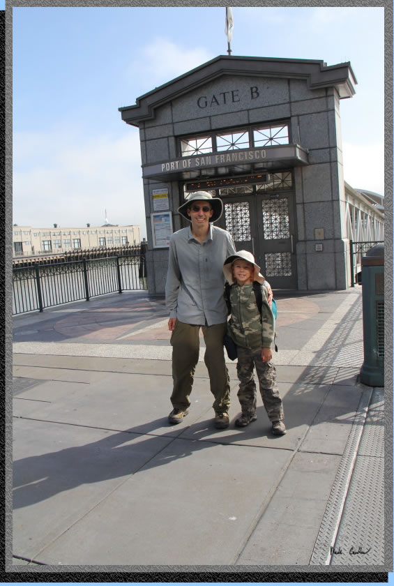
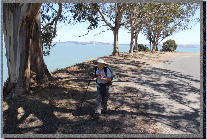
Here is Tyler and I waiting
for the Ferry from the Ferry Terminal in San Francisco. There are no
real signs that say the Blue and Gold runs a ferry from this gate, but
if you ask inside they will direct you here. There is only the one ferry
out of the Ferry terminal each weekday. It is easier to get to the island
(and back) on the weekends. This gate is the leftmost gate as you face
the Ferry Building as you approach from Embarcadero/BART.
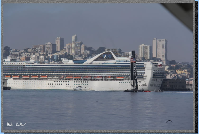
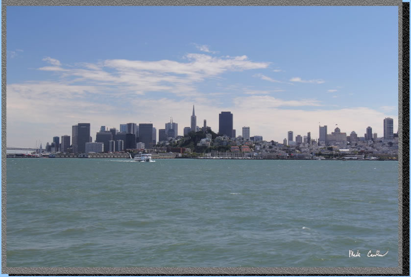
The trip on the ferry is
nice and Tyler loved that it was longer than the Tiburon option. There
were some nice views of this cruise ship and the Oracle sailboat getting
some practice for the America's Cup races this summer .
After we disembarked
we checked in with the ranger at the small kiosk after hitting the facilities.
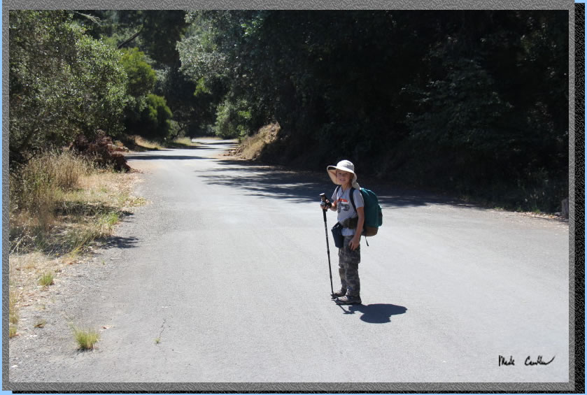
We hit the trail after getting the run down from the ranger. Tyler wanted
to hike the longer way to camp this time so we headed west, past the
Visitor Center, and up to the Perimeter Road. Our plan was to take the
Perimeter Road most of the way until the junction with the Service Road/Fire
Road. We took the fire road to camp the rest of the way. The
Perimeter Road has nice views and benches/tables along the way, so take
a break and enjoy them. The downside of the road is that the tours and
bikes travel them and there is not much shade. If you want more solitude
or shade use the trails and Fire Road (unpaved) to get around. Both
the Perimeter Road and the Fire Road make a complete circle around the
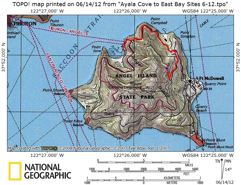
island. See map below for your options to get around.
Bikes are not allowed on the trails only the Fire Road and Perimeter
Road. They are also not allowed at the Immigration Station but there
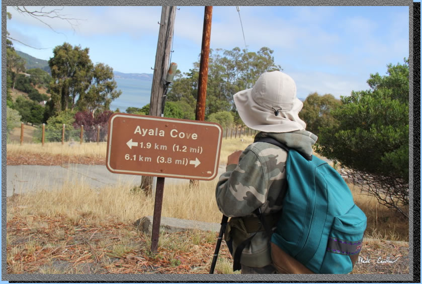
are a couple bike racks. This is a shot of Ayala Cove between the ferry
dock and the Visitor Center.
So the Perimeter Road does not look like much in this shot, right! Well
remember that you are on a historic island so in addition to the things
to see on the island you have the views of the things surrounding the
island.
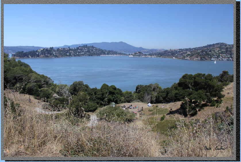
Here is a good example of that. There is Kayak camp below with Tiburon
and Belvedere in the background. The weather was great with it being
cool enough that the lack of shade on the Perimeter Road was not a factor.
The breeze was also helping us stay cool.
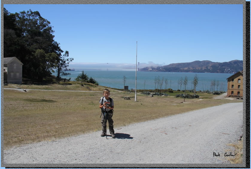
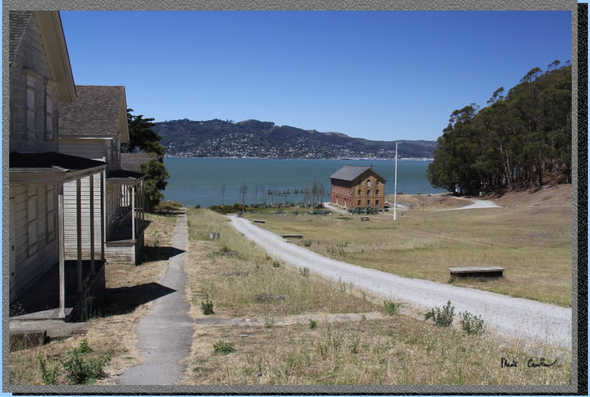
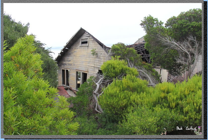
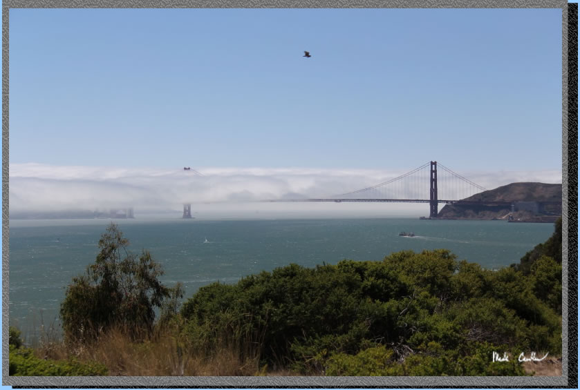
We decided to explore the
West Garrison (Camp Reynolds). There is a gravel road that leads you
around the structures here. The Golden Gate Bridge is visible in the
background (you can see where the cool breeze is coming from) . Most
of the buildings are locked up, or boarded up, with the exception of
the bake house and a couple of the houses that the upper ranks of the
military got to use while stationed here.
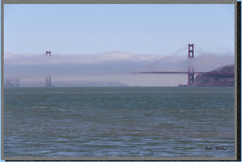
Here is a close up of the
Golden Gate Bridge. I think the view of the Golden Gate is the best
from Fort Reynolds..
We hiked back up the road
on the other side past the officer quarters. Apparently the "regular"
troops lived in bunkhouses that were across the field , long since destroyed..
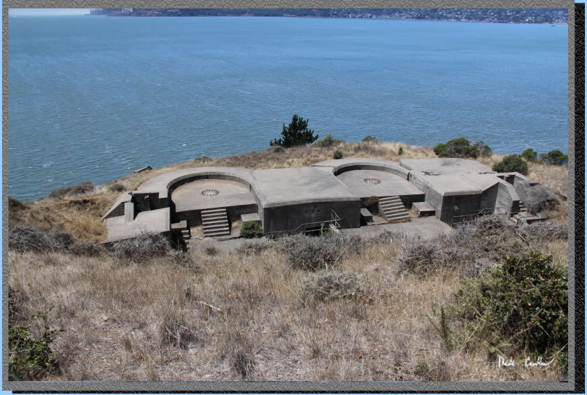
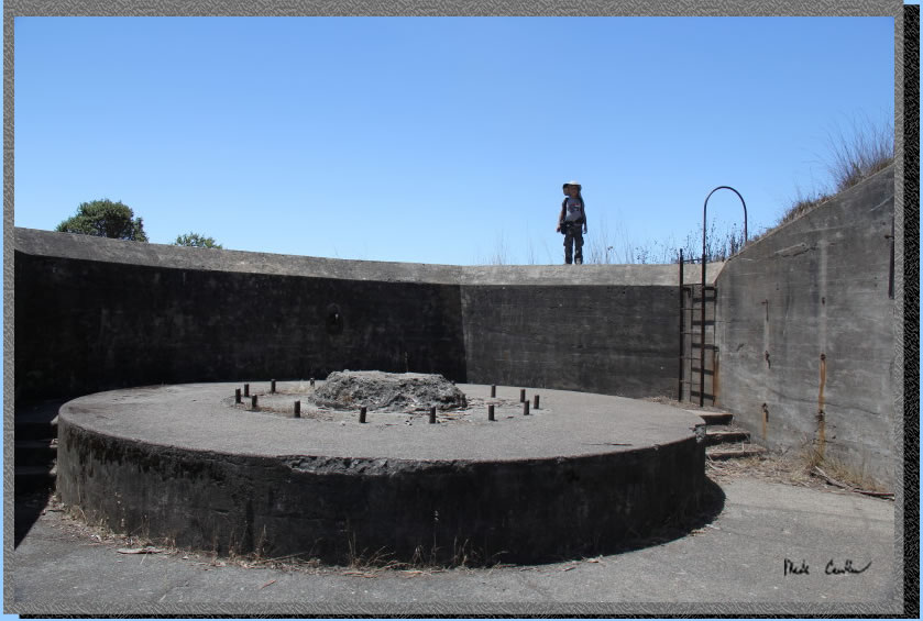
We hiked back up the Perimeter Road and over to Battery Ledyard. This
gun emplacement is not very accessible, at least it didn't appear to
have a path down to it that was not fenced off. Still cool to check
out, even if from this distance. It was a different time when we needed
to protect the Bay from attacking sea vessels... with mounted guns/cannons.
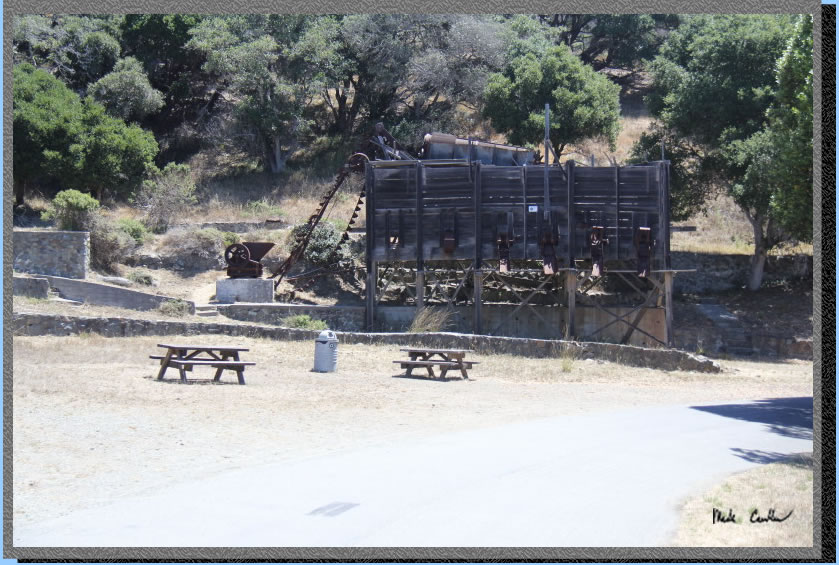
We hiked further on the Perimeter
Road to some old quarry equipment. It is amazing that it still stands.
We took the junction to the
left here to Battery Drew. Just up and over this rise and you are there..
You can go in Battery Drew
and also check out the mounting for the gun here. This was a big weapon
based on the mounting it had (and the sign I read :-).
Here is a shot of Battery
Ledyard from above, on the way back to the Perimeter Road. You can see
the open doors that allow you to walk all the way through it. The officer
in charge had a small living space with a fireplace. I imagine that
was quite a luxury when the fog rolled in. 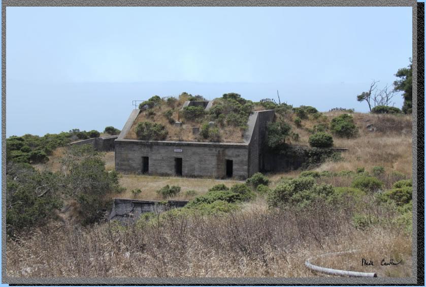
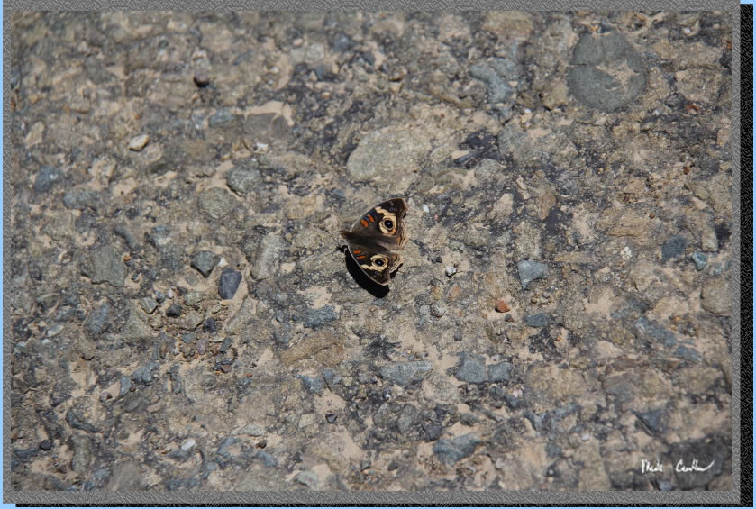
I grabbed this shot of one
of the many butterflies on the island. This was the only one that stayed
still long enough for me to grab a shot.
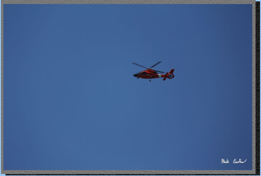
Of course that was not the
only thing flying around (or over) this island. We saw this Coast Guard
helicopter fly over the island a few times. We also saw quite a few
other helicopters and airplanes flying over. Being surrounded by three
big airports makes for a lot of air traffic. I didn't really notice
that many at night though. Probably the fog horns drowning them out.
Tyler hiked me around the island enough that no amount of fog horns
was going to keep me up.
At the junction with the
Service Road/Perimeter Road and the Fire Road we took a left onto the
Fire Road. We decided that we wanted to get to camp rather than explore
the East Garrison (Fort McDowell) today. Along the Fire Road you get
a nice bird's eye shot of the fort and I got a shot of a large sailing
ship passing by.

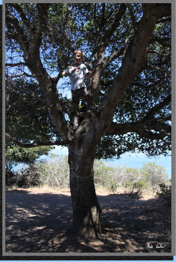
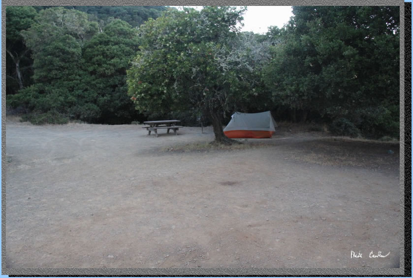
We made it up to the sites.
Junction to camp sites are well marked. East Bay Site #1 is the furthest
in and also the largest. Tyler is climbing up one of the trees at the
site here. There is a large tree that is good for climbing between sites
#1 and #2, well usually good for climbing. It turns out that some wasps
thought it would make a good home and when Tyler and I headed down to
it he spotted the busy wasps going in and out of their nest. We let
a ranger we saw the next morning know about it but he says they are
prevalent on the island,so keep an eye out. We saw one other nest at
Fort McDowell the next day. They nest below ground and won't likely
bother you unless you bother them. Or as the ranger told us, run a lawn
mower over their nest. Apparently that gets you stung a few times. The
ranger also said that they spray them when they are in sites but they
usually just move over to the next tree so keep an eye out.
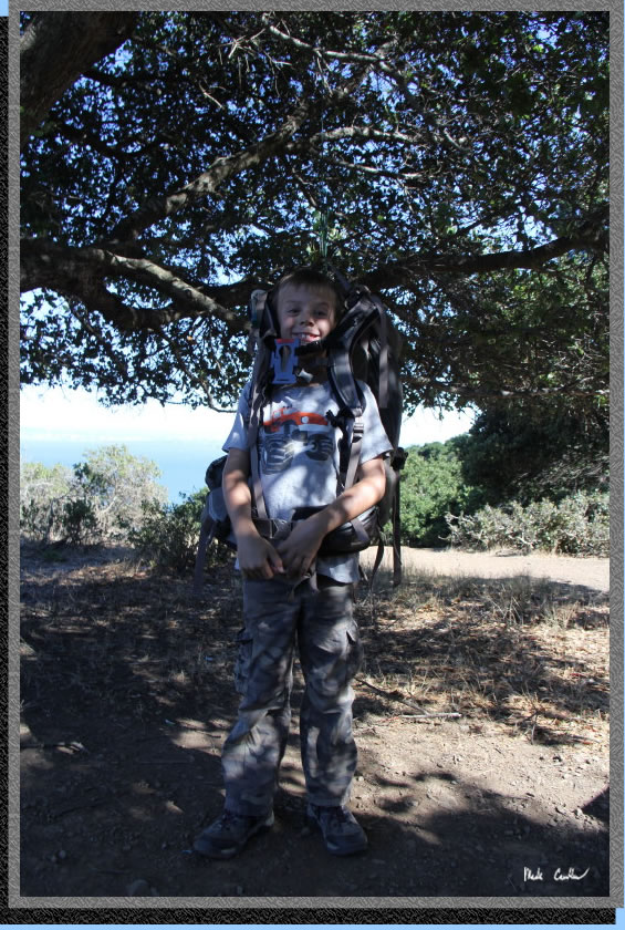
Here is Tyler trying on my
pack as it hangs from the tree. That night a racoon thought I was hanging
food in the tree and decided to claw through the garbage bag I had on
my pack (to prevent it from getting wet should the fog/mist roll in).
Luckily the racoon did not hurt my pack at all. It did open a zippered
pouch on my hip belt that had my polarizer filter in it. The filter
(in a case) was on the ground but undamaged. I had no food or anything
else that resembled or smelled of food in my pack so I think that helped.
All food or smelly stuff (soap, toothpaste, lotion) should go in the
food storage lockers provided at each site. Oh and there is a pit toilet
shared between the three East Bay sites and a water spigot with potable
water near site #2. There are also picnic tables at each site.
We had a nice dinner and
then watched the ships come in and out of the fog that was rolling in.
This side of the island is more sheltered from the elements. I have
chatted with people that stayed in the Ridge sites and they have told
me it can be cold and windy with the fog rolling right over you. I still
want to stay there next though, as there is another battery up there
by the sites to explore.
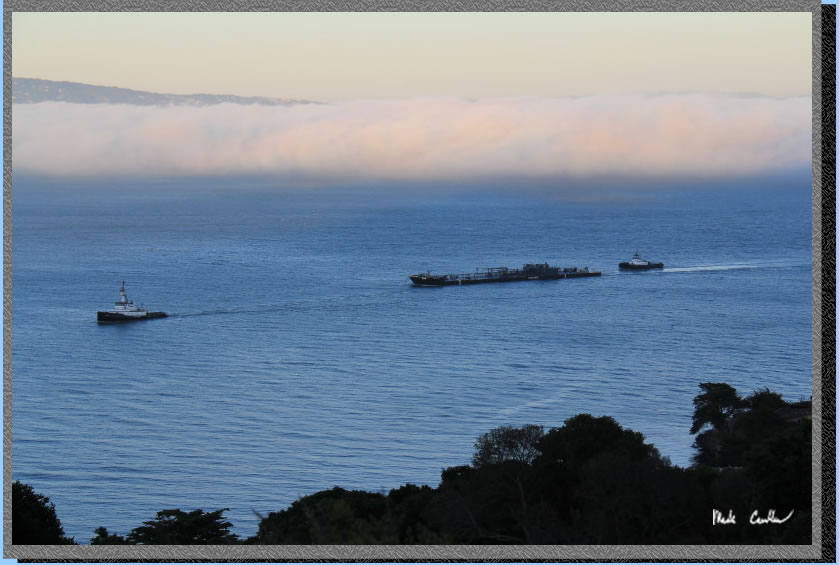
Here is another tanker headed
to the refinery to offload. The fog was really getting thick now. We
could see the Bay Bridge earlier but not anymore. The ships are required
to give a mighty toot before heading into the fog. Not sure I would
want to hear that if I was out in the bay in a small boat.

I took this picture the next
morning. This is my latest tent, Big Agnes Scout UL2. It is ultralight
and single wall. I have had it on this island twice now and the last
time it saw some rain (and a lot of misty fog), it did well. It does
get some condensation in the rain (as many single walls do) but it seems
well worth it given the weight savings. This thing packs up small and
uses trekking poles... hard to beat. I would say my only gripe is the
no screen on the door. It would breath so much better even with a half
screen. I am not sure it was not included for weight savings or water
proofing but I predict the next version of this tent will have one.
I will take it to the Sierras on the next two scheduled trips to really
test it out.
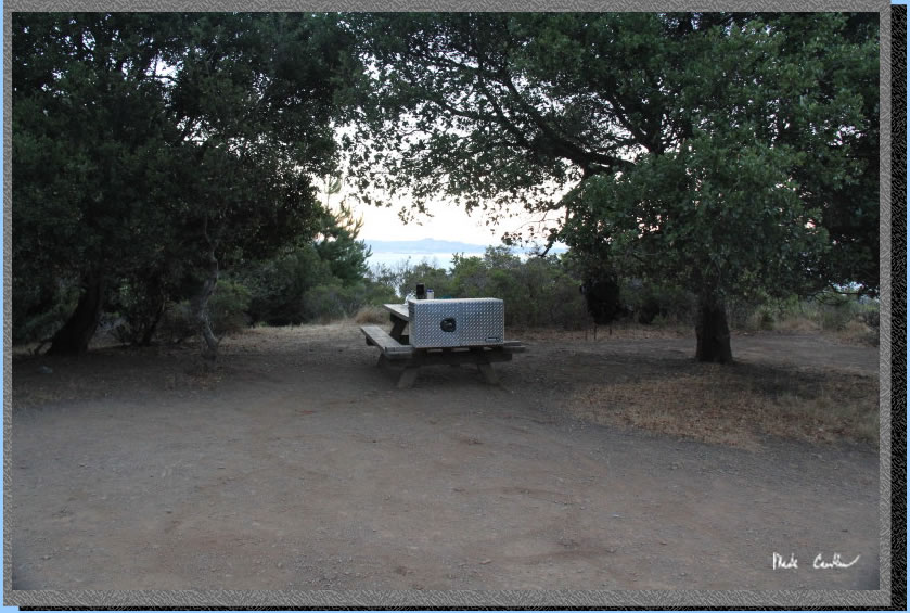
Here is the picnic table
(this site actually has two). I did not pack in the big silver cooler
looking thing on the table, this is the food locker. They were recently
installed and are greatly improved over the previous ones.
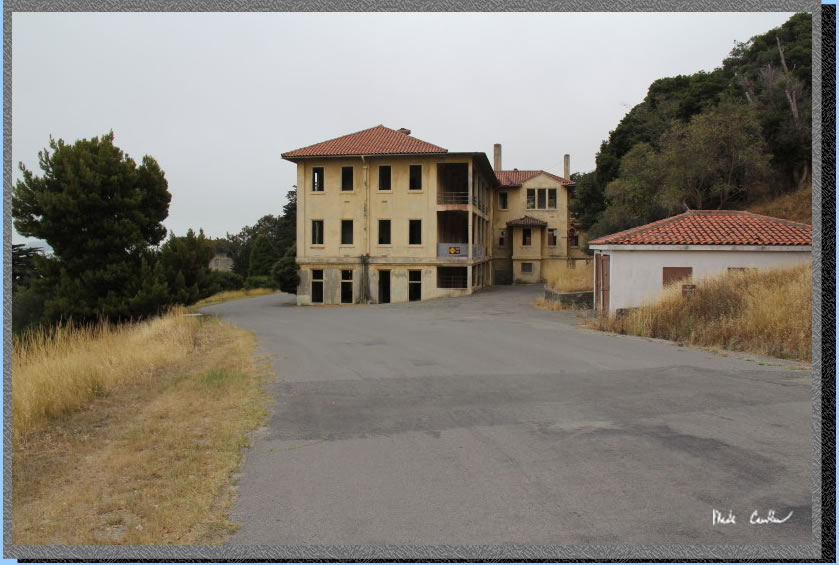
We planned on catching the
1:55 pm ferry back to the City so we hiked back to Fort McDowell (East
Garrison) the next morning. Most of the buildings are still standing
but can only be explored on the bottom level. Still neat to go into
these old buildings and to read about the history of each. I think this
one was the hospital.
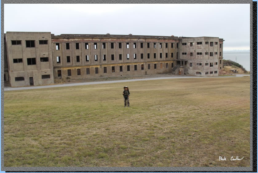
There is a giant grass field
and also a baseball field with stands. There is also a small beach area
out to the right. This large building housed troops.
Some of the buildings have
been abandoned and don't need signs to tell you that it would not be
safe to explore them....
We headed back toward Ayala
Cove now, and the Immigration Station as it was closed the last time
we were here (I believe they are only open 11 to 3 ).
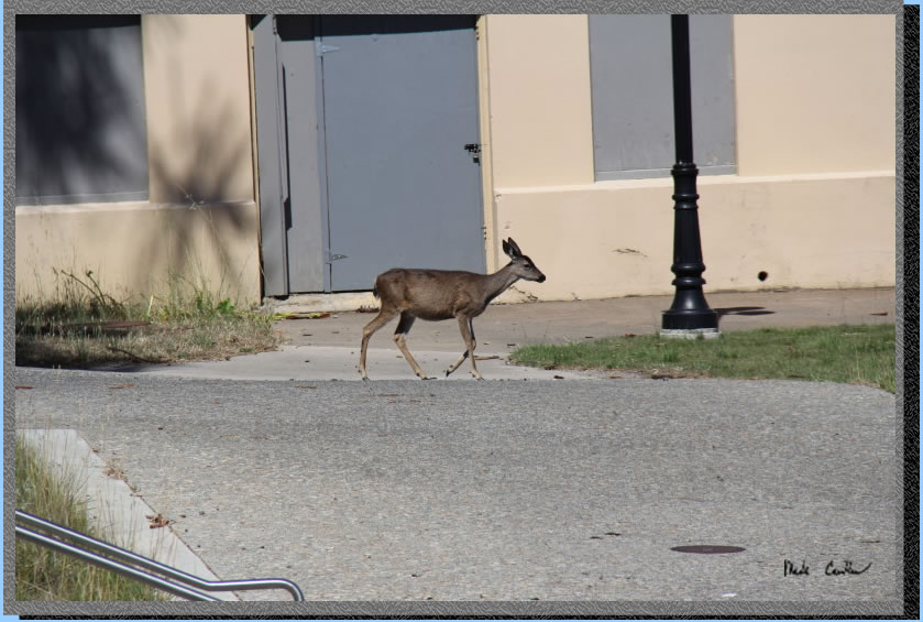
We got there at 10:30 so
we hiked down to the beach. This small deer didn't seem to mind us watching
it walk down to the drain outlet at the beach for a drink. After walking
along the beach and reading about some of the history of the Immigration
Station it was nearly 11, so we did a self guided tour of the main building.
You can explore 2 floors and they wave plenty to see. I may take the
guided tour next time (I wanted to be sure we got back to the Cove in
time to get lunch before our ferry on this day).
We hiked through the blustery
wind on the way back. It is amazing how different the conditions are
on this island depending on which side you are on. This section of the
trail turns the corner and you are hit with the breeze. It was nice
though as it was warming up.
We had a nice lunch at the
Cove Cafe before boarding our ferry. There was some type of day camp
for kids that was going on in the picnic area at the Visitor Center.
I imagine that would be a cool camp to be part of, since you have to
take a ferry over and back to get there. It was another beautiful day
with less fog than the day before. It was windy though. Tyler and I
were out on the top deck and once we got out past Angel Island (the
ferry goes around the east side on the return trip, makes you think
you got on the wrong ferry at first) the waves picked up. The ferry
moves at a good clip and that combined with the winds/waves gave us
some salt water sprays occasionally. Most people cleared out and went
to sit inside. Tyler and I just enjoyed it. It wasn't long before people
streamed back outside with cameras clicking away.
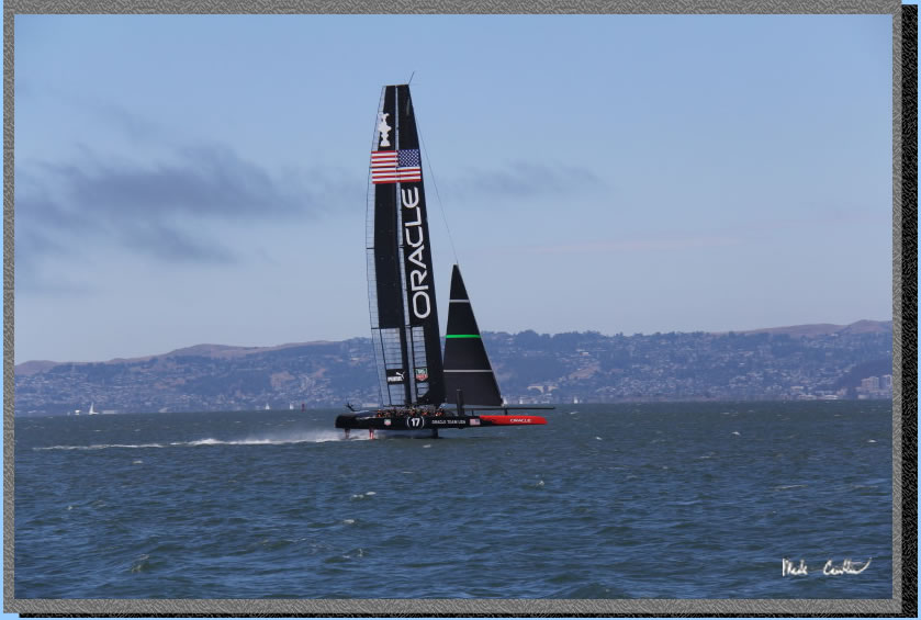
I looked around and grabbed
this shot before burying my camera again in my pack. I didn't mind the
salt water spray but I know my camera would. It was amazing to see this
high tech sailing boat pass us. This America's Cup thing looks pretty
exciting.
This is a great and easy
trip. Once the last ferry leaves you have the island to yourself. I
have seen many families that were camping that chose to use bikes to
haul gear. I have also seen some gals with coolers that had wheels.
You really can make this as close to car camping as you want to. You
could even use the snack bar as a meal source as well. With the short
mileage and the amount of history, beaches and views this island is
really a gem in the middle of the bay worth exploring. Make sure you
get out here, even if it is only for the day. Though there is really
no excuse not to spend the night... If you can make it up to the top
of Mount Livermore after dark you won't be disappointed. A shot from
the Perimeter Road south of Camp Reynolds where a bird happened to be
flying at the right time.
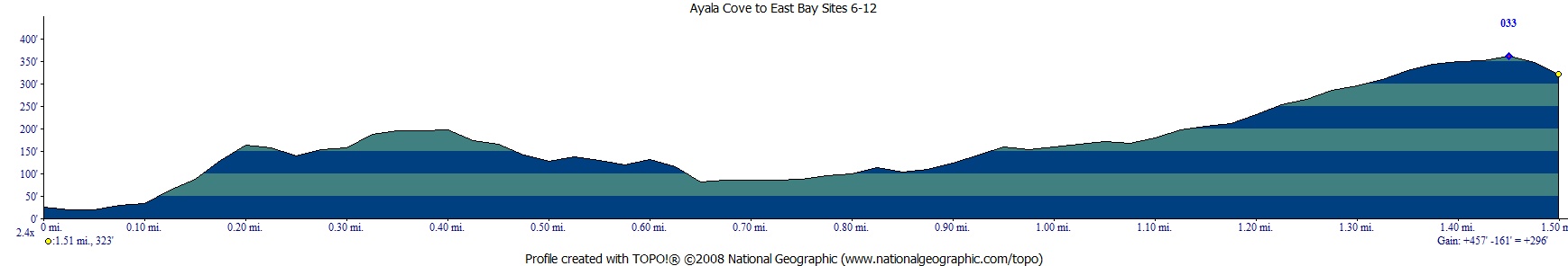
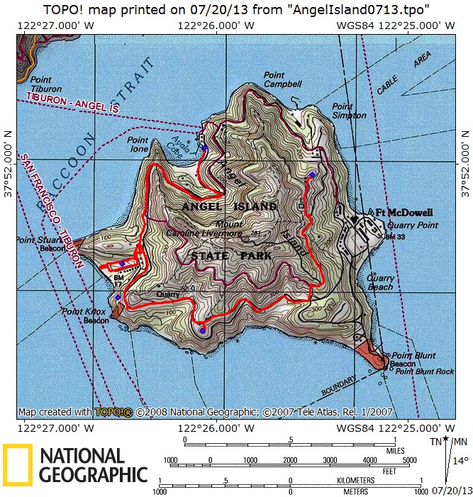
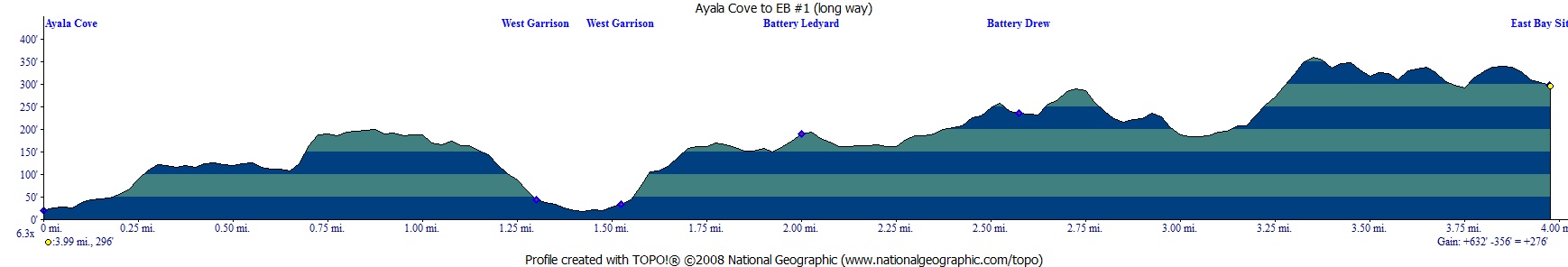
Red line shows the path we
hiked on the way in from Ayala Cove to East Bay site #1. This is the
long way, scroll down for the shorter way we took on the way out. Elevation
profile shows how easy this hike is on the lungs/knees. Click either
for a larger version.
(back
to top)
Red line shows the path we
hiked on the way out from East Bay site #1 to the snack bar at Ayala
Cove. Elevation profile shows how easy this hike is on the lungs/knees.
Click either for a larger version.
.
(back to top)